Cumbres de Majalca National Park
|
Cumbres de Majalca National Park
|
||
|
Cumbres de Majalca (2011) |
||
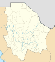
| location | Chihuahua (State) , Mexico | |
| WDPA ID | 5392 | |
| Geographical location | 28 ° 48 ' N , 106 ° 29' W | |
|
|
||
| Sea level | from 2200 m to 2600 m | |
| Setup date | September 1, 1939 | |
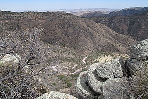
The National Park Cumbres de Majalca is a National Park in Chihuahua , Mexico .
geography
The national park was created by presidential decree in 1939. The 4772 hectare area is located around 40 km northwest of Chihuahua at an altitude of 2200 m to 2600 m and belongs to the Sierra Madre Occidental . Its rock formations, which are heavily influenced by erosion , are remarkable .
Web links
Commons : Majalca National Park - Collection of pictures, videos and audio files
literature
- E. Estrada-Castillón et al. (2003): Plant associations of Cumbres de Majalca National Park, Chihuahua, Mexico. The Southwestern Naturalist, 48 (2), 177-187.
- Fernanda Figueroa and Víctor Sánchez-Cordero (2008): "Effectiveness of natural protected areas to prevent land use and land cover change in Mexico." Biodiversity and Conservation 17.13 (2008): 3223-3240.
- Estrada-Castillón, Eduardo, and José Ángel Villarreal-Quintanilla (2010): "Flora del centro del estado de Chihuahua, México." Acta botánica mexicana 92 (2010): 51-118.
Individual evidence
- ↑ Cumbres de Majalca | Protected Planet. (No longer available online.) Formerly in the original ; Retrieved July 6, 2017 . ( Page no longer available , search in web archives ) Info: The link was automatically marked as defective. Please check the link according to the instructions and then remove this notice.

