
Neutral Zone (Kuwait)
Coordinates: 28 ° 32 ' N , 48 ° 4' E


The neutral zone between Saudi Arabia and Kuwait was an area of 5,770 km² on the northwest coast of the Persian Gulf , which from 1922 to 1969 was not divided between the neighboring states of Kuwait and Saudi Arabia or the forerunner state of the Sultanate of Najd , but was administered jointly has been.
geography
The area extended over a coastline of around 83 kilometers as the crow flies from the headland of Ra’s al Qulay'ah (رَأْس اَلْقُلَيْعَة) in the north to Ra's al Mish'āb (رأس المشعاب) in the south, and an average of 70 kilometers inland to the west of the coast. The small islands of Karuh and Umm al-Maradim , the southernmost islands of Kuwait , lie 38 and 26 kilometers off the coast . Despite their southern location at the level of the neutral zone, the islands were traditionally regarded as part of the Shaikdom of Kuwait or the Kuwait Principality , even before the establishment of the neutral zone. After its establishment, it was noted in the 1924/25 trade report that at least the southernmost island Umm al-Marādim was within the borders drawn for Kuwait (Karu was not mentioned there). In the military report of 1939, in addition to Umm-al-Maradim , Qaruh is explicitly mentioned as part of the state, as was the case in 1908 ( i.e. before the establishment of the zone) in the Gazetteer of the Persian Gulf.
history
The boundaries of the area were set in the Uqair Protocol on December 2, 1922 . This protocol was negotiated between the Najd Sultanate, the forerunner of modern Saudi Arabia, and Kuwait, which was a British protectorate at the time . In the area, the boundaries between the Najd and Kuwait were not precisely defined, instead a neutral zone was established. In the same protocol, another neutral zone was established further west inland, between Najd and Iraq , the neutral zone (Iraq) . The protocol stated that the governments of Najd and Kuwait had equal rights in the area until a successor agreement regulates more precisely. However, interest in defining a definitive boundary remained low on both sides until 1938 the Burgan oil field was discovered directly on the northern border of the area, and oil deposits were to be expected in the neutral zone. In 1948 and 1949, both governments granted production concessions to private companies. According to a later agreement, the revenues from oil production in the neutral zone were shared.
In October 1960, the heads of state of Kuwait and Saudi Arabia (legal successor to the Najd Sultanate) agreed at a meeting that the neutral zone should be divided between their countries. The agreement on the exact demarcation of the boundaries was signed on December 17, 1967, and came into force on December 18, 1969 when the documents were exchanged. Ratification followed on January 18, 1970.
The border was drawn roughly in the middle along the latitude 28 ° 31 'north. The northern part with an area of 2590 km² was incorporated into the Kuwaiti governorate al-Ahmadi . The southern part became part of the Saudi eastern province of Ash-Sharqiyyah .
Individual evidence
- ↑ Frank Jacobs: Put it in neutral . New York Times, May 1, 2012 (map)
- ↑ Gazetteer of the Persian Gulf, Oman and Central Arabia: Qaru (1908)
- ^ Gazetteer of the Persian Gulf, Oman and Central Arabia: Umm al Maradim (1908)
- ^ JC More: Report on the Trade of Kuwait for the year 1924/25
- ^ Military Report and Route Book. The Arabian States of the Persian Gulf. 1939
- ^ John Gordon Lorimer: Kuwait Principality. in: Gazetteer of the Persian Gulf, Vol. II, Geographical and Statistical, p. 1061
- ↑ Frank Jacobs: Put it in neutral . New York Times, May 1, 2012
- ↑ United States Central Intelligence Area: Kuwait, 1993 (map)
Web links
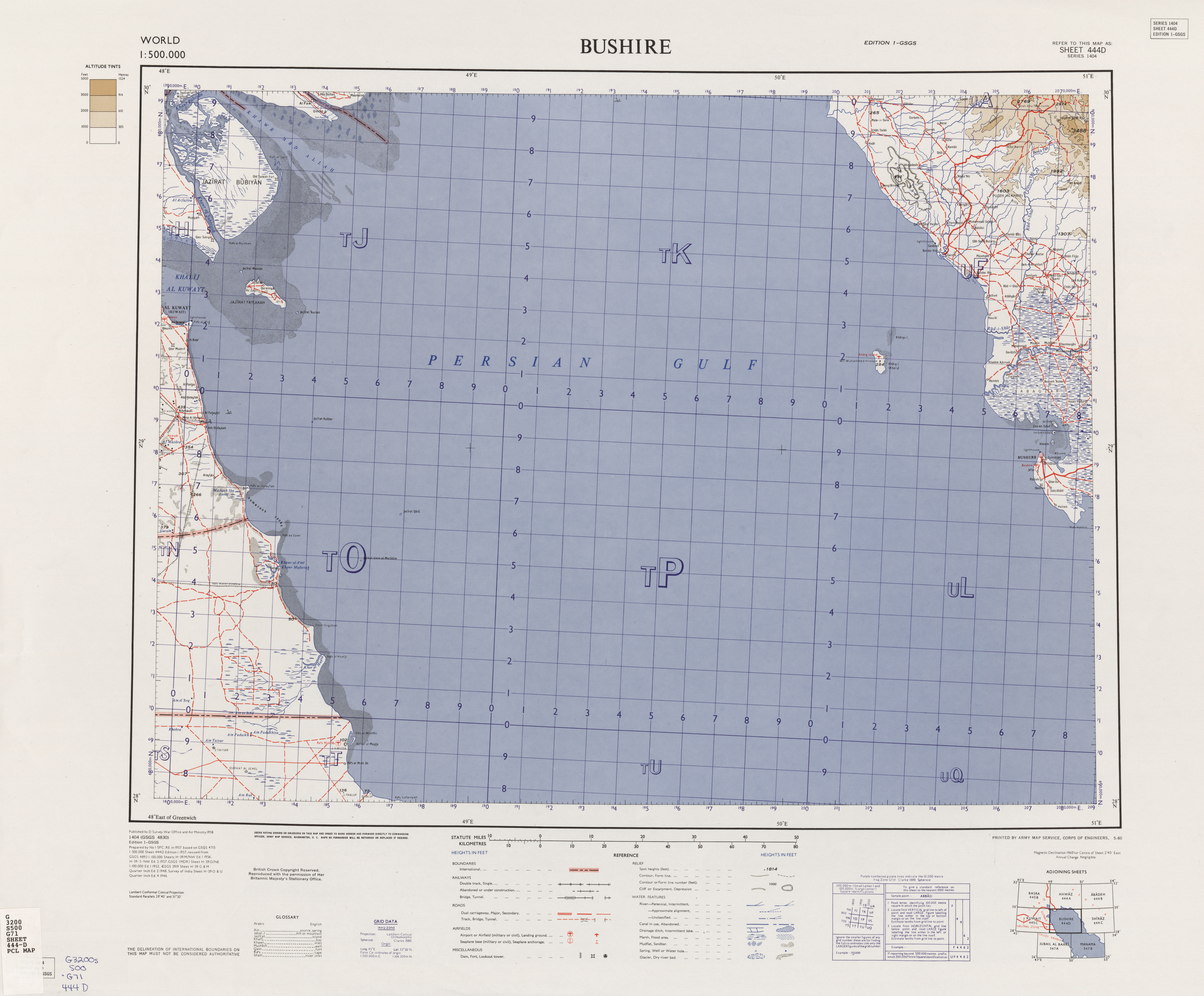
- Map sheet from 1958 (with the eastern part of the neutral zone)
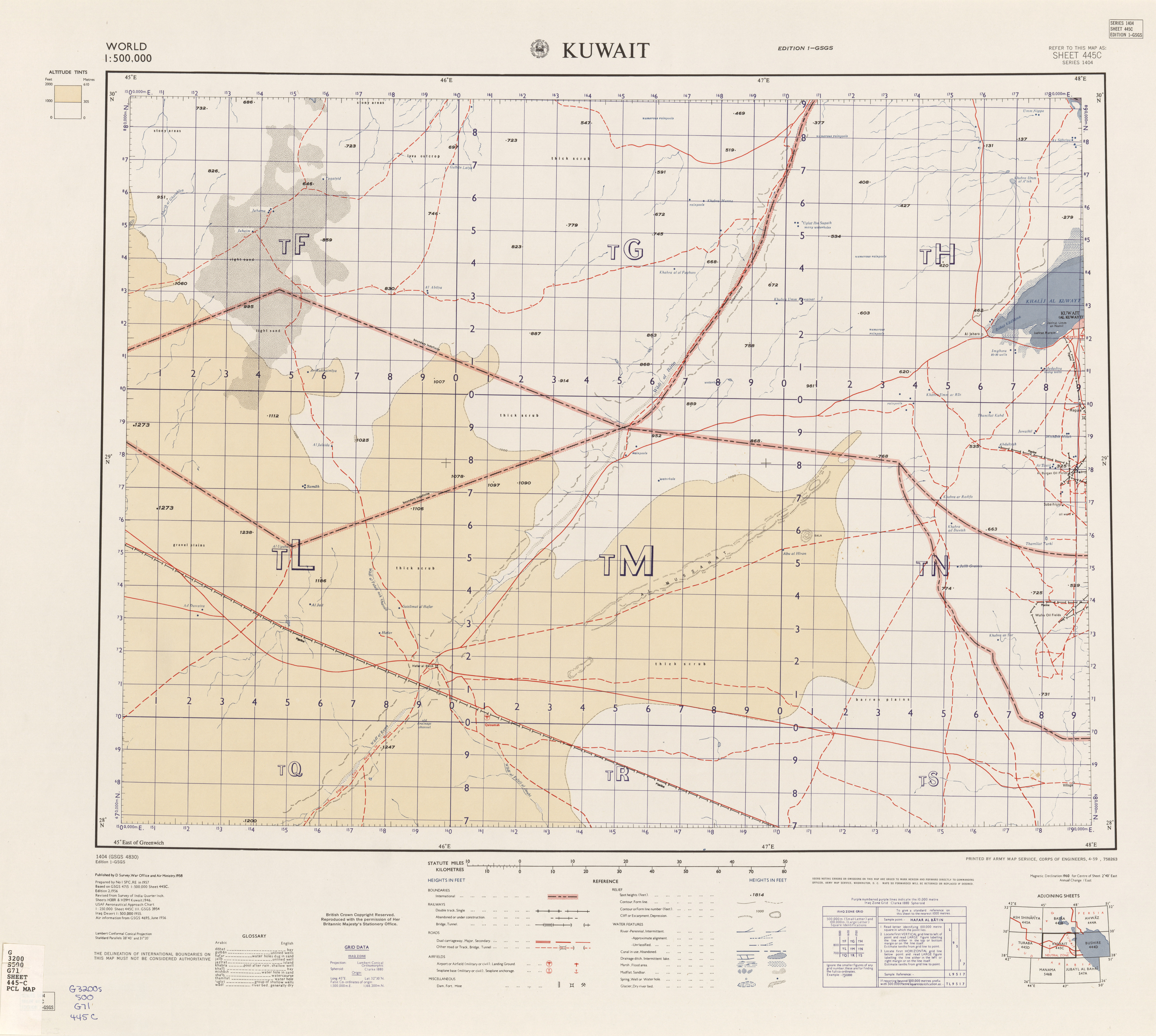
- Map sheet from 1958 (with western part of the neutral zone)
- International Boundary Study No. 103: Kuwait - Saudi Arabia Boundary (1970)