Colima (volcano)
| Colima | ||
|---|---|---|
|
Volcán de Colima |
||
| height | 3860 m | |
| location | Jalisco / Colima , Mexico | |
| Coordinates | 19 ° 30 '44 " N , 103 ° 37' 2" W | |
|
|
||
| Type | Stratovolcano | |
| Last eruption | 2010, ongoing | |
The Colima is a Mexican volcano and consists of two elevations: the older and inactive Nevado de Colima ( 4330 m ), also called Zapotepetl , and the younger and very active Volcán de Colima ( 3850 m ), which is a little further south and also called Volcán de Fuego de Colima is known. It is the most active volcano in Mexico .
location
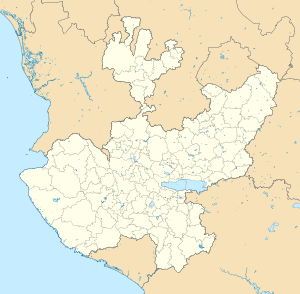
The Colima volcano is located on the border of the state of Colima with Jalisco , the Pacific coast is only about 100 km away. The city of Colima is about 60 km (as the crow flies) south of the mountain peak in the state of Colima.
geology
In the late Pleistocene period , a huge landslide took place, moving around 25 km³ of rubble up to 120 km and reaching the Pacific Ocean. An area of about 2200 km² was covered by the rubble. Massive events of this type seem to take place every few millennia. The current active cone resides in a large caldera that was likely formed from a combination of landslides and large eruptions. At the end of the 1990s, the two cones were wired to measuring instruments.
Volcanic activity
The Colima has a five million year history of volcanic activity and is ranked among the 16 most dangerous volcanoes in the world by the UN . It broke out more than 40 times since 1576. In the most violent known eruption to date in 1913, ash fell in Guadalajara, 120 km away .
In recent years, the surrounding villages have had to be evacuated due to volcanic activity. An eruption on May 23, 2005 was the most violent since 1991, and another eruption took place on June 4, 2005, throwing ash up to a height of 9 km into the atmosphere . It was the strongest outbreak in the previous two decades. As a result, a 7.5 km exclusion zone was established and the 300,000 residents in the area prepared for a possible evacuation . After a period of rest, the volcano released another ash cloud on January 6, 2013. Another ash cloud was ejected on November 21, 2014, which reached a height of about 5 km.
Ascent
The ascent of the Nevado de Colima is possible: A piste road leads to the weather station at an altitude of approx. 4000 m; the summit can be reached with hiking boots. An ascent of the frequently active Volcán de Fuego de Colima is only permitted in the company of an experienced guide.
Remarks
Web links
- Webcam on the volcano
- Universidad de Colima, Observatorio Vulcanológico (in Spanish)
- Universidad de Colima, Center of Exchange and Research in Volcanology (in English and Spanish)
- Colima in the Global Volcanism Program of the Smithsonian Institution (English)
Individual evidence
- Domínguez T., Ramírez JJ, Breton M. (2003), Present Stage Of Activity At Colima Volcano, Mexico , American Geophysical Union, Fall Meeting 2003, abstract # V42B-0350
- Süddeutsche Zeitung , June 8, 2005, p. 12


