New York State Route 17M

|
|
|---|---|
| map | |

|
|
| Basic data | |
| Overall length: | 26.63 mi. / 42.86 km |
| Opening: | 1952 |
| Starting point: | County Road 76 in Fair Oaks |
| End point: |
|
| County: | Orange County |
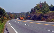
New York State Route 17M or NY 17M is a 42.86 km state route in Orange County of New York . It runs in an east-west direction and has its eastern starting point west of Middletown and ends in the west on the north-south section of the current New York State Route 17 south of Harriman . In fact, this State Route is largely the same as State Route 17 before it was upgraded to the expressway that will become part of Interstate 86 .
The State Route overlaps US Highway 6 between New Hampton and Chester . The eastern part of this section between Goshen and Chester leads over the Quickway, so that the route also overlaps with NY 17. The road is very busy between Monroe and Middletown; there it is separated by a median and serves as the city's main shopping street south to Interstate 84 . Otherwise, NY 17M is a two-lane rural road.
Route description
Orange County Route 76 becomes State Route 17M at the former junction - then Exit 118A - of the nearby Quickway north of the former New York, Ontario and Western Railway in the Town of Wallkill . It leads over gentle hills and after about 800 m you will reach a traffic light . At this intersection is the southern end of New York State Route 302 . It is the first intersection of NY 17M with another state route.
From this intersection, the route first leads to the traffic light intersection with Ingrassia Road and then into the more developed Washington Heights district just outside Middletown . State Route turns left on North Street and enters town. The street is reasonably wide at first, but then narrows in the mostly Hispanic neighborhoods near the center before turning right onto New York State Route 211 at the traffic lights intersection with Wickham Avenue . The streets that are combined here go up a little and then become West Main Street at a junction.
The common course of both streets ends at the traffic light on Monhagen Avenue, where NY 211 turns right towards Otisville and NY 17M turns left. It expands into a tree-lined parkway that stretches several blocks south of the city center. This section ends at the lights on Fulton Street; There State Route turns left. After a few crossings and crossing the Middletown and New Jersey Railway , it expands into Dolson Avenue. This has two lanes in both directions and has an additional lane in the middle, which is used to turn to the various shopping centers on the other side of the street.
Finally, US Highway 6 joins from the right. Both roads join together on Interstate 84 at Exit 3, which provides access to Port Jervis and Newburgh . After crossing the motorway, the hamlet of New Hampton begins . In this section the street is lined with car dealerships and other commercial objects. The road narrows to two lanes before descending to the bridge over the Wallkill River , at the northern end of the county's Black Dirt region . The uphill direction on either side of the bridge has a short passing lane.
The river forms the border to the Town of Goshen and after the road has climbed the hill, the development on both sides of the road increases again. Outside the Village of Goshen , US 6 and NY 17M eventually merge into NY 17.
State Route 17M leaves the Quickway before US 6 and resumes its own course at the intersection with New York State Route 94 in Chester. It runs through the rural areas south of Blooming Grove . It passes the Village of Monroe Historic District , which was added to the National Register of Historic Places in 1998. Both sides of the street are fully built in Monroe and Woodbury .
The development then goes back again before NY 17M leads after a slight bend to the south to its end point at the intersection with NY 17 in Harriman.
history
NY 17M was created after the first section of the freeway, the Middletown Bypass, opened in 1950. The original name 17M refers to the fact that the route served as a business route for the city. This is one of the few times in New York where the letter used to denote a highway branch actually has a meaning. NY 17M originally led from where Exit 123 of the expressway is now through Denton, New Hampton and Middletown to the former Exit 118A on NY 17.
With the addition of more sections of State Route 17 to the expressway, also known as The Quickway , the section of old NY 17 through Chester, Monroe and Harriman was repurposed to NY 17M.
Individual evidence
- ↑ 2007 Traffic Data Report for New York State ( English , PDF) New York State Department of Transportation . S. p. 126 July 25, 2008. Retrieved February 24, 2009.
- ^ New York Routes - New York State Route 17M ( English ) Retrieved February 21, 2009.
See also
Web links
- NY-17M-termini (English)


