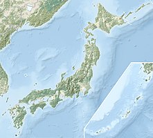
Noto Hantō Quasi National Park
|
Noto Hantō Quasi National Park
|
||
| location | Prefectures Toyama , Ishikawa , Japan | |
| surface | 96.72 km² | |
| WDPA ID | 3101 | |
| Geographical location | 37 ° 33 ' N , 137 ° 20' E | |
|
|
||
| Setup date | May 1, 1968 | |
The Noto Hantō Quasi National Park ( Japanese 能 登 半島 国 定 公園 Notohantō Kokutei Kōen ) is a Japanese quasi national park in the Toyama and Ishikawa prefectures . The prefectures are responsible for the administration of the respective park areas. Established on May 1, 1968, the park covers 9672 hectares and stretches along the coast of the Noto Peninsula . With the IUCN Category V, the park area is classified as a Protected Landscape / Protected Marine Area .
See also
Web links
Commons : Noto-Hantō-Quasi-National Park - Album with pictures, videos and audio files

