
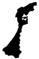
Ishikawa Prefecture
|
Ishikawa-ken 石川 県 |
|
|---|---|
  |
|
| Basic data | |
| Administrative headquarters : | Kanazawa |
| Region : | Chūbu |
| Main island : | Honshu |
| Area : | 4,186.05 km² |
| Residents : | 1,137,181 (October 1, 2019) |
| Population density : | 272 inhabitants per km² |
| Counties : | 5 |
| Municipalities : | 19th |
| ISO 3166-2 : | JP-17 |
| Governor : | Masanori Tanimoto |
| Website: | www.pref.ishikawa.jp |
| Symbols | |
| Prefecture flag : |
 |
| Prefecture tree : | Noto Hiba tree of life |
| Prefecture flower : | Fritillaria camschatcensis |
| Vogel prefecture : | Golden eagle |
| Fish prefecture : |
|
| Prefecture song : |
Ishikawa-kenmin no uta ("Song of the Ishikawa Citizens") |
The Ishikawa prefecture ( Japanese 石川県 , Ishikawa-ken ) is a prefecture of Japan . It is located in the Chūbu region on the island of Honshū . The seat of the prefectural administration is Kanazawa .
history
After the abolition of the feudal system in the Meiji Restoration , Ishikawa Prefecture was established in 1871 in the ancient provinces of Kaga , Noto , Echizen and Etchū from several fiefs ( Han ) or prefectures that emerged from them. At times it comprised areas from two other current prefectures: Fukui prefecture was finally separated from Ishikawa in 1881, Toyama prefecture only in 1883.
politics
Masanori Tanimoto has been governor of Ishikawa since 1994 . He was re-elected for a seventh term in the 2018 gubernatorial election against a communist challenger with almost 80% of the vote. The voter turnout decreased compared to the 2014 election (45%) to 39.07%, the lowest value ever. Since Masaru Hashimoto was voted out of office in Ibaraki in autumn 2017, Tanimoto has been the country's longest-serving governor.
Even after the elections in April 2019 , the Liberal Democratic Party (LDP) still holds an absolute majority in the prefecture parliament .
In the national parliament , Ishikawa is represented in the lower house by three directly elected MPs and is part of the Hokuriku-Shin'etsu proportional representation . The prefecture elects one member per partial election to the upper house . After the 2016 , 2017 and 2019 elections , all five of Ishikawa's representatives are Liberal Democrats, namely:
- in the lower house
- for constituency 1, which only includes the prefecture capital Kanazawa, Hiroshi Hase (LDP, 7th term), former professional wrestler and member of the House of Lords,
- for constituency 2, which includes the south of Ishikawa, Hajime Sasaki (LDP, 3rd term of office), who replaced the long-standing MP and former party chairman Yoshirō Mori in 2012 ,
- for constituency 3 in the north Shōji Nishida (LDP, 1st term), former Vice President of the Prefectural Parliament, and
- in the upper house
- until 2022 Naoki Okada (LDP, 3rd term) and
- by 2025 Shūji Yamada (LDP, 2nd term), a former official in the Ministry of Agriculture who sovereignly prevailed against the Democratic incumbent and former Defense Minister Yasuo Ichikawa in the 2013 election .

The main building of the prefectural administration in the Kuratsuki district of Kanazawa, completed in 2002

The parliament building in the same building complex


Administrative division
When today's community forms were introduced in 1889, Ishikawa was divided into 274 communities, including the city of Kanazawa as the first and initially only independent city. In April 1996, the seat of the prefectural administration also became a "core city" .
The number of municipalities fell in almost 100 years from 221 (1920), over 72 (1955) and 43 (1960) to the present (since 2011) 19. Eleven urban districts ( -shi ) and eight urban districts ( 6 -machi / 2 - chō ) shows the current structure. With the incorporation of the village of Yanagida ( -mura ) into the district town of Noto ( -chō ), the last village in the prefecture disappeared in March 2005. The number of counties ( -gun ) has fallen from eight to five since 1889.
In the table below, the districts ( 郡 , -gun ) are shown in italics, below each (indented) the small towns ( 町 , -chō / -machi ) within them. A dependency between rural district and small town can also be seen in the first three digits of the code (1st column). At the beginning of the table are the independent cities ( 市 , -shi ).
| code | Surname | Area (in km²) | population | Population density (inh / km²) 3 |
||
|---|---|---|---|---|---|---|
| Rōmaji | Kanji | October 1, 2017 1 | October 1, 2018 2 | October 1, 2015 3 | ||
| 17201 | Kanazawa- shi | 金 沢 市 | 468.64 | 465.325 | 465.699 | 993.72 |
| 17202 | Nanao- shi | 七 尾市 | 318.29 | 52,914 | 55,325 | 173.82 |
| 17203 | Komatsu- shi | 小松 市 | 371.05 | 107.014 | 106,919 | 288.15 |
| 17204 | Wajima- shi | 輪 島 市 | 426.32 | 25,505 | 27,216 | 63.84 |
| 17205 | Suzu- shi | 珠 洲 市 | 247.2 | 13,489 | 14,625 | 59.16 |
| 17206 | Kaga- shi | 加 賀 市 | 305.87 | 65.009 | 67.186 | 219.66 |
| 17207 | Hakui- shi | 羽 咋 市 | 81.85 | 20,837 | 21,729 | 265.47 |
| 17209 | Kahoku- shi | か ほ く 市 | 64.44 | 34,572 | 34,219 | 531.02 |
| 17210 | Hakusan- shi | 白山 市 | 754.93 | 110.197 | 109.287 | 144.76 |
| 17211 | Nomi- shi | 能 美 市 | 84.14 | 49.166 | 48,881 | 580.95 |
| 17212 | Nonoichi-shi | 野 々 市 市 | 13.56 | 56,045 | 55,099 | 4063.35 |
| 17320 | Nomi-gun | 能 美 郡 | 14.64 | 6323 | 6347 | 433.54 |
| 17324 | Kawakita-machi | 川北 町 | 14.64 | 6323 | 6347 | 433.54 |
| 17360 | Kahoku-gun | 河北 郡 | 130.92 | 63,563 | 63,955 | 488.5 |
| 17361 | Tsubata-machi | 津 幡 町 | 110.59 | 36,799 | 36,968 | 334.28 |
| 17365 | Uchinada-machi | 内 灘 町 | 20.33 | 26,764 | 26,987 | 1327.45 |
| 17380 | Hakui-gun | 羽 咋 郡 | 358.29 | 31,723 | 33,596 | 93.77 |
| 17384 | Shika-machi | 志 賀 町 | 246.76 | 19,212 | 20,422 | 82.76 |
| 17386 | Hōdatsushimizu-chō | 宝 達 志 水 町 | 111.52 | 12,511 | 13,174 | 118.13 |
| 17400 | Kashima gun | 鹿島 郡 | 89.45 | 16,929 | 17,571 | 196.43 |
| 17407 | Nakanoto-machi | 中 能 登 町 | 89.45 | 16,929 | 17,571 | 196.43 |
| 17460 | Hosu-gun | 鳳珠 郡 | 456.47 | 24,354 | 26,354 | 57.73 |
| 17461 | Anamizu-machi | 穴 水 町 | 183.21 | 8119 | 8786 | 47.96 |
| 17463 | Noto-cho | 能 登 町 | 273.27 | 16,235 | 17,568 | 64.29 |
| Shi-bu ( All Shi , proportion of urban districts) | 市 部 | 3136.28 | 1,000,073 | 1.006.185 | 320.82 | |
| Gun-bu ( All Gun , percentage of counties) | 郡 部 | 1049.77 | 142,892 | 147,823 | 140.81 | |
| 17000 | Ishikawa-Ken (Ishikawa Prefecture) | 石川 県 | 4186.05 | 1,142,965 | 1,154,008 | 275.68 |
1 Area data from 2017
2 Estimated population 2018
3 Results of the 2015 census
Biggest places
| VZ year | Residents | |||
|---|---|---|---|---|
| 2015 | 2010 | 2005 | 2000 | |
| Kanazawa-shi | 465.699 | 462.361 | 454607 | 456.438 |
| Hakusan.shi | 109.287 | 110,459 | 109,450 | —— |
| Komatsu-shi | 106,919 | 108,433 | 109.084 | 108,622 |
| Kaga-shi | 67.186 | 71,887 | 74,982 | 68,368 |
| Nanao-shi | 55,325 | 57,900 | 61,871 | 47,351 |
| Nonoichi-shi | 55,099 | —— | —— | —— |
| Nomi-shi | 48,881 | 48,680 | 47.207 | —— |
| Tsubata-machi | 36,968 | 36,940 | 35,712 | 34,304 |
| Kahoku-shi | 34,219 | 34,651 | 34,847 | —— |
| Wajima-shi | 27,216 | 29,858 | 25,301 | 26,381 |
| Uchinada-machi | 26,987 | 26,927 | 26,896 | 26,560 |
| Hakui-shi | 21,729 | 23,032 | 24,517 | 25,541 |
| Shika-machi | 20,422 | 22,216 | 23,790 | 15,681 |
| Nakanoto-machi | 17,571 | 18,535 | 18,959 | —— |
| Noto-cho | 17,568 | 19,565 | 21,792 | 11,433 |
| Suzu-shi | 14,625 | 16,300 | 18,050 | 19,852 |
| Hodatsushimizu-chō | 13,174 | 14,277 | 15,236 | —— |
| Mattō-shi | —— | —— | —— | 65,370 |
- March 1, 2004 - The independent city of Kahoku consists of three parishes .
- February 1, 2005 - The independent city of Matto and seven other parishes form the independent city of Hakusan .
- February 1, 2005 - Three parishes form the independent city of Nomi .
- March 1, 2005 - The district town of Hodatsushimizu is formed from two parishes.
- March 1, 2005 - The district town of Nakanoto is formed from three parishes.
- November 1, 2011 - The district town of Nonoichi is raised to the status of an independent town .
Population development in the prefecture
| Census year |
Total population |
male population |
female population |
Gender ratio men to 1000 women |
Area in km² |
Population density per km 2 |
|---|---|---|---|---|---|---|
| 1920 | 747.360 | 364,375 | 382.985 | 951 | 4197.51 | 178.1 |
| 1925 | 750.854 | 365.597 | 385.257 | 949 | 4197.51 | 178.9 |
| 1930 | 756.835 | 368.402 | 388,433 | 948 | 4197.51 | 180.3 |
| 1935 | 768.416 | 370.907 | 397.509 | 933 | 4192.42 | 183.3 |
| 1940 | 757.676 | 363,922 | 393.754 | 924 | 4192.42 | 180.7 |
| 1945 | 887.510 | 405.264 | 482.246 | 840 | 4192.42 | 211.7 |
| 1950 | 957.279 | 460,859 | 496.420 | 928 | 4195.75 | 228.2 |
| 1955 | 966.187 | 463.477 | 502.710 | 922 | 4193.92 | 230.4 |
| 1960 | 973.418 | 464.889 | 508,529 | 914 | 4193.92 | 232.1 |
| 1965 | 980.499 | 468,518 | 511,981 | 915 | 4194.54 | 233.8 |
| 1970 | 1,002,420 | 480,380 | 522.040 | 920 | 4195.27 | 238.9 |
| 1975 | 1,069,872 | 518.594 | 551.278 | 941 | 4196.08 | 255.0 |
| 1980 | 1,119,304 | 542,782 | 576,522 | 942 | 4196.82 | 266.7 |
| 1985 | 1,152,325 | 557.664 | 594,661 | 938 | 4197.39 | 274.5 |
| 1990 | 1,164,628 | 562,684 | 601.944 | 935 | 4184.56 | 278.3 |
| 1995 | 1,180,068 | 570.835 | 609.233 | 937 | 4184.83 | 282.0 |
| 2000 | 1,180,977 | 572.244 | 608.733 | 940 | 4185.22 | 282.2 |
| 2005 | 1,174,026 | 567.060 | 606.966 | 934 | 4185.46 | 280.5 |
| 2010 | 1,169,788 | 564,972 | 604.816 | 934 | 4185.66 | 279.5 |
| 2015 | 1,154,008 | 558,589 | 595.419 | 938 | 4186.09 | 275.7 |
Outline of the prefecture

Higashiyama Chaya

Road signs in Ishikawa Prefecture


Web links
Individual evidence
- ↑ 府 県 の 変 遷
- ↑ 福井 県 誕生 ま で の 歴 史 . History pages for children. (No longer available online.) In: Fukui Prefecture. Archived from the original on April 19, 2015 ; Retrieved August 15, 2016 (Japanese).
- ↑ Toyama Prefecture: 歴 史 と 伝 説 ( Memento of the original from October 19, 2013 in the Internet Archive ) Info: The archive link was inserted automatically and has not yet been checked. Please check the original and archive link according to the instructions and then remove this notice.
- ↑ Ishikawa Prefecture Parliament : Members by political group , accessed August 7, 2019.
- ↑ 石川 県 知事 選 谷 本 氏 7 選 . In: Mainichi Shimbun . March 12, 2018, Retrieved April 3, 2018 (Japanese).
- ↑ 石川 県 知事 に 谷 本 氏 、 現 職 最多 の 7 選 . In: Sankei WEST. March 11, 2018, Retrieved April 3, 2018 (Japanese).
- ↑ Kokudo Chiriin (GSI - Geospatial Information Authority of Japan), 平 成 29 年 全国 都 道 府 県 市区 町 村 別 面積 調 (Nationwide survey of all prefectures and municipalities 2017) , p. 48: 17 Ishikawa-ken (Japanese), accessed on 17 February 2019
- ↑ 簡 単 検 索 ・ 詳細 検 索 ・ 検 索 サ ン プ ル , accessed February 17, 2019 (Japanese)
- ↑ e-stat (English), accessed on February 17, 2019
- ↑ e-Stat database , accessed on February 17, 2019 (English)
- ↑ e-Stat database , accessed on February 17, 2019 (English)
Aichi | Akita | Aomori | Chiba | Ehime | Fukui | Fukuoka | Fukushima | Gifu | Gunma | Hiroshima | Hokkaidō | Hyōgo | Ibaraki | Ishikawa | Iwate | Kagawa | Kagoshima | Kanagawa | Kochi | Kumamoto | Kyoto | Mie | Miyagi | Miyazaki | Nagano | Nagasaki | Nara | Niigata | Ōita | Okayama | Okinawa | Osaka | Saga | Saitama | Shiga | Shimane | Shizuoka | Tochigi | Tokyo | Tokushima | Tottori | Toyama | Wakayama | Yamagata | Yamaguchi | Yamanashi
Coordinates: 36 ° 38 ' N , 136 ° 39' E