
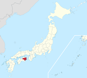
Tokushima Prefecture
|
Tokushima-ken 徳 島 県 |
|
|---|---|
  |
|
| Basic data | |
| Administrative headquarters : | Tokushima |
| Region : | Shikoku |
| Main island : | Shikoku |
| Area : | 4,146.75 km² |
| Water content: | 1.5 % |
| Residents : | 728,633 (October 1, 2019) |
| Population density : | 176 inhabitants per km² |
| Counties : | 8th |
| Municipalities : | 24 |
| ISO 3166-2 : | JP-36 |
| Governor : | Kamon Iizumi |
| Website: | www.pref.tokushima.jp |
| Symbols | |
| Prefecture flag : |
 |
| Prefecture tree : | Myrica rubra |
| Prefecture flower : | Citrus sudachi |
| Vogel prefecture : | White heron ( middle heron , but also great egret or little egret ) |
| Prefecture song : |
Tokushima-kenmin no uta ("Song of the Citizens of Tokushima") |
The Tokushima Prefecture ( Jap. 徳島県 , Tokushima-ken ) is a prefecture of Japan . It is located in the Shikoku region, mainly on the island of Shikoku, and was founded in 1871 in the Awa province . The seat of the prefecture administration is the city of the same name Tokushima .
There is an official partnership between the prefecture and the state of Lower Saxony .
Administrative division
Since April 2006, the prefecture has been divided into eight independent cities ( sowie Shi ) as well as 15 (district / small) cities ( 町 chō ) and one village ( 村 son ). The latter are organized in eight districts ( Gun ).
In the table below, the former rural districts ( 郡 gun ) are shown in italics, below (indented) the cities and the village within them. The prefectural affiliation can be seen in the first two digits of the code (1st column). The third digit is the independent cities 2, historically the municipalities 3 to 7.
| code | Surname | Area (in km²) | population | Population density (inh / km²) |
||
|---|---|---|---|---|---|---|
| Transcription ( lat. , Hepburn ) |
Name ( jap. ) |
01.10.2017 1 | 01.10.2018 2 | 01/10/2015 3 | ||
| 36201 | Tokushima- shi | 徳 島 市 | 191.39 | 256,698 | 258,554 | 1341.23 |
| 36202 | Naruto- shi | 鳴 門市 | 135.66 | 56,857 | 59.101 | 419.11 |
| 36203 | Komatsushima -shi | 小松 島 市 | 45.37 | 37,168 | 38,755 | 819.22 |
| 36204 | Anan- shi | 阿南 市 | 279.25 | 70,935 | 73.019 | 254.02 |
| 36205 | Yoshinogawa- shi | 吉野 川 市 | 144.14 | 39,832 | 41,466 | 276.34 |
| 36206 | Awa- shi | 阿波 市 | 191.11 | 35,690 | 37.202 | 186.75 |
| 36207 | Mima- shi | 美 馬 市 | 367.14 | 29,069 | 30.501 | 79.18 |
| 36208 | Miyoshi- shi | 三好 市 | 721.42 | 24,875 | 26,836 | 34.48 |
| 36300 | Katsuura gun | 勝浦 郡 | 179.46 | 6450 | 6846 | 35.94 |
| 36301 | Katsuura-cho | 勝浦 町 | 69.83 | 5047 | 5301 | 72.28 |
| 36302 | Kamikatsu-cho | 上 勝 町 | 109.63 | 1403 | 1545 | 12.80 |
| 36320 | Myōdō-gun | 名 東郡 | 42.28 | 2144 | 2289 | 50.71 |
| 36321 | Sanagouchi-son | 佐 那 河内 村 | 42.28 | 2144 | 2289 | 50.71 |
| 36340 | Myozai gun | 名 西 郡 | 202.15 | 29,981 | 30,890 | 148.31 |
| 36341 | Ishii-cho | 石井 町 | 28.85 | 25,165 | 25,590 | 872.27 |
| 36342 | Kamiyama-cho | 神山 町 | 173.30 | 4816 | 5300 | 27.79 |
| 36360 | Naka-gun | 那 賀 郡 | 694.98 | 7697 | 8402 | 11.08 |
| 36368 | Naka-cho | 那 賀 町 | 694.98 | 7697 | 8402 | 11.08 |
| 36380 | Kaifu-gun | 海 部 郡 | 525.07 | 19,186 | 20,634 | 36.54 |
| 36383 | Mugi-cho | 牟 岐 町 | 56.62 | 3930 | 4259 | 69.41 |
| 36387 | Minami-cho | 美 波 町 | 140.80 | 6541 | 7092 | 46.46 |
| 36388 | Kaiyo-cho | 海陽 町 | 327.65 | 8715 | 9283 | 26.60 |
| 36400 | Itano gun | 板 野 郡 | 110.05 | 97,640 | 97,673 | 887.23 |
| 36401 | Matsushige-cho | 松茂 町 | 14.24 | 14,972 | 15.204 | 1051.40 |
| 36402 | Kitajima-cho | 北島 町 | 8.74 | 22,724 | 22,446 | 2600.00 |
| 36403 | Aizumi-cho | 藍 住 町 | 16.27 | 35,026 | 34,626 | 2152.80 |
| 36404 | Itano-cho | 板 野 町 | 36.22 | 13,261 | 13,358 | 366.12 |
| 36405 | Kamiita-cho | 上 板 町 | 34.58 | 11,657 | 12,039 | 337.10 |
| 36460 | Mima-gun | 美 馬 郡 | 194.84 | 8064 | 8927 | 41.39 |
| 36468 | Tsurugi-cho | つ る ぎ 町 | 194.84 | 8064 | 8927 | 41.39 |
| 36480 | Miyoshi-gun | 三好 郡 | 122.48 | 14,189 | 14,638 | 115.85 |
| 36489 | Higashimiyoshi-chō | 東 み よ し 町 | 122.48 | 14,189 | 14,638 | 115.85 |
| JP-36 36000 |
Tokushima-ken | 徳 島 県 | 4146.80 | 736.475 | 755.733 | 182.24 |
swell
1 Area data from 2017
2 Estimated population 2018
3 Results of the 2015 census
Largest independent cities
| Census year | Residents | |||
|---|---|---|---|---|
| 2015 | 2010 | 2005 | 2000 | |
| Tokushima | 258,554 | 264,548 | 258,554 | 268.218 |
| Anan | 73.019 | 76.063 | 73.019 | 56,728 |
| Naruto | 59.101 | 61,513 | 59.101 | 64,620 |
| Komatsushima | 38,755 | 40,614 | 38,755 | 43,078 |
| Yoshinogawa | 41,466 | 44.020 | 41,466 | —— |
| Awa | 37.202 | 39,247 | 37.202 | —— |
| Mima | 30.501 | 32,484 | 30.501 | —— |
| Miyoshi | 26,836 | 29,951 | 26,836 | —— |
On 1 October 2004 4 municipalities merged to city Yoshinogawa
On 1 March 2005 merged four communities to the city Mima
On 1 April 2005 merged four communities to the city Awa
On 1 March 2006 merged six municipalities for town Miyoshi
Population development in the prefecture
| Census year |
Total population |
male population |
female population |
Gender ratio men to 1000 women |
Area in km 2 |
Population density per km 2 |
|---|---|---|---|---|---|---|
| 1920 | 670.212 | 331,768 | 338,444 | 980 | 4135.31 | 162.1 |
| 1925 | 689.814 | 344,550 | 345.264 | 998 | 4135.31 | 166.8 |
| 1930 | 716,544 | 356,958 | 359,586 | 993 | 4143.22 | 172.9 |
| 1935 | 728.748 | 362.042 | 366.706 | 987 | 4143.22 | 175.9 |
| 1940 | 718.717 | 354.423 | 364.294 | 973 | 4143.22 | 173.5 |
| 1945 | 835.763 | 386.052 | 449.711 | 858 | 4143.22 | 201.7 |
| 1950 | 878.511 | 427,684 | 450,827 | 949 | 4141.63 | 212.1 |
| 1955 | 878.109 | 427.204 | 450.905 | 947 | 4142.85 | 212.0 |
| 1960 | 847.274 | 408,300 | 438,974 | 930 | 4142.85 | 204.5 |
| 1965 | 815.115 | 389.795 | 425,320 | 917 | 4143.37 | 196.7 |
| 1970 | 791.111 | 376.729 | 414,382 | 909 | 4144.23 | 190.9 |
| 1975 | 805.166 | 384.812 | 420.354 | 915 | 4144.97 | 194.3 |
| 1980 | 825.261 | 395.994 | 429.267 | 923 | 4145.23 | 199.1 |
| 1985 | 834.889 | 399,689 | 435.200 | 918 | 4145.22 | 201.4 |
| 1990 | 831,598 | 395.906 | 435,692 | 909 | 4143.22 | 200.7 |
| 1995 | 832.427 | 395,636 | 436.791 | 906 | 4144.37 | 200.9 |
| 2000 | 824.108 | 391.718 | 432,390 | 906 | 4145.10 | 198.8 |
| 2005 | 809.950 | 384,635 | 425.315 | 904 | 4145.33 | 195.4 |
| 2010 | 785.491 | 372.710 | 412.781 | 903 | 4146.67 | 189.4 |
| 2015 | 755.733 | 359.790 | 395.943 | 909 | 4146.65 | 182.3 |
politics
In the fourth term of office of Tokushima, Kamon Iizumi is governor , who was last re-elected for a fifth term in the uniform regional elections in April 2019 with the support of the LDP and Kōmeitō against the LDP prefectural parliamentarian Taiji Kishimoto. The parliament is also elected in the unified regional elections. In 2019, the LDP won 22 of the 38 seats.
The national parliament Tokushima sent since the election in 2014 , only two directly elected members to the House of Commons and selects since 2016 no longer own deputies to the upper house , Tokushima forms since then, together with the adjacent Kōchi the common Einmandatswahlkreis Tokushima Kōchi. In the lower house, Tokushima (as of August 2019) represent Masazumi Gotōda (LDP, 7th term, 51.5% of the vote in the 2017 election ), who represented the abolished constituency 3 until 2014, for the new constituency 1 in the south and for the enlarged constituency 2 in north Shun'ichi Yamaguchi (LDP, 10th term, 2017 71.0%), former minister in the Abe cabinet. In the House of Lords, Tokushima's independent representation has ceased to exist; but the LDP uses the new system of optionally unelected list places in the proportional representation to the upper house to give the LDP prefectural associations affected by the constituency associations safe seats: In the 2019 election , Kōjirō Takano from Kōchi received the (successful) majority candidate Tokushima-Kōchi, and Tōru Miki from Tokushima took the LDP list position 1 in the proportional representation.
Web links
Individual evidence
- ^ Partnership with Tokushima Prefecture. Lower Saxony State Chancellery, September 13, 2007, accessed January 6, 2009 .
- ↑ Kokudo Chiriin (GSI - Geospatial Information Authority of Japan), 平 成 29 年 全国 都 道 府 県 市区 町 村 別 面積 調 (Nationwide Survey of All Prefectures and Municipalities 2017) , p. 82: 36 Tokushima-ken (Japanese), accessed on 9 December 2018
- ↑ 簡 単 検 索 ・ 詳細 検 索 ・ 検 索 サ ン プ ル , accessed December 9, 2018 (Japanese)
- ↑ e-stat (English), accessed on December 9, 2018
- ↑ e-Stat database , accessed on January 1, 2019 (English)
- ↑ Tokushima Prefectural Parliament : Members by parliamentary group , accessed on August 12, 2019.
- ↑ 統一 地方 選 2019 徳 島 県 議 選 各 党 議席 . In: NHK Senkyo Web. April 8, 2019. Retrieved August 12, 2019 (Japanese).
Aichi | Akita | Aomori | Chiba | Ehime | Fukui | Fukuoka | Fukushima | Gifu | Gunma | Hiroshima | Hokkaidō | Hyōgo | Ibaraki | Ishikawa | Iwate | Kagawa | Kagoshima | Kanagawa | Kochi | Kumamoto | Kyoto | Mie | Miyagi | Miyazaki | Nagano | Nagasaki | Nara | Niigata | Ōita | Okayama | Okinawa | Osaka | Saga | Saitama | Shiga | Shimane | Shizuoka | Tochigi | Tokyo | Tokushima | Tottori | Toyama | Wakayama | Yamagata | Yamaguchi | Yamanashi
Coordinates: 34 ° 2 ′ N , 134 ° 26 ′ E