
Niigata prefecture
|
Niigata-ken 新潟 県 |
|
|---|---|
  |
|
| Basic data | |
| Administrative headquarters : | Niigata |
| Region : | Chūbu |
| Main island : | Honshu |
| Area : | 12,584.24 km² |
| Water content: | 0.2 % |
| Residents : | 2,222,004 (October 1, 2019) |
| Population density : | 177 inhabitants per km² |
| Counties : | 9 |
| Municipalities : | 30th |
| ISO 3166-2 : | JP-15 |
| Governor : | Hideyo Hanazumi |
| Website: | www.pref.niigata.lg.jp |
| Symbols | |
| Prefecture flag : |
 |
| Prefecture tree : | Camellia japonica var. Decumbens |
| Prefecture flower : | tulip |
| Vogel prefecture : | Nipponibis |
| Prefecture song : |
Kenminka ("song of the citizens of the prefecture") |
The Niigata prefecture ( Jap. 新潟県 , Niigata-ken ) is a prefecture of Japan . It is located in the Chūbu region on the coast of the Sea of Japan on the main island of Honshū and comprises over 90 other islands, including Sado-shima, one of the largest islands in the country. The city of the same name Niigata (Niigata-shi) is the seat of the prefecture administration.
Niigata is famous for its excellent rice and accordingly also for its sake .
history
Until the Meiji Restoration , the provinces of Japan Echigo and Sado were in today's prefecture . The latter, as well as from 1843 a Shogunate domain ( bakuryō ) around the city of Niigata were directly from the Tokugawa controlled. The principalities (-han) in the province of Echigo in the late Edo period included Murakami under the Naitō , Nagaoka under the Makino , Shibata under the Mizoguchi and Takada (with the prince's seat in today's city of Jōetsu ) under the Sakakibara .
In the Meiji Restoration, the former Niigata shogunate administration ( Niigata bugyōsho ) became the [city] prefecture (-fu) Echigo , from which the prefecture (-ken) Kashiwazaki was later temporarily separated. Echigo was renamed Niigata in the same year and converted into an ordinary prefecture (-ken) in 1869 . The Sado prefecture emerged from the Sado shogunate administration and was later renamed Aikawa. After the abolition of the principalities , Niigata and Kashiwazaki were united with the prefectures that emerged from the principalities in Echigo Province. In 1873 Kashiwazaki Prefecture was incorporated into Niigata, and in 1876 Aikawa. With the transfer of the district (gun) Higashi-Kambara ("East Kambara ") from Fukushima in 1886, Niigata essentially received its present-day borders.
Before the modernization of the prefecture, district and municipality regulations from 1889, Niigata had a city district (-ku) , the administrative seat Niigata, and 18 districts. In 1889 the capital Niigata was named the first independent city (-shi) in the prefecture, before other cities followed, beginning with Nagaoka-shi in 1906 in the 20th century. After the major territorial reforms of the post-war period, there are still nine counties in Niigata today, but most of them only consist of a single municipality.
In the 1970s and 1980s, most of the kidnappings of Japanese citizens by the Democratic People's Republic of Korea took place on the Niigata coast .
On October 23, 2004, a severe earthquake struck Niigata: The Chūetsu quake reached a level of 6+ on the Japanese intensity scale and hit the area around Ojiya in particular . Without electricity and gas, thousands spent weeks in private cars on large parking lots during the cold nights, safe from aftershocks. On July 16, 2007, the Niigata Chūetsu coastal earthquake took place.
politics
Niigata's governor Ryūichi Yoneyama resigned in April 2018. In the new election on June 6, 2018 , the most important national government and opposition parties supported various candidates: Hideyo Hanazumi , former lieutenant governor and deputy head of the national government, who was supported by the LDP and Kōmeitō but was looking to distance himself from parties (and the scandalous Abe government) during the election campaign Coast Guard , with 49.6% of the vote narrowly prevailed against the former prefectural parliament member Chikako Ikeda (46.2%), who was supported by opposition parties (KDP, DVP, KPJ, LP, SDP). As in the 2016 gubernatorial election , the planned restart of the Kashiwazaki-Kariwa nuclear power plant was a key issue in the election. With around four percent of the vote, the independent Satoshi Annaka, who ran without recommendation from major parties, was a former city parliament member in Gosen , who positioned himself even more clearly than Ikeda as an opponent of nuclear power. The turnout rose to over 58%.
In the 53-member parliament, the LDP defended an absolute majority with 28 seats in the April 2019 elections .
In the national parliament , Niigata is represented by six directly elected members of the Shūgiin and one per partial election in the Sangiin , after the elections in 2016 , 2017 , 2019 and since then party reshuffles currently (as of August 2019) mostly opposition politicians, namely:
- in the Shūgiin
- for the constituency Niigata 1 in the center of the capital Niigata Chinami Nishimura ( KDP , 5th term),
- for constituency 2 southwest of it on the coast and with the island of Sado Eiichirō Washio ( LDP , 5th term), ex-democrat, joined the LDP in 2019,
- for constituency 3 in the northeast Takahiro Kuroiwa (non-party / KDP parliamentary group, 3rd term, previously in the 2000s for Niigata in Sangiin),
- for constituency 4 with the interior south of the capital Makiko Kikuta (non-party / KDP parliamentary group, 6th term),
- for constituency 5 in the interior of Niigata from the south of the city of Nagaoka to the border with Gunma Hirohiko Izumida (LDP, 1st term of office), from 2004 to 2016 governor of Niigata, and
- for constituency 6 in the southwest Shūichi Takatori (LDP, 4th term), from 2018 Secretary of State for Agriculture for the Abe cabinet, and
- in the Sangiin
- by 2022 Yūko Mori ( DVP , 3rd term) and
- until 2025 Sakura Uchikoshi (non-party and non-attached, 1st term of office), a lawyer who stood as a unity candidate for the center-left opposition in the 2019 election with an absolute majority against LDP incumbent Ichirō Tsukada (2018-19 MLIT State Secretary; a Son of Governor Jūichirō Tsukada ).
The family of ex-Prime Minister Kakuei Tanaka , who was one of the most influential politicians of the LDP and thus of the country from the 1960s to the early 1980s ("shadow shogun") and its extensive political and economic network in Niigata around his support organization Etsuzankai cited as a prime example of how LDP dominance worked in the post-war decades, is no longer represented in parliament after Makiko Tanaka was voted out in 2012 and Naoki Tanaka in 2016.
Administrative division
With the introduction of today's municipal forms in 1889, Niigata was divided into 816 municipalities (including the first and initially only independent city the city of Niigata and another 48 cities belonging to the district) distributed over 17 districts.
The number of municipalities fell in almost 100 years from 417 (1920), over 179 (1955), 120 (1960) and 43 (2005) to currently (since April 2010) 30. The current breakdown shows 20 district-free ( -shi ) and six towns ( -machi ) and four villages ( -mura ) belonging to the district. The number of counties ( -gun ) is nine, eight of which consist of only one municipality each. Between 1951 and 1959, 14 municipalities were elevated to cities.
The administrative center Niigata is since April 2007 a ( "designated city" ), Jōetsu and Nagaoka are since 2007 an "exceptional city" ( Tokureishi ).
In the table below, the districts ( 郡 , - gun ) are shown in italics, below (indented) the small towns ( 町 , -machi ) and villages ( 村 , -mura ) within them. A dependency between rural district and small town can also be seen in the first three digits of the code (1st column). At the beginning of the table are the independent cities ( 市 , - shi ). In addition, the affiliation to the four "regions" ( 地方 , chihō ) is given in the last column .
| code | Surname | Area (in km²) | population | Population density (inh / km²) 3 |
region | ||
|---|---|---|---|---|---|---|---|
| Rōmaji | Kanji | October 1, 2017 1 | October 1, 2018 2 | October 1, 2015 3 | |||
| 15100 | Niigata- shi | 新潟 市 | 726.45 | 800,582 | 810.157 | 1115.23 | Kaetsu-chihō |
| 15202 | Nagaoka- shi | 長 岡 市 | 891.06 | 269.508 | 275.133 | 308.77 | Chūetsu-chihō |
| 15204 | Sanjō- shi | 三条 市 | 431.97 | 96,482 | 99.192 | 229.63 | Chūetsu-chihō |
| 15205 | Kashiwazaki- shi | 柏 崎 市 | 442.03 | 83,826 | 86,833 | 196.44 | Chūetsu-chihō |
| 15206 | Shibata- shi | 新 発 田 市 | 533.10 | 96,267 | 98,611 | 184.98 | Kaetsu-chihō |
| 15208 | Ojiya -shi | 小 千 谷 市 | 155.19 | 35,142 | 36,498 | 235.18 | Chūetsu-chihō |
| 15209 | Kamo- shi | 加 茂 市 | 133.72 | 26,343 | 27,852 | 208.29 | Chūetsu-chihō |
| 15210 | Tōkamachi- shi | 十 日 町 市 | 590.39 | 51,822 | 54,917 | 93.02 | Chūetsu-chihō |
| 15211 | Mitsuke -shi | 見附 市 | 77.91 | 39,801 | 40,608 | 521.22 | Chūetsu-chihō |
| 15212 | Murakami- shi | 村 上市 | 1174.26 | 59,137 | 62,442 | 53.18 | Kaetsu-chihō |
| 15213 | Tsubame- shi | 燕 市 | 110.96 | 77,915 | 79,784 | 719.03 | Kaetsu-chihō |
| 15216 | Itoigawa- shi | 糸 魚 川 市 | 746.24 | 42.111 | 44,162 | 59.18 | Jōetsu-chihō |
| 15217 | Myōkō- shi | 妙 高市 | 445.63 | 31,685 | 33.199 | 74.50 | Jōetsu-chihō |
| 15218 | Gosen- shi | 五 泉 市 | 351.91 | 49.091 | 51,404 | 146.07 | Kaetsu-chihō |
| 15222 | Joetsu- shi | 上 越 市 | 973.81 | 191,835 | 196.987 | 202.28 | Jōetsu-chihō |
| 15223 | Agano- shi | 阿 賀 野 市 | 192.74 | 41,728 | 43,415 | 225.25 | Kaetsu-chihō |
| 15224 | Sado- shi | 佐渡 市 | 855.66 | 54,126 | 57,255 | 66.91 | Sado-chiho |
| 15225 | Uonuma- shi | 魚 沼 市 | 946.76 | 35,516 | 37,352 | 39.45 | Chūetsu-chihō |
| 15226 | Minamiuonuma -shi | 南 魚 沼 市 | 584.55 | 56,689 | 58,568 | 100.19 | Chūetsu-chihō |
| 15227 | Tainai- shi | 胎 内 市 | 264.89 | 29,106 | 30.198 | 114.00 | Kaetsu-chihō |
| 15300 | Kitakambara gun | 北 蒲 原 郡 | 37.58 | 14,025 | 14,040 | 373.60 | Kaetsu-chihō |
| 15307 | Seirō-machi | 聖 籠 町 | 37.58 | 14,025 | 14,040 | 373.60 | Kaetsu-chihō |
| 15340 | Nishikambara gun | 西 蒲 原 郡 | 25.17 | 7,953 | 8,209 | 326.14 | Kaetsu-chihō |
| 15342 | Yahiko-mura | 弥 彦 村 | 25.17 | 7,953 | 8,209 | 326.14 | Kaetsu-chihō |
| 15360 | Minamikambara gun | 南 蒲 原 郡 | 31.71 | 11,662 | 12,188 | 384.36 | Chūetsu-chihō |
| 15361 | Tagami-machi | 田 上 町 | 31.71 | 11,662 | 12,188 | 384.36 | Chūetsu-chihō |
| 15380 | Higashikambara gun | 東 蒲 原 郡 | 952.89 | 10,632 | 11,680 | 12.26 | Kaetsu-chihō |
| 15385 | Aga-machi | 阿 賀 町 | 952.89 | 10,632 | 11,680 | 12.26 | Kaetsu-chihō |
| 15400 | Santō-gun | 三島 郡 | 44.38 | 4243 | 4528 | 102.03 | Chūetsu-chihō |
| 15405 | Izumozaki-machi | 出 雲 崎 町 | 44.38 | 4243 | 4528 | 102.03 | Chūetsu-chihō |
| 15460 | Minamiuonuma-gun | 南 魚 沼 郡 | 357.29 | 7958 | 8046 | 22.52 | Chūetsu-chihō |
| 15461 | Yuzawa-machi | 湯 沢 町 | 357.29 | 7958 | 8046 | 22.52 | Chūetsu-chihō |
| 15480 | Nakauonuma-gun | 中 魚 沼 郡 | 170.21 | 9410 | 10,029 | 58.92 | Chūetsu-chihō |
| 15482 | Tsunan-machi | 津南 町 | 170.21 | 9410 | 10,029 | 58.92 | Chūetsu-chihō |
| 15500 | Kariwa-gun | 刈 羽 郡 | 26.27 | 4667 | 4775 | 181.77 | Chūetsu-chihō |
| 15504 | Kariwa-mura | 刈 羽 村 | 26.27 | 4667 | 4775 | 181.77 | Chūetsu-chihō |
| 15580 | Iwafune gun | 岩 船 郡 | 309.40 | 5795 | 6202 | 20.05 | Kaetsu-chihō |
| 15581 | Sekikawa-mura | 関 川村 | 299.61 | 5431 | 5832 | 19.47 | Kaetsu-chihō |
| 15586 | Awashimaura-mura | 粟 島 浦村 | 9.78 | 364 | 370 | 37.83 | Kaetsu-chihō |
| Shi-bu ( All Shi , proportion of urban districts) | 市 部 | 10629.25 | 2,168,712 | 2,224,567 | 209.29 | ||
| Shi-bu ( All Shi , proportion of urban districts) | 市 部 | 1954.91 | 76,345 | 79,697 | 40.77 | ||
| 15000 | Niigata-Ken (Niigata Prefecture) | 新潟 県 | 12584.15 | 2,245,057 | 2,304,264 | 183.11 | |
1 Area data from 2017
2 Estimated population 2018
3 Results of the 2015 census
Biggest places
| Census year | Residents | |||
|---|---|---|---|---|
| 2015 | 2010 | 2005 | 2000 | |
| Niigata | 810.157 | 811.901 | 785.134 | 501.431 |
| Nagaoka | 275.133 | 282,674 | 236.344 | 193,414 |
| Jōetsu | 196.987 | 203,899 | 208.082 | 134,751 |
| Sanjō | 99.192 | 102.292 | 104,749 | 84,447 |
| Shibata | 98,611 | 101.202 | 104,634 | 80.734 |
| Kashiwazaki | 86,833 | 91,451 | 94,648 | 88,418 |
| Tsubame | 79,784 | 81,876 | 43,255 | 43,480 |
| Murakami | 62,442 | 66,427 | 30,685 | 31,758 |
| Minamiuonuma | 58,568 | 61,624 | 63,329 | - |
| Sado | 57,255 | 62,727 | 67,386 | - |
| Tōkamachi | 54,917 | 58,911 | 62,058 | 43.002 |
| Gosen | 51,404 | 54,550 | 37,282 | 38,306 |
| Itoigawa | 44,162 | 47,702 | 49,844 | 32.003 |
| Agano | 43,415 | 45,560 | 47,043 | - |
| Mitsuke | 40,608 | 41,862 | 42,668 | 43,526 |
| Uonuma | 37,352 | 40,361 | 43,555 | - |
| Ojiya | 36,498 | 38,600 | 39,956 | 41,641 |
| Myōkō | 33.199 | 35,457 | 37,831 | 27,882 |
| Tainai | 30.198 | 31,424 | 32,813 | - |
| Kamo | 27,852 | 29,762 | 31,482 | 33,085 |
| Niitsu | - | - | - | 65,860 |
| Toyosaka | - | - | - | 48.997 |
| Shirone | - | - | - | 40,012 |
| Tochio | - | - | 23,168 | 24,704 |
| Ryotsu | - | - | - | 17,394 |
- March 1, 2004 - The independent city of Ryōtsu forms the new independent city of Sado with nine municipalities .
- April 1, 2004 - Four municipalities form the independent city of Agano .
- November 1, 2004 - Two parishes form the independent city of Minamiuonuma .
- November 1, 2004 - Six parishes form the independent city of Uonuma .
- March 21, 2005 - The cities of Niitsu, Shirone and Toyosaka are incorporated into the city of Niigata .
- April 1, 2005 - Two municipalities form the independent city of Arai , which at the same time changes its name to Myōkō .
- September 1, 2005 - Two parishes form the independent city of Tainai .
Population development in the prefecture
| Census year |
Total population |
male population |
female population |
Gender ratio men to 1000 women |
Area in km² |
Population density per km 2 |
|---|---|---|---|---|---|---|
| 1920 | 1,776,474 | 871,532 | 904.942 | 963 | 12578.64 | 141.2 |
| 1925 | 1,849,807 | 913,886 | 935.921 | 977 | 12578.64 | 147.1 |
| 1930 | 1,933,326 | 955.621 | 977.705 | 977 | 12578.64 | 153.7 |
| 1935 | 1,995,777 | 982.497 | 1,013,280 | 970 | 12578.05 | 158.7 |
| 1940 | 2,064,402 | 1,017,080 | 1,047,322 | 971 | 12578.05 | 164.1 |
| 1945 | 2,389,653 | 1,095,809 | 1,293,844 | 847 | 12578.05 | 190.0 |
| 1950 | 2,460,997 | 1,194,929 | 1,266,068 | 944 | 12570.46 | 195.8 |
| 1955 | 2,473,492 | 1,195,872 | 1,277,620 | 936 | 12575.33 | 196.7 |
| 1960 | 2,442,037 | 1,177,923 | 1,264,114 | 932 | 12575.33 | 194.2 |
| 1965 | 2,398,931 | 1,160,283 | 1,238,648 | 937 | 12575.38 | 190.8 |
| 1970 | 2,360,982 | 1,140,148 | 1,220,834 | 934 | 12577.06 | 187.7 |
| 1975 | 2,391,938 | 1,160,869 | 1,231,069 | 943 | 12577.37 | 190.2 |
| 1980 | 2,451,357 | 1,193,653 | 1,257,704 | 949 | 12578.30 | 194.9 |
| 1985 | 2,478,470 | 1,205,071 | 1,273,399 | 946 | 12578.62 | 197.0 |
| 1990 | 2,474,583 | 1,200,376 | 1,274,207 | 942 | 12581.62 | 196.7 |
| 1995 | 2,488,364 | 1,209,833 | 1,278,531 | 946 | 12581.75 | 197.8 |
| 2000 | 2,475,733 | 1,202,004 | 1,273,729 | 944 | 12582.37 | 196.8 |
| 2005 | 2,431,459 | 1,176,919 | 1,254,540 | 938 | 12583.32 | 193.2 |
| 2010 | 2,374,450 | 1,148,236 | 1,226,214 | 936 | 12583.81 | 188.7 |
| 2015 | 2,304,264 | 1,115,413 | 1,188,851 | 938 | 12584.10 | 183.1 |
Transport and economy
railroad
- The Jōetsu Shinkansen connects Tokyo with Niigata.
- Echigo line
- Yahiko line
- Jōetsu line
- Shin'etsu main line
- Hakushin line
- Uetsu main line
- Ban'etsu West Line
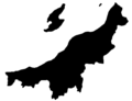
Outline of the prefecture

Farmhouse in the Northern Culture Museum

Fukushimagata in Niigata

Nagaoka Lyric Hall

Niigata prefecture border shield


Web links
Individual evidence
- ↑ Ishida Satoshi, 地理 デ ー タ 集 : 版 籍 奉還 か ら 廃 藩 置 置 県 ま で (中部 地方)
- ↑ Ishida Satoshi, 地理 デ ー タ 集 : 郡 区 町 村 編制 法 下 の 郡 ・ 区 (1889 年 1 月)
- ↑ Niigata Prefectural Parliament : MPs , accessed August 7, 2019.
- ↑ 新潟 県 知事 選 自 民 ・ 公 明 支援 の 花 角 氏 が 初 当選 . In: NHK Senkyo Web. June 10, 2018. Retrieved May 22, 2019 (Japanese).
- ↑ 新潟 知事 選: 自 公 支持 の 花 角 英 世 氏 が 初 当選 確 実 に . In: Mainichi Shimbun . June 10, 2018. Retrieved June 10, 2018 (Japanese).
- ↑ 新潟 県 知事 選 、 花 角 英 世 氏 の 当選 確 実 . In: Niigata Nippō . June 10, 2018. Retrieved June 10, 2018 (Japanese).
- ↑ Victory of LDP-backed candidate in Niigata gubernatorial race likely to give boost to Abe and key ally. In: The Japan Times . June 10, 2018, accessed October 5, 2018 .
- ↑ 新潟 県 議 選 各 党 議席 . In: NHK Senkyo Web. April 8, 2019, accessed May 22, 2019 (Japanese).
- ↑ Kokudo Chiriin (GSI - Geospatial Information Authority of Japan), 平 成 29 年 全国 都 道 府 県 市区 町 村 別 面積 調 (Nationwide survey of all prefectures and municipalities 2017) , p. 45: 15 Niigata-ken (Japanese), accessed on 17 February 2019
- ↑ 簡 単 検 索 ・ 詳細 検 索 ・ 検 索 サ ン プ ル , accessed February 17, 2019 (Japanese)
- ↑ e-stat (English), accessed on February 17, 2019
- ↑ e-Stat database , accessed on February 17, 2019 (English)
Aichi | Akita | Aomori | Chiba | Ehime | Fukui | Fukuoka | Fukushima | Gifu | Gunma | Hiroshima | Hokkaidō | Hyōgo | Ibaraki | Ishikawa | Iwate | Kagawa | Kagoshima | Kanagawa | Kochi | Kumamoto | Kyoto | Mie | Miyagi | Miyazaki | Nagano | Nagasaki | Nara | Niigata | Ōita | Okayama | Okinawa | Osaka | Saga | Saitama | Shiga | Shimane | Shizuoka | Tochigi | Tokyo | Tokushima | Tottori | Toyama | Wakayama | Yamagata | Yamaguchi | Yamanashi
Coordinates: 37 ° 37 ' N , 138 ° 52' E