
Gunma Prefecture
|
Gunma-ken 群 馬 県 |
|
|---|---|
  |
|
| Basic data | |
| Administrative headquarters : | Maebashi |
| Region : | Kanto |
| Main island : | Honshu |
| Area : | 6,362.28 km² |
| Water content: | 0.2 % |
| Residents : | 1,937,626 (October 1, 2019) |
| Population density : | 305 inhabitants per km² |
| Counties : | 7th |
| Municipalities : | 35 |
| ISO 3166-2 : | JP-10 |
| Governor : | Ichita Yamamoto |
| Website: | www.pref.gunma.jp |
| Symbols | |
| Prefecture flag : |
 |
| Prefecture tree : | Japanese black pine |
| Prefecture flower : | Japanese azalea |
| Vogel prefecture : | Copper pheasant |
| Fish prefecture : | Plecoglossus altivelis altivelis |
| Citizens Day: | 28th of October |
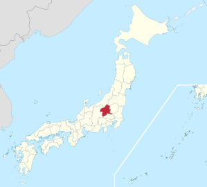
The Gunma prefecture ( Jap. 群馬県 , Gunma-ken / Gumma-ken ) is a prefecture of Japan . It is located in the Kantō region on the island of Honshū . The seat of the prefectural administration is Maebashi .
politics
In the gubernatorial election in July 2019, with the support of LDP-Kōmeitō, the former councilor Ichita Yamamoto was elected to succeed Masaaki Ōsawa as governor of Gunma . Even after the last elections in April 2019 , the LDP holds a clear majority in parliament .
Gunma is a "conservative kingdom" ( hoshu ōkoku ), so an LDP stronghold, and the home prefecture of the LDP party chairman-Prime Ministers Fukuda , Nakasone and Obuchi , whose descendants Tatsuo Fukuda , Hirofumi Nakasone and Yūko Obuchi still today for Gunma in the national Sitting parliament . Gunma elects five members directly to the House of Representatives - in 2017 the LDP won all five seats unchanged - and two members to the Council House , after the elections in 2016 and 2019 both Liberal Democrats.

Administrative division
When today's community forms were introduced in 1889, Gunma was divided into 206 communities, 171 of which were villages. It was not until 1892 that Maebashi became the first community to become a city. The number of municipalities has decreased in almost 100 years from 208 (1920), over 97 (1955) to currently 35 (since the end of March 2010). The current structure shows 12 independent (-shi) and 15 district (-machi) cities as well as 8 villages (-mura). The number of counties ( - gun ) has dropped from 17 to seven since 1889.
In the table below, the districts are shown in italics, below each (indented) the municipalities within them. The first two digits of the local authority code are, like everywhere else, the prefecture key of Gunma, the third digit indicates the type of authority as everywhere. The seven districts have not had any significance as administrative units since the 1920s, but they are still used for geographical division; they were therefore assigned round keys (divisible by 20), the 23 municipalities belonging to the district received consecutive keys; however, due to mergers / incorporations / upgrading to -shi, gaps have arisen in many places. The independent cities are at the beginning of the table. Among them is the capital Maebashi since 2009, a "core city", chūkakushi , Takasaki followed two years later. "Exceptional cities " ( tokureishi ) have been Isesaki and Ōta since April 2007.
| code | Surname | Area (in km²) | population | Population density (inh / km²) 3 |
||
|---|---|---|---|---|---|---|
| Rōmaji | Kanji | October 1, 2018 1 | October 1, 2018 2 | October 1, 2015 3 | ||
| 10201 | Maebashi- shi | 前 橋 市 | 311.59 | 334.261 | 336.154 | 1078.83 |
| 10202 | Takasaki- shi | 高崎 市 | 459.16 | 369.733 | 370,884 | 807.74 |
| 10203 | Kiryu- shi | 桐 生 市 | 274.45 | 109,850 | 114.714 | 417.98 |
| 10204 | Isesaki- shi | 伊 勢 崎 市 | 139.44 | 210.614 | 208.814 | 1497.52 |
| 10205 | Ōta -shi | 太 田 市 | 175.54 | 221,514 | 219,807 | 1252.18 |
| 10206 | Numata- shi | 沼 田 市 | 443.46 | 46,543 | 48,676 | 109.76 |
| 10207 | Tatebayashi- shi | 館 林 市 | 60.97 | 74,993 | 76,667 | 1257.45 |
| 10208 | Shibukawa- shi | 渋 川 市 | 240.27 | 75,453 | 78.391 | 326.26 |
| 10209 | Fujioka- shi | 藤 岡 市 | 180.29 | 64,234 | 65,708 | 364.46 |
| 10210 | Tomioka- shi | 富 岡 市 | 122.85 | 48,325 | 49,746 | 404.93 |
| 10211 | Annaka- shi | 安 中 市 | 276.31 | 56,362 | 58,531 | 211.83 |
| 10212 | Midori -shi | み ど り 市 | 208.42 | 49,984 | 50.906 | 244.25 |
| 10340 | Kitagunma gun | 北 群 馬 郡 | 48.38 | 36.164 | 35,409 | 731.89 |
| 10344 | Shinto-mura | 榛 東村 | 27.92 | 14,373 | 14,329 | 513.22 |
| 10345 | Yoshioka-machi | 吉岡 町 | 20.46 | 21,791 | 21,080 | 1030.3 |
| 10360 | Tano-gun | 多 野 郡 | 296.44 | 2,827 | 3,184 | 10.74 |
| 10366 | Ueno- mura | 上 野村 | 181.85 | 1,119 | 1,230 | 6.76 |
| 10367 | Kanna-machi | 神 流 町 | 114.6 | 1,708 | 1,954 | 17.05 |
| 10380 | Kanra gun | 甘 楽 郡 | 365.81 | 21,372 | 22,743 | 62.17 |
| 10382 | Shimonita-machi | 下 仁 田 町 | 188.38 | 6,795 | 7,564 | 40.15 |
| 10383 | Nammoku-mura | 南 牧 村 | 118.83 | 1,753 | 1,979 | 16.65 |
| 10384 | Kanra-machi | 甘 楽 町 | 58.61 | 12,824 | 13,200 | 225.22 |
| 10420 | Agatsuma-gun | 吾 妻 郡 | 1278.55 | 53,643 | 56,391 | 44.11 |
| 10421 | Nakanojo-machi | 中 之 条 町 | 439.28 | 15,918 | 16,850 | 38.36 |
| 10424 | Naganohara-machi | 長野 原 町 | 133.85 | 5,273 | 5,536 | 41.36 |
| 10425 | Tsumagoi-mura | 嬬 恋 村 | 337.58 | 9,542 | 9,780 | 28.97 |
| 10426 | Kusatsu- machi | 草津 町 | 49.75 | 6.331 | 6,518 | 131.02 |
| 10428 | Takayama-mura | 高 山村 | 64.18 | 3,509 | 3,674 | 57.25 |
| 10429 | Higashiagatsuma-machi | 東 吾 妻 町 | 253.91 | 13,070 | 14,033 | 55.27 |
| 10440 | Tone gun | 利 根 郡 | 1322.23 | 32,953 | 34,731 | 26.27 |
| 10443 | Katashina-mura | 片 品 村 | 391.76 | 4.101 | 4,390 | 11.21 |
| 10444 | Kawaba-mura | 川 場 村 | 85.25 | 3,557 | 3,647 | 42.78 |
| 10448 | Shōwa-mura | 昭和 村 | 64.14 | 7.138 | 7,347 | 114.55 |
| 10449 | Minakami-machi | み な か み 町 | 781.08 | 18,157 | 19,347 | 24.77 |
| 10460 | Sawa-gun | 佐波 郡 | 25.78 | 36,291 | 36,654 | 1421.8 |
| 10464 | Tamamura-machi | 玉 村 町 | 25.78 | 36,291 | 36,654 | 1421.8 |
| 10520 | Ōra-gun | 邑 楽 郡 | 132.36 | 104,324 | 105.005 | 793.33 |
| 10521 | Itakura-machi | 板倉 町 | 41.86 | 14,411 | 15,015 | 358.7 |
| 10522 | Meiwa-machi | 明 和 町 | 19.64 | 10,969 | 11,044 | 562.32 |
| 10523 | Chiyoda- machi | 千代 田 町 | 21.73 | 11,103 | 11,318 | 520.85 |
| 10524 | Ōizumi- machi | 大 泉 町 | 18.03 | 41,692 | 41,202 | 2285.19 |
| 10525 | Ōra-machi | 邑 楽 町 | 31.11 | 26,149 | 26,426 | 849.44 |
| Shi-bu ( All Shi , proportion of urban districts) | 市 部 | 2892.74 | 1,661,866 | 1,678,998 | 580.42 | |
| Gun-bu ( All Gun , percentage of counties) | 郡 部 | 3469.55 | 287,574 | 294.117 | 84.77 | |
| 10,000 | Gunma-Ken (Gunma Prefecture) | 群 馬 県 | 6362.28 | 1,949,440 | 1,973,115 | 310.13 |
Sources
1 Area data from 2018
2 Estimated population 2018
3 Results of the 2015 census
Biggest places
| VZ year | Residents | |||
|---|---|---|---|---|
| 2015 | 2010 | 2005 | 2000 | |
| Takasaki | 370,884 | 371,302 | 245,100 | 239.904 |
| Maebashi | 336.154 | 340.291 | 318,584 | 284.155 |
| Ōta | 219,807 | 216,465 | 213.299 | 147.906 |
| Isesaki | 208.814 | 207.221 | 202,447 | 125,751 |
| Kiryu | 114.714 | 121,704 | 128.037 | 115,434 |
| Shibukawa | 78.391 | 83,330 | 47,961 | 48,761 |
| Tatebayashi | 76,667 | 78,608 | 79,454 | 79,371 |
| Fujioka | 65,708 | 67,975 | 62,480 | 62,951 |
| Annaka | 58,531 | 61,077 | 46,911 | 47,665 |
| Midori | 50.906 | 51,899 | —— | —— |
| Tomioka | 49,746 | 52,070 | 49,038 | 49,349 |
| Numata | 48,676 | 51,265 | 53,177 | 46,339 |
* During the period mentioned, the independent city of Midori was created on March 27, 2006 from three municipalities belonging to the district.
Population development in the prefecture
| Census year |
Total population |
male population |
female population |
Gender ratio men to 1000 women |
Area in km² |
Population density per km 2 |
|---|---|---|---|---|---|---|
| 1920 | 1,052,610 | 514.106 | 538.504 | 955 | 6315.28 | 166.7 |
| 1925 | 1,118,858 | 548,633 | 570.225 | 962 | 6315.28 | 177.2 |
| 1930 | 1,186,080 | 581.007 | 605.073 | 960 | 6335.82 | 187.2 |
| 1935 | 1,242,453 | 606.779 | 635.674 | 955 | 6335.87 | 196.1 |
| 1940 | 1,299,027 | 637.708 | 661.319 | 964 | 6335.87 | 205.0 |
| 1945 | 1,546,081 | 723,804 | 822.277 | 880 | 6335.87 | 244.0 |
| 1950 | 1,601,380 | 778.910 | 822.470 | 947 | 6334.12 | 252.8 |
| 1955 | 1,613,549 | 781607 | 831,942 | 940 | 6331.86 | 254.8 |
| 1960 | 1,578,476 | 759.639 | 818.837 | 928 | 6349.96 | 248.6 |
| 1965 | 1,605,584 | 778.916 | 826,668 | 942 | 6349.96 | 252.9 |
| 1970 | 1,658,909 | 808.270 | 850.639 | 950 | 6355.61 | 261.0 |
| 1975 | 1,756,480 | 859.364 | 897.116 | 958 | 6355.61 | 276.4 |
| 1980 | 1,848,562 | 908.871 | 939,691 | 967 | 6355.61 | 290.9 |
| 1985 | 1,921,259 | 947.013 | 974.246 | 972 | 6355.61 | 302.3 |
| 1990 | 1,966,265 | 971.704 | 994.561 | 977 | 6363.18 | 309.0 |
| 1995 | 2,003,540 | 989.610 | 1,013,930 | 976 | 6363.18 | 314.9 |
| 2000 | 2,024,852 | 999.349 | 1,025,503 | 975 | 6363.16 | 318.2 |
| 2005 | 2,024,135 | 996.346 | 1,027,789 | 969 | 6363.16 | 318.1 |
| 2010 | 2,008,068 | 988.019 | 1,020,049 | 969 | 6362.33 | 315.6 |
| 2015 | 1,973,115 | 973.283 | 999.832 | 973 | 6362.28 | 310.1 |

outline

Oze

Tomioka

Road signs in Gunma Prefecture


Web links
Individual evidence
- ↑ Gunma Prefecture Parliament : Members by parliamentary group , accessed on June 26, 2019.
- ^ Ruling coalition-backed Ichita Yamamoto wins Gunma governor race. In: The Japan Times . July 21, 2019, accessed on July 24, 2019 .
- ↑ 統一 地方 選 2019 群 馬 県 議 選 各 党 議席 . In: NHK Senkyo Web. April 8, 2019. Retrieved May 23, 2019 (Japanese).
- ↑ Kokudo Chiriin (GSI - Geospatial Information Authority of Japan), 平 成 30 年 全国 都 道 府 県 市区 町 村 別 面積 調 (Nationwide survey of all prefectures and municipalities 2018) , p. 32: 10 Gunma-ken (Japanese), accessed on 1 April 2019
- ↑ [1] (Japanese) Retrieved April 1, 2019
- ↑ e-stat (English), accessed on April 1, 2019
- ↑ e-Stat database , accessed on April 1, 2019 (English)
- ↑ e-Stat database , accessed on April 1, 2019 (English)
Aichi | Akita | Aomori | Chiba | Ehime | Fukui | Fukuoka | Fukushima | Gifu | Gunma | Hiroshima | Hokkaidō | Hyōgo | Ibaraki | Ishikawa | Iwate | Kagawa | Kagoshima | Kanagawa | Kochi | Kumamoto | Kyoto | Mie | Miyagi | Miyazaki | Nagano | Nagasaki | Nara | Niigata | Ōita | Okayama | Okinawa | Osaka | Saga | Saitama | Shiga | Shimane | Shizuoka | Tochigi | Tokyo | Tokushima | Tottori | Toyama | Wakayama | Yamagata | Yamaguchi | Yamanashi
Coordinates: 36 ° 22 ′ N , 139 ° 7 ′ E