
Aichi prefecture
|
Aichi-ken 愛 知 県 |
|
|---|---|
  |
|
| Basic data | |
| Administrative headquarters : | Nagoya |
| Region : | Chūbu |
| Main island : | Honshu |
| Area : | 5,173.06 km² |
| Water content: | 5.4 % |
| Residents : | 7,549,594 (June 1, 2019) |
| Population density : | 1459 inhabitants per km² |
| Counties : | 7th |
| Municipalities : | 54 |
| ISO 3166-2 : | JP-23 |
| Governor : | Hideaki Ōmura |
| Website: | www.pref.aichi.jp |
| Symbols | |
| Prefecture flag : |
 |
| Prefecture tree : | Acer pycnanthum |
| Prefecture flower : | Iris laevigata |
| Vogel prefecture : | Otus scops japonicus |
| Fish prefecture : | Marsupenaeus japonicus |
| Prefecture song : |
Warera ga Aichi ("We are Aichi") |
The Aichi Prefecture ( Jap. 愛知県 , Aichi-ken ) is a prefecture of Japan . It is located in the Chūbu region on the island of Honshū . The seat of the prefecture administration is in Nagoya .
geography
Aichi Prefecture is located near the center of the Japanese chain of islands . In the south are the Ise and Mikawa Bay . Aichi is bordered by Shizuoka Prefecture to the east, Nagano Prefecture to the northeast , Gifu Prefecture to the north, and Mie Prefecture to the west . The prefecture measures 106 km from east to west and 94 km from north to south. Aichi has a total area of 5172.92 km² which corresponds to about 1.37% of the total area of Japan.
The outermost border points of the prefecture are:
- in the north: 35 ° 25'30 - Inuyama city
- in the east: 137 ° 50'17 "ö.L. - Toyone municipality (village)
- in the south: 34 ° 34'41 "- City of Tahara
- in the west: 136 ° 40'15 "east - town of Aisai
Historically and geographically, Aichi is divided into two parts. In the west is the Owari region ( 尾張 地方 , Owari-chihō ) and in the east the Mikawa region ( 三河 地方 , Mikawa-chihō ), which go back to the historical provinces of Owari and Mikawa . Owari consists of the Nōbi plain in the west - the second largest in Japan - created by the Kiso River , the Owari hill country in the east and the Chita Peninsula in the south. In contrast, Mikawa consists of little flat land, the Okazaki Plain in the southwest and the Toyohashi Plain with the Atsumi Peninsula as a continuation in the south. Most of Mikawa, however, consists of mountains, such as the Shitara Mountains ( 設 楽 山地 , Shitara-sanchi ) in the northeast and the Yana-Yumihari Mountains ( 八名 ・ 弓 張 山地 , Yana-Yumihari-sanchi ) in the southeast. In the northeast is the Chausuyama as the highest point of the prefecture with a height of 1415 m above sea level .
Due to the Kuroshio current, Aichi has a mild climate, with the Nōbi plain tending to be warmer. In the eastern part, more precipitation falls due to the mountainous character.

Outline of the prefecture

Landsat image of Mikawa Bay

Road signs in Aichi Prefecture


history
The area of today's Aichi Prefecture was divided by the provinces Owari and Mikawa in the Japanese Middle Ages . Favored by the favorable location on the traffic route between the eastern provinces and the capital Nara or Kyōto , the region benefits from trade and very early became one of the dominant provinces on Honshū.
The Daimyō Oda Nobunaga (1534–1583) and Toyotomi Hideyoshi (1535–1598), who shaped Japan significantly, came from Owari and Mikawa and ruled over the region. Tokugawa Ieyasu from Okazaki in Mikawa rose to power in 1600 after the Battle of Sekigahara. Ieyasu founded the Tokugawa Shogunate in 1602 , which lasted until the restoration. After the Meiji Restoration , the Han system was abolished and prefectures were established. The provinces of Owari and Mikawa were combined to form Aichi Prefecture.
Today the former provincial names can still be seen in numerous place and train station names as well as on some number plates .
From March 25th to September 25th 2005 the Expo 2005 took place in the prefecture under the motto “Wisdom of Nature” . The exhibition areas were the cities of Seto and Nagakute .
Demographics
With around 7.4 million inhabitants (VZ 2010), Aichi ranks fourth among the most populous prefectures behind Tokyo, Kanagawa and Osaka. The growth rate between 2005 and 2010 was 2.2 percent. Some suburbs of Nagoya saw high growth rates in the early 2000s, the city of Nagakute also grew 11.9 percent between 2005 and 2010, while other parishes in the prefecture shrank double-digit percentages.
Aichi is the country's prefecture with the highest number of residents of Brazilian nationality.
Population development in the prefecture
| Census year |
Total population |
male population |
female population |
Gender ratio men to 1000 women |
Area in km 2 |
Population density per km 2 |
|---|---|---|---|---|---|---|
| 1920 | 2,089,762 | 1,033,860 | 1,055,902 | 979.1 | 5055.06 | 413.40 |
| 1925 | 2,319,494 | 1,150,325 | 1,169,169 | 983.9 | 5055.06 | 458.85 |
| 1930 | 2,567,413 | 1,277,720 | 1,289,693 | 990.7 | 5081.14 | 505.28 |
| 1935 | 2,862,701 | 1,418,218 | 1,444,483 | 981.8 | 5081.14 | 563.40 |
| 1940 | 3,166,592 | 1,582,580 | 1,584,012 | 999.1 | 5081.14 | 623.21 |
| 1945 | 2,857,851 | 1,357,054 | 1,500,797 | 904.2 | 5081.14 | 562.44 |
| 1950 | 3,390,585 | 1,649,189 | 1,741,396 | 947.0 | 5049.06 | 671.53 |
| 1955 | 3,769,209 | 1,829,729 | 1,939,480 | 943.4 | 5057.55 | 745.26 |
| 1960 | 4,206,313 | 2,064,726 | 2,141,587 | 964.1 | 5057.48 | 831.70 |
| 1965 | 4,798,653 | 2,382,085 | 2,416,568 | 985.7 | 5064.01 | 947.60 |
| 1970 | 5,386,163 | 2,694,991 | 2,691,172 | 1001.4 | 5083.96 | 1059.44 |
| 1975 | 5,923,569 | 2,966,388 | 2,957,181 | 1003.1 | 5113.73 | 1158.37 |
| 1980 | 6,221,638 | 3.112.306 | 3,109,332 | 1001.0 | 5130.27 | 1212.73 |
| 1985 | 6,455,172 | 3,228,724 | 3,226,448 | 1000.7 | 5137.59 | 1256.46 |
| 1990 | 6,690,603 | 3,354,827 | 3,335,776 | 1005.7 | 5146.84 | 1299.94 |
| 1995 | 6,868,336 | 3,439,180 | 3,429,156 | 1002.9 | 5150.45 | 1333.54 |
| 2000 | 7,043,300 | 3,525,698 | 3,517,602 | 1002.3 | 5155.84 | 1366.08 |
| 2005 | 7,254,704 | 3,638,994 | 3,615,710 | 1006.4 | 5164.02 | 1404.86 |
| 2010 | 7.410.719 | 3,704,220 | 3,706,499 | 999.4 | 5165.04 | 1434.78 |
| 2015 | 7,483,128 | 3,740,844 | 3,742,284 | 999.6 | 5172.48 | 1446.72 |
Politics and administration
(as of May 2019)
- LDP : 56
- Shinsei Aichi ( DVP , KDP , Independent): 34
- Kōmeitō : 6
- Non-attached (Kensei Jimin Club): 1
- Non-attached ( Genzei Nippon ): 1
- Non-attached: 4

Aichi's governor has been the former Shūgiin MP Hideaki Ōmura since February 2011 , who was elected against candidates from both major parties in 2011 . In February 2019 , with the support of LDP Aichi, DVP , KDP and Kōmeitō , he was confirmed for a third term of office against only one, CPY-supported opponent with over 83% of the vote. At 35.5%, voter turnout remained similarly low as in 2015.
In the Aichi prefecture parliament, the Liberal Democratic Party defended its absolute majority in the regional elections in April 2019 . The CPJ is no longer represented, and the Genzei Nippon of Nagoya's mayor Takashi Kawamura has returned to the prefecture parliament with a member.
Aichi is one of the financially strongest prefectures in the country. At times the “financial strength index ” ( 財政 力 指数 , zaiseiryoku shisū ) was above 1, i.e. H. Aichi was able to cover his theoretically necessary expenses entirely from his own tax resources and therefore received no more funds from the "regional allocation taxes " ( 地方 交付 税 , chihō-kōfu-zei ), which the central state transfers to financially weak prefectures.
Aichi was traditionally considered a stronghold of the center-left or center-right camp: the unions organized in the Dōmei trade union federation and the Democratic Socialist Party (DSP) associated with it . Since the 1990s, when the DSP was absorbed into the NFP and finally the Democratic Party, parts of Aichi and especially Nagoya were considered Minshu Ōkoku , "democratic kingdom", that is, the stronghold of the Democratic Party.
In the national parliament , Aichi is represented by 15 directly elected members in the Shūgiin and eight in the Sangiin . The 15 Shūgiin constituencies in Aichi are (as of August 2019) represented by eight Liberal Democrats, three People's Democrats, three Constitutional Democrats and a non-party former Progressive Democrat in the Shakaihoshō o tatenaosu kokumin kaigi faction . After the 2016 and 2019 elections and the party reshuffle since then (as of August 2019), Aichi has two members each from LDP, DVP, KDP and Kōmeitō in the Sangiin .
economy
Aichi is the most important Japanese industrial region. The prefecture is known for the automotive, aerospace and machine tool industries. Internationally active companies have their headquarters in Aichi:
- Aisin Seiki ( Kariya )
- Aisin AW ( Anjō )
- Brother (Nagoya)
- Central Japan Railway Company (Nagoya)
- Denso ( Kariya )
- Nippon Sharyō (Nagoya)
- Toray (Okazaki)
- Toyota ( Toyota )
- Yamazaki Mazak (Oguchi)
Bayer , Daimler , Fuji Heavy Industries , Mitsubishi , Pfizer , Sony , Suzuki , UBS and Volkswagen have branches in Aichi.
The legal minimum wage in Aichi is 820 yen from October 2015 to 2016 , making it one of the highest in the country - only in Tokyo (907 ¥), Kanagawa (905 ¥) and Osaka (858 ¥) is it currently higher, in Saitama it is higher also ¥ 820.

Toyota headquarters


traffic
The largest railway company in Aichi is the JR Central as part of the Japan Railways group and the private railway Meitetsu . Aichi is connected to the Japanese high-speed rail network via the Tokaido Shinkansen . Shinkansen stations are in Nagoya , Toyohashi and Mikawa- Anjō .
The motorway network is dense, but due to the high traffic density it is also heavily used. Aichi has the most traffic accidents in Japan after Hokkaidō . The most important are the Tōmei (Tokyo-Nagoya), Meishin (Nagoya-Kobe) and Chūō (Nagoya-Nagano-Tokyo) expressways . In 2005, the Isewangan motorway (Toyota-Yokkaichi) and the Tōkai-Kanjō motorway (Toyota-Gifu) opened and by 2014 the expansion of the Shin-Tōmei motorway (Tokyo-Toyota) in the prefecture should be completed.
On February 17, 2005, the new Chūbu Airport (Chubu-Kokusai-Kuko) opened. The former major airport in Nagoya (Komaki Airport) is now only used for regional flights.
science
There are numerous universities in the prefecture. The largest and most prestigious university is Nagoya State University , where u. a. Ryōji Noyori teaches.
tourism
Well-known tourist destinations are the Toyota plants, the monkey park in Inuyama and the castles in Nagoya and Inuyama. Due to the location of Aichi on the eastern coast, there are numerous protected forest landscapes, in the south there are smaller but beautiful beaches. For example in Hazu (merged with the city of Nishio since April ).
Other attractions in the prefecture include:
- Atsuta-jingū : an old Shinto note with 1,000-year-old trees and one of the three divine symbols of the Japanese imperial family
- Cape Irago: westernmost point of the Atsumi Peninsula
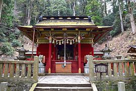
- Inuyama Castle : built in 1537, in Inuyama
- Meiji Mura : one of the first theme parks in Japan with 63 buildings from the Meiji period, in Inuyama
- Horaiji Mountain: 684 meters high dormant volcano, in Horai
- Ninomaru Garden at Nagoya Castle : laid out in 1625, in Nagoya
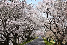
- Okazaki Castle , birthplace of Tokugawa Ieyasu , beautiful park and museum (very famous for the cherry blossom in spring and the gigantic fireworks in early August)
- Tenryū Okumikawa Quasi National Park : extends over the prefectures of Aichi, Shizuoka and Nagano with the 1,415 meter high Chausu-yama, the highest mountain in Aichi
- Tokugawa Art Museum : Exhibits of historical and contemporary utensils and tools

Inuyama Castle

Cape Irago
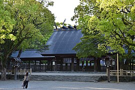
Atsuta-jingū
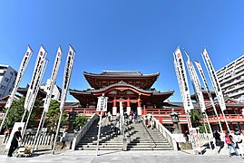
Ōsu Kannon
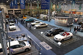
Toyota Commemorative Museum of Industry and Technology

Railway Museum

Toyota Museum
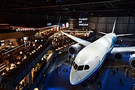
Flight of Dreams

Meiji Mura

Little World Museum of Man

Okazaki Castle

Laguna Ten Bosch

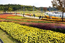
Flower clearing (Minamichita)
Horai

Toyokawa Inari
Ai Chikyū-Haku Kinen Kōen

Kōrankei

The Sakurabuchi Park
Kisogawa embankment

Nomazaki lighthouse
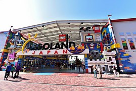
Legoland Japan (Nagoya)

Ferris wheel in Nagoya Harbor


symbol
The symbol of Aichi Prefecture is a stylized hiragana character あ ( a ), い ( i ) and ち ( chi ), which was introduced in the 1950s.
Foreign representations and partnerships
In 1972 a representative office for the Aichi prefecture in Hamburg, the Japanese External Trade Organization ( JETRO ), was opened. After moving to Berlin in 1997 , it was dissolved in 2003 and merged with the Paris office.
Aichi Prefecture has partnerships with:
- Jiangsu Province in the People's Republic of China
- State of Victoria in Australia
Administrative division
With the introduction of the modern communities in 1889, the Aichi prefecture consisted of an independent city, 23 small towns and 624 villages (in 19 districts). Through incorporations and mergers, the number of communities fell from 264 (1920) to 127 (1955) to 88 in 2000. Since 2012, the prefecture has consisted of 38 independent cities ( Shi ), 14 small towns ( Chō ) and two villages ( Mura ), the latter summarized in seven counties. Three of these districts consist of only one municipality each.
Of the 38 independent cities, five cities have special rights:
- Nagoya as the prefecture capital is at the same time a "government-designed city" ( 政令 指定 都市 , Seirei shitei toshi )
- Okazaki, Toyohashi and Toyota are "core cities" ( 中 核 市 , Chūkakushi )
- Ichinomiya and Kasugai are "special cities" ( 特例 市 , Tokureishi )
In the table below, the districts ( 郡 , Gun ) are shown in italics, below each (indented) the small towns ( 町 , Chō ) and villages ( 村 , Mura ) within them. A dependency between rural district and small town can also be seen in the first three digits of the code (1st column). At the beginning of the table are the independent cities ( 市 , Shi ).

| code | Surname | Area (in km²) | population | Population density (inh / km²) 3 |
||
|---|---|---|---|---|---|---|
| Rōmaji | Kanji | October 1, 2017 1 | October 1, 2019 2 | October 1, 2015 3 | ||
| 23100 | Nagoya- shi | 名古屋 市 | 326.45 | 2,320,361 | 2,295,638 | 7032.13 |
| 23201 | Toyohashi- shi | 豊 橋 市 | 261.86 | 373,592 | 374.765 | 1431.17 |
| 23202 | Okazaki- shi | 岡 崎 市 | 387.20 | 386,639 | 381.051 | 984.12 |
| 23203 | Ichinomiya- shi | 一 宮 市 | 113.82 | 380,235 | 380,868 | 3346.23 |
| 23204 | Seto- shi | 瀬 戸 市 | 111.40 | 127,819 | 129,046 | 1158.4 |
| 23205 | Handa- shi | 半 田 市 | 47.42 | 117,983 | 116.908 | 2465.37 |
| 23206 | Kasugai- shi | 春日 井 市 | 92.78 | 307.180 | 306.508 | 3303.6 |
| 23207 | Toyokawa- shi | 豊 川 市 | 161.14 | 183,559 | 182,436 | 1132.16 |
| 23208 | Tsushima- shi | 津 島 市 | 25.09 | 61,960 | 63,431 | 2528.14 |
| 23209 | Hekinan- shi | 碧南 市 | 36.68 | 72,695 | 71,346 | 1945.09 |
| 23210 | Kariya- shi | 刈 谷 市 | 50.39 | 152.208 | 149.765 | 2972.12 |
| 23211 | Toyota- shi | 豊 田 市 | 918.32 | 425.848 | 422,542 | 460.13 |
| 23212 | Anjo- shi | 安 城市 | 86.05 | 187,668 | 184.140 | 2139.92 |
| 23213 | Nishio- shi | 西 尾市 | 161.22 | 169,592 | 167.990 | 1041.99 |
| 23214 | Gamagori -shi | 蒲 郡 市 | 56.92 | 80.179 | 81,100 | 1424.81 |
| 23215 | Inuyama- shi | 犬 山 市 | 74.90 | 73,783 | 74,308 | 992.1 |
| 23216 | Tokoname -shi | 常 滑 市 | 55.90 | 57,549 | 56,547 | 1011.57 |
| 23217 | Kōnan- shi | 江南 市 | 30.20 | 97.937 | 98,359 | 3256.92 |
| 23219 | Komaki- shi | 小 牧 市 | 62.81 | 148,665 | 149,462 | 2379.59 |
| 23220 | Inazawa- shi | 稲 沢 市 | 79.35 | 135,745 | 136,867 | 1724.85 |
| 23221 | Shinshiro- shi | 新 城市 | 499.23 | 45.266 | 47,133 | 94.41 |
| 23222 | Tōkai- shi | 東海 市 | 43.43 | 113,460 | 111,944 | 2577.57 |
| 23223 | Ōbu -shi | 大 府 市 | 33.66 | 91,725 | 89,157 | 2648.75 |
| 23224 | Chita- shi | 知 多 市 | 45.90 | 83,927 | 84,617 | 1843.51 |
| 23225 | Chiryu -shi | 知 立 市 | 16.31 | 71,874 | 70.501 | 4322.56 |
| 23226 | Owariasahi -shi | 尾 張旭 市 | 21.03 | 81,674 | 80,787 | 3841.51 |
| 23227 | Takahama- shi | 高 浜 市 | 13.11 | 48.091 | 46,236 | 3526.77 |
| 23228 | Iwakura- shi | 岩 倉 市 | 10.47 | 47,885 | 47,562 | 4542.69 |
| 23229 | Toyoake -shi | 豊 明 市 | 23.22 | 69,223 | 69,127 | 2977.05 |
| 23230 | Nisshin- shi | 日 進 市 | 34.91 | 90.773 | 87,977 | 2520.11 |
| 23231 | Tahara- shi | 田原 市 | 191.12 | 60,787 | 62,364 | 326.31 |
| 23232 | Aisai shi | 愛 西 市 | 66.70 | 61,568 | 63,088 | 945.85 |
| 23233 | Kiyosu- shi | 清 須 市 | 17.35 | 69,344 | 67,327 | 3880.52 |
| 23234 | Kitanagoya shi | 北 名古屋 市 | 18.37 | 85.817 | 84.133 | 4579.91 |
| 23235 | Yatomi- shi | 弥 富 市 | 49.00 | 43.193 | 43,269 | 883.04 |
| 23236 | Miyoshi- shi | み よ し 市 | 32.19 | 62,908 | 61,810 | 1920.16 |
| 23237 | Ama- shi | あ ま 市 | 27.49 | 87,442 | 86,898 | 3,161.08 |
| 23238 | Nagakute- shi | 長久 手 市 | 21.55 | 60,447 | 57,598 | 2672.76 |
| 23300 | Aichi-gun | 愛 知 郡 | 18.03 | 43,712 | 42,858 | 2377.04 |
| 23302 | Tōgō-chō | 東 郷 町 | 18.03 | 43,712 | 42,858 | 2377.04 |
| 23340 | Nishikasugai gun | 西 春日 井 郡 | 6.18 | 15,657 | 15,177 | 2455.83 |
| 23342 | Toyoyama- chō | 豊 山 町 | 6.18 | 15,657 | 15,177 | 2455.83 |
| 23360 | Niwa-gun | 丹羽 郡 | 24.80 | 58.097 | 57,080 | 2301.61 |
| 23361 | Ōguchi -chō | 大 口 町 | 13.61 | 23,998 | 23,274 | 1710.07 |
| 23362 | Fusō-chō | 扶桑 町 | 11.19 | 34,099 | 33,806 | 3021.09 |
| 23420 | Ama-gun | 海 部 郡 | 40.10 | 73,767 | 72,472 | 1807.28 |
| 23424 | Ōharu-chō | 大治 町 | 6.59 | 32,183 | 30,990 | 4702.58 |
| 23425 | Kanie-cho | 蟹 江 町 | 11.09 | 37,049 | 37,085 | 3344 |
| 23427 | Tobishima-mura | 飛 島村 | 22.42 | 4535 | 4397 | 196.12 |
| 23440 | Chita-gun | 知 多 郡 | 165.89 | 160,839 | 161,732 | 974.94 |
| 23441 | Agui-cho | 阿 久 比 町 | 23.80 | 28,308 | 27,747 | 1165.84 |
| 23442 | Higashiura-cho | 東浦 町 | 31.14 | 49.004 | 49,230 | 1580.92 |
| 23445 | Minamichita-cho | 南 知 多 町 | 38.37 | 17,689 | 18,707 | 487.54 |
| 23446 | Mihama-cho | 美 浜 町 | 46.20 | 22,909 | 23,575 | 510.28 |
| 23447 | Taketoyo-chō | 武 豊 町 | 26.38 | 42,929 | 42,473 | 1610.05 |
| 23500 | Nukata-gun LINK | 額 田 郡 | 56.72 | 41,704 | 39,549 | 697.27 |
| 23501 | Kōta-chō LINK | 幸 田 町 | 56.72 | 41,704 | 39,549 | 697.27 |
| 23560 | Kitashitara gun | 北 設 楽 郡 | 553.20 | 8808 | 9655 | 17.45 |
| 23561 | Shitara-cho | 設 楽 町 | 273.94 | 4648 | 5074 | 18.52 |
| 23562 | Tōei-chō | 東 栄 町 | 123.38 | 3097 | 3446 | 27.93 |
| 23563 | Toyone-mura | 豊 根 村 | 155.88 | 1063 | 1135 | 7.28 |
| Shi-bu ( All Shi , proportion of urban districts) | 市 部 | 4304.95 | 7,136,601 | 7,084,605 | 1645.69 | |
| Gun-bu ( All Gun , percentage of counties) | 郡 部 | 864.91 | 402,584 | 398,523 | 460.77 | |
| 23000 | Aichi-Ken (Aichi Prefecture) | 愛 知 県 | 5172.92 | 7,539,185 | 7,483,128 | 1446.60 |
swell
1 Area data from 2017
2 Estimated population 2018
3 Results of the 2015 census
Biggest places
| VZ year | Residents | |||
|---|---|---|---|---|
| 2015 | 2010 | 2005 | 2000 | |
| Nagoya | 2,295,638 | 2,263,894 | 2,215,062 | 2,171,557 |
| Toyota | 422,542 | 421,487 | 412.141 | 351.101 |
| Okazaki | 381.051 | 372.357 | 354.704 | 336,583 |
| Ichinomiya | 380,868 | 378,566 | 371,687 | 273.711 |
| Toyohashi | 374.765 | 376,665 | 372.479 | 364,856 |
| Kasugai | 306.508 | 305,569 | 295,802 | 287,623 |
| Anjō | 184.140 | 178,691 | 170,250 | 158.824 |
| Toyokawa | 182,436 | 181.928 | 120,967 | 117,327 |
| Nishio | 167.990 | 106,823 | 104,321 | 100,805 |
| Kariya | 149.765 | 145.781 | 142.134 | 132.054 |
| Komaki | 149,462 | 147.132 | 147.182 | 143.122 |
| Inazawa | 136,867 | 136,442 | 136.965 | 100,270 |
| Seto | 129,046 | 132.224 | 131,925 | 131,650 |
| Handa | 116.908 | 118,828 | 115,845 | 110,837 |
| Tōkai | 111,944 | 107,690 | 104,339 | 99,921 |
| Konan | 98,359 | 99.730 | 99,055 | 97.923 |
| Ōbu | 89,157 | 85,249 | 80.262 | 75.273 |
| Nisshin | 87,977 | 84,237 | 78,591 | 70,188 |
| Ama | 86,898 | 86,714 | - | - |
| Chita | 84,617 | 84,768 | 83,373 | 80,536 |
| Kitanagoya | 84.133 | 81,571 | - | - |
| Gamagōri | 81,100 | 82,249 | 82,108 | 82,108 |
| Owariasahi | 80,787 | 81,140 | 78.394 | 75,066 |
| Inuyama | 74,308 | 75.198 | 74,294 | 72,583 |
| Hekinan | 71,346 | 72,018 | 71,408 | 67,814 |
| Chiryu | 70.501 | 68,398 | 66,085 | 62,587 |
| Toyoake | 69,127 | 69,745 | 68,285 | 66,495 |
| Kiyosu | 67,327 | 65,757 | 55.038 | - |
| Tsushima | 63,431 | 65,258 | 65,547 | 65,422 |
| Aisai | 63,088 | 64,978 | 65,556 | - |
| Tahara | 62,364 | 64.119 | 66,390 | - |
| Miyoshi | 61,810 | 60,098 | - | - |
| Nagakute | 57,598 | - | - | - |
| Tokoname | 56,547 | 54,858 | 51,265 | 50.183 |
| Iwakura | 47,562 | 47,340 | 47,926 | 46.906 |
| Shinshiro | 47,133 | 49,864 | 52,178 | 36,022 |
| Takahama | 46,236 | 44,027 | 41,351 | 38.127 |
| Yatomi | 43,269 | 43,272 | - | - |
| Bisai | - | - | - | 57,956 |
- August 20, 2003 - The small town of Tahara integrates another community and is raised to the status of an independent city .
- April 1, 2005 - Four parishes found the independent city of Aisai .
- April 1, 2005 - The independent city of Bisai is incorporated into the independent city of Ichinomiya .
- July 7, 2005 - The small town of Kiyosu integrates two communities and is raised to the status of an independent city .
- March 1, 2006 - The independent city of Kitanagoya is formed from two communities.
- April 1, 2006 - The small town of Yatomi integrates another municipality and is raised to the status of an independent city .
- January 4, 2010 - The small town of Miyoshi receives the status of an independent city .
- March 22, 2010 - The independent city of Ama is formed from three parishes.
- January 4, 2012 - The small town of Nagakute receives the status of an independent city .
See also
Web links
Individual evidence
- ↑ 県 内 の 市町村 . Aichi Prefecture, accessed May 6, 2012 (Japanese).
- ↑ a b Aichi Overview. Aichi Prefecture, accessed May 6, 2012 .
- ^ Kinder / Hilgemann: dtv-Atlas zur Weltgeschichte, Munich 1986
- ↑ I-BAC / Aichis history. In: Aichi-Nagoya International Business Access Center. Archived from the original on March 16, 2012 ; accessed on August 18, 2016 .
- ↑ Aichi Prefecture, December 26, 2011: 平 成 22 年 国 勢 調査 愛 知 県 の 人口 (“Population of Aichi Prefecture after the 2010 census”) , results (PDF; 300 kB)
- ^ Sōmushō , statistics portal "e-Stat": Statistics of registered foreigners 2011
- ↑ Aichi Prefectural Parliament : MPs , accessed on August 8, 2019.
- ↑ 愛 知 県 知事 選 現 職 の 大村 秀 章氏 3 回 目 の 当選 . In: NHK Senkyo Web. February 3, 2019, Retrieved February 4, 2019 (Japanese).
- ↑ 愛 知 県 議 選 各 党 議席 . In: NHK Senkyo Web. April 7, 2019, Retrieved May 21, 2019 (Japanese).
- ↑ Ministry of Social Affairs and Labor : 地域 別 最低 賃 金 の 全国 一 覧
- ↑ Aichi Prefectural Administration , Industry and Labor Department: 愛 知 県 の 最低 賃 金 (also includes the higher minimum wages applicable in individual sectors)
- ↑ Kokudo Chiriin (GSI - Geospatial Information Authority of Japan), 平 成 29 年 全国 都 道 府 県 市区 町 村 別 面積 調 (Nationwide survey of all prefectures and municipalities 2017) , p. 59: 23 Aichi-ken (Japanese), accessed on 30 January 2019
- ↑ 簡 単 検 索 ・ 詳細 検 索 ・ 検 索 サ ン プ ル , accessed January 30, 2019 (Japanese)
- ↑ e-stat (English), accessed on January 30, 2019.
- ↑ e-Stat database , accessed on January 30, 2019 (English)
Aichi | Akita | Aomori | Chiba | Ehime | Fukui | Fukuoka | Fukushima | Gifu | Gunma | Hiroshima | Hokkaidō | Hyōgo | Ibaraki | Ishikawa | Iwate | Kagawa | Kagoshima | Kanagawa | Kochi | Kumamoto | Kyoto | Mie | Miyagi | Miyazaki | Nagano | Nagasaki | Nara | Niigata | Ōita | Okayama | Okinawa | Osaka | Saga | Saitama | Shiga | Shimane | Shizuoka | Tochigi | Tokyo | Tokushima | Tottori | Toyama | Wakayama | Yamagata | Yamaguchi | Yamanashi
Coordinates: 35 ° 5 ' N , 136 ° 59' E