Nishio
| Nishio-shi 西 尾市 |
||
|---|---|---|
| Geographical location in Japan | ||
|
|
||
| Region : | Chūbu | |
| Prefecture : | Aichi | |
| Coordinates : | 34 ° 52 ' N , 137 ° 4' E | |
| Basic data | ||
| Surface: | 75.78 km² | |
| Residents : | 169,926 (June 1, 2019) |
|
| Population density : | 2242 inhabitants per km² | |
| Community key : | 23213-1 | |
| Symbols | ||
| Flag / coat of arms: | ||
| Tree : | Camphor tree | |
| Flower : | rose | |
| town hall | ||
| Address : |
Nishio City Hall 22 Shimoda, Yorizumi-chō Nishio -shi Aichi 445-8501 |
|
| Website URL: | http://www.city.nishio.aichi.jp | |
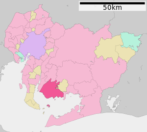
| Location Nishios in Aichi Prefecture | ||
Nishio ( Japanese 西 尾市 , - shi ) is a city in Aichi Prefecture in Japan .
geography
Nishio is around 35 kilometers south of Nagoya and west of Okazaki . The municipality the island inhabited belongs Saku-shima in Mikawa Bay , as well as the off-shore islands Maejima ( 前島 also Usagishima ( うさぎ島 , "rabbit island"); 34 ° 46 '45 " N , 137 ° 8' 40 ″ O ), Oki (no) shima ( 沖 (ノ) 島 , also Saru-ga-shima ( 猿 ヶ 島 , "island of the monkeys"); 34 ° 46 ′ 19 ″ N , 137 ° 8 ′ 47 ″ E ) and Kajishima ( 梶 島 ; 34 ° 46 ′ 3 ″ N , 137 ° 6 ′ 3 ″ E ).
history
Nishio is an old castle town where the Ōgyū-Matsudaira last resided. The remains of Nishio Castle have been preserved.
There has been evidence of tea cultivation in Nishio since 1601, which today produces almost 30% of all Matcha tea production in Japan.
On December 15, 1953, the city was named an independent city ( shi ). On April 1, 2011, the neighboring towns of Isshiki , Hazu and Kira were incorporated.
traffic
- Street:
- National roads 23, 247
- Train:
- Meitetsu Nishio Line
- Meitetsu Gamagōri Line
Neighboring cities and communities
Web links
- Official website of the city of Nishio (Japanese, English)
Individual evidence
- ↑ a b 猿 ヶ 島 ・ う さ ぎ 島 . (No longer available online.) In: Hazu-net.com. Archived from the original on April 8, 2015 ; Retrieved March 24, 2015 (Japanese). Info: The archive link was inserted automatically and has not yet been checked. Please check the original and archive link according to the instructions and then remove this notice.
- ↑ The national Kokudo Chiriin uses on the official maps http://maps.gsi.go.jp/#16/34.771803/137.146175 den 島 , the municipality of Nishio itself http://www.city.nishio.aichi.jp/index. cfm / 10.32262, c, html / 32262 / 4.pdf # page = 12 the notation 沖 ノ 島 .
- ↑ 西 尾 の 抹茶 ・ お 茶 . Nishio City, accessed March 24, 2015 (Japanese).


