Ise Bay
| Ise Bay | ||
|---|---|---|
| Waters | Philippine Sea | |
| Land mass | Honshu | |
| Geographical location | 34 ° 42 ′ N , 136 ° 46 ′ E | |
|
|
||
| width | approx. 30 km | |
| depth | approx. 60 km | |
| surface | 2 130 km² | |
| Greatest water depth | 49 m | |
| Medium water depth | 19.5 m | |
| Tributaries | Ibi , Nagara , Kiso , Nikkō , Shōnai , Tempaku , ... | |
|
Expansion of the Ise Bay with the coast opposite Tōshi-shima (purple) or Cape Daiō-zaki (purple + blue) as the most south-westerly point |
||
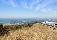
The Ise Bay ( Jap. 伊勢湾 , Ise-wan , English. Ise Bay ) is a bay at the Japanese Pacific coast .
Chūbu Airport is located on an artificial island in the north of the Ise Bay .
expansion
The bay is bounded in the north by the Nōbi plain with the confluence of the "Three Kiso Rivers" ( 木 曽 三 川 , Kiso sansen ) Ibi , Nagara and Kiso in the northwest, the mouth areas of the Nikkō , Shōnai and Tempaku in the northeast and in the south from the Shima Peninsula . In the east joins the Mikawa Bay , which is separated from the Chita Peninsula from the Ise Bay and from the Atsumi Peninsula from the Pacific. Only in the southeast is the bay open to the Pacific. The south-eastern end forms Cape Irago-misaki ( 伊 良 湖 岬 , Irago-misaki ; 34 ° 34 ′ 45.5 ″ N , 137 ° 0 ′ 58 ″ E ) as the extreme end of the Atsumi Peninsula. There are two definitions for the southwest end. The Implementing the Japanese Water Pollution Act calls in item 4 Cape Daiozaki ( 大王埼 ; 34 ° 16 '34 " N , 136 ° 53' 57" O ) at the east end of the Shima Peninsula. With this definition the bay has a size of 2130 km² with 49 m as the deepest point. In addition, the coast further north ( 34 ° 30 ′ 21 ″ N , 136 ° 49 ′ 57 ″ E ) opposite the island of Tōshi-jima is taken as a limit. This results in an area of around 2000 km².
history
In September 1959, the bay gave its name to the Ise-wan typhoon , internationally known as “Typhoon Vera”, and in Japan, where the storms are usually numbered chronologically, it was called Typhoon No. 15. Winds over 250 km / h, floods and landslides devastated the area around the bay: More than 5,000 people died and over 1.5 million became homeless. After the typhoon, dams were built around the bay and other coastal protection measures were taken to minimize the number of victims in a future typhoon.
Industrial plants
There are numerous power plants of the electricity supplier Chūbu Denryoku around the Ise Bay . B. Chita , Chita Daini , Kawagoe , Shin-Nagoya and Yokkaichi as well as the associated infrastructure for their operation: LNG terminals, storage tanks and a gas pipeline that runs under Ise Bay and the LNG terminals of the Chita power plants (on the eastern bank ) and Kawagoe (on the western bank).
In addition, oil refineries and steel mills (e.g. Nippon Steel & Sumitomo Metal on the eastern bank) are located along the Jeza Bay.
Individual evidence
- ↑ 日本 の 閉鎖 性 海域 . (No longer available online.) 国際 エ メ ッ ク ス セ ン タ ー March 25, 2009, archived from the original on September 1, 2011 ; Retrieved October 20, 2013 (Japanese). Info: The archive link was inserted automatically and has not yet been checked. Please check the original and archive link according to the instructions and then remove this notice.
- ↑ 伊 勢 湾 . In: 世界 大 百科 事 典 第 2 版 at kotobank.jp. Retrieved October 20, 2013 (Japanese).
- ↑ Own calculation from 2130km², minus the triangle Iragomisaki – Daiōzaki – coast opposite Tōshishima
- ↑ Keiichi YONEYAMA: Actual situation of LNG use at Chubu Electric Power Co., Inc. (PDF 1.1 MB, pages 8 and 14) Chubu Electric Power Company Group, March 21, 2010, accessed on September 16, 2014 (English) .


