
Geography of japan
Physical map of Japan |


Japan is the fourth largest island nation in the world after Indonesia , Madagascar and Papua New Guinea . It is located in the Pacific off the coasts of Russia and Korea .
Japan is a chain of islands that stretches along the east coast of Asia . The five main islands are Hokkaidō in the north, the central and largest island Honshū and Shikoku , Kyūshū and Okinawa in the south. In addition, there are 6,847 smaller islands (with a circumference of at least 100 m at high tide), which are mainly concentrated in the Seto Inland Sea and the Ryūkyū Islands .
The Japanese islands are a northwestern section of the Pacific Ring of Fire .
Japan is actually a mountain range that rises from the sea. Accordingly, around three quarters of the country are so steeply inclined that they can neither be used for agriculture nor as settlement areas. The settlement area is limited to a few large plains, the coastal strips and the mountain valleys.
Geology and geography
The Japanese archipelago as we know it today includes the five main islands of Hokkaidō , Honshū , Kyūshū , Shikoku and Okinawa as well as more than 6847 other islands .
expansion


- The northernmost point of Japan is controversial. If the areas claimed in the Kuril conflict are not taken into account, it is Cape Sōya ( 45 ° 31 ′ 21.7 ″ N , 141 ° 56 ′ 10.6 ″ E ) which belongs to the area of the city of Wakkanai on Hokkaidō .
- The southernmost point is Okinotorishima ( 20 ° 25 ′ 18 ″ N , 136 ° 5 ′ 17 ″ E ).
- The westernmost point is the western tip of Yonaguni Island ( Okinawa Prefecture ) ( 24 ° 27 ′ N , 122 ° 59 ′ E ).
- The easternmost point is Minami-Torishima ( 24 ° 17 ′ 18 ″ N , 153 ° 58 ′ 52 ″ E ), part of the Ogasawara archipelago .
A mountain range runs across the entire archipelago , making up approximately 73% of the land mass of Japan. The highest point in Japan is Mount Fuji on the main island of Honshū at 3776 m above sea level . Larger plains can only be found in the regions of Kantō (Greater Tōkyō) and Kansai (Kyōto – Ōsaka – Kobe). Both are densely populated and the location of several megacities. Due to the lack of flat land, mountain slopes are cultivated through terraced cultivation.
History of the origin of the Japanese archipelago


The Japanese archipelago was formed about 16 to two million years ago, from the Miocene to the Pliocene , which precedes the geological phase of the Pleistocene .
Emergence of the island arc, creation of the Sea of Japan and the Shikoku Sea Basin
Around 30 million years ago, neither the Sea of Japan nor the Sea of Okhotsk existed . The Japanese archipelago was still part of the continent, which enlarged from north-northwest to south-southeast through sediments of an accretion wedge of two tectonic plates. About 19 million years ago, the Indian subcontinent collided with Tibet, opening up a rift in the land mass that expanded and filled with water. So the Sea of Japan was initially created as an inland lake. The changes over the next four million years then resulted in an enlargement of the water and a rotation of southwest Japan by about 45 degrees clockwise, the pivot point being on today's island of Tsushima .
At the same time, the northeast of the emerging Japanese island arc turned in the opposite direction to the southern part by about 40 degrees counterclockwise. In the period from 16 to 11 million years per cent, large parts of south-west Japan were already solid land, while north-east Japan was largely still covered by the sea due to the rise in sea levels. Instead of a contiguous land mass, a multitude of islands rose from the sea in the northeast. A renewed subduction of the Pacific under the continental plate raised the northeastern part and formed the Ō mountain range and the Dewa mountain range ( orogeny ).
Breaking up the Shikoku sea basin and creation of the Izu-Ogasawara arc
The ocean floor also broadened on the Pacific side of southwestern Japan, with the breaking off of the eastern part of the then still contiguous Palau-Kyūshū Ridge ( Japanese 九州 ・ パ ラ オ 海 嶺 , Kyūshū Palau kairei ) and the forming Izu-Ogasawara arc drifted to the east. The land in between is the Shikoku Sea Basin, which, together with the Philippine sea floor, forms the Philippine plate. In the shallow sea between southwest and northeast Japan, sediments were deposited that were compressed by compression and which subsequently formed the Japanese Alps. The Fossa Magna was formed and geologically separates northeast from southwest Japan since then (see figure: Geology and tectonics ). In the east (fig. Left blue line) the Fossa Magna is bounded by the Itoigawa-Shizuoka tectonic line ( 糸 魚 川 静岡 構造 線 , short: ISTL), in the west (fig. Right blue line) by the Shibata-Koide tectonic line ( 新 発 田 小 出 構造線 , short: SKTL) and bounded by the Kashiwazaki-Chiba tectonic line ( 柏 崎 千葉 構造 線 ).
The three land masses of Hokkaidō
Hokkaidō was formed from three land masses: from north-west Hokkaidō, the continuation of the original north-west Japan, from central Hokkaidō, the continuation of the north-south land mass of Sakhalin, and from northeast Hokkaidō, which belonged to the Kuril Arch. Northwest Hokkaidō had drifted eastward due to the expansion of the Sea of Japan, while on the opposite side northeast Hokkaidō was pulled westward from the Pacific plate. These two land masses collided with Central Hokkaidō and thereby caused the uplift of the Hidaka Mountains . About six million years ago, the Ryūkyū arch also broke off the continental land mass and developed into islands with coral reefs. The development of an environment similar to that of today began around the beginning of the Pliocene six to five mya .
structure
Japan is divided into eight regions: Hokkaidō , Tōhoku , Kantō , Chūbu , Kinki , Chūgoku , Shikoku and Kyūshū . This classification is historically justified and nowadays only plays a subordinate role. Politically, Japan is divided into prefectures .
Political structure
See: Prefectures of Japan
Japan is a centralized state , which only assigns clearly defined tasks to the 47 prefectures for implementation. Within these tasks, the prefectures are relatively autonomous, but always bound by instructions from the central government and also dependent on funding from the central state .
The 47 prefectures are divided into large cities as well as small towns and villages , the municipal level. The only exception is the Tokyo Prefecture , which is divided into the 23 central city districts on the one hand and surrounding small towns and villages on the other. The prefectures are very different in size and population density. Most of them are on the main island of Honshū, while the second largest island, Hokkaidō, for example, has only one prefecture. Within the prefectural and communal levels there is - in contrast to national parliamentarism - a presidential system within which, on the one hand, the heads of government and administration and, on the other hand, the municipal assemblies and prefectural parliaments are elected autonomously.
The five main islands

The five largest islands, which make up the majority of the land mass of the national territory of Japan, are known as the main Japanese islands.
Honshu
Honshū is the largest island in Japan and is also known as the Japanese "heartland". The capital Tokyo is located on Honshū . Honshū is about 1300 km long and between 50 and 240 km wide. The area is about 230,500 km², which corresponds to about 60% of the total area of Japan. The coastline is 5450 km long. The highest point on the island is Mount Fuji with a height of 3776 m. The area is very fertile , especially in the Kantō plain, and many rivers flow there. The climatic conditions range from the cool northern tip of the island to subtropical zones in the south.
Hokkaidō
The island of Hokkaidō is the second largest island in Japan with an area of 77,984 km². Together with several surrounding small islands, it forms the northernmost and by far largest prefecture in the country. The highest point is the Asahi at 2291 meters above sea level. To the south, Hokkaidō is bordered by Tsugaru Strait , which separates the island from Honshū. The largest city is Sapporo .
Kyushu
Kyūshū is with an area of 35,640 km² and 13.44 million inhabitants (1995) the second most populous and third largest island in Japan. Its name comes from the original division of the island into nine provinces. Kyushu Island is the southernmost of the five main islands. Kyushu is very mountainous. On top of it is the Aso (1592 m), the most active volcano in Japan. Other active volcanoes are the Sakurajima (near Kagoshima ) and the Unzen (near Nagasaki ). The largest and most important city on Kyushu is Fukuoka with a port, industry and numerous administrations. Kyushu has a subtropical climate . The main agricultural products are rice , tea , tobacco , table potatoes and soy . Furthermore, silk produced.
Shikoku
Shikoku is the second smallest of the five main islands. It is around 18,000 km² and has a population of around 4.5 million. It is divided into four prefectures: Ehime , Kagawa , Kōchi and Tokushima . The island is named four countries due to the fact that it has consisted of four provinces, namely Awa , Sanuki , Iyo and Tosa, since the time of the provinces . The boundaries of these ancient provinces correspond to those of today's prefectures.
Okinawa
Okinawa is the smallest of the five main islands. It is the largest of the Ryūkyū Islands and the main island of the Okinawa archipelago . As an island of the Ryūkyū island arc , Okinawa Hontō also belongs to the Nansei Islands .
Seas
To the northwest of the main islands is the Sea of Japan , to the east is the Pacific . The Ryūkyū Islands delimit the East China Sea in the west from the Philippine Sea in the east, which also borders the main islands from the south. The Sea of Okhotsk is in northern Japan . The Japangraben is only a few kilometers off the east coast of Japan , and its deepest point is the Ramapo Depth at 10,554 meters.
Off the east coast of Japan, roughly at the 36th parallel, two main ocean currents meet, the cold Oyashio from the north and the warm Kuroshio from the south. A branch of the Kuroshio, the Tsushima Current , flows up the west coast into the Sea of Japan.
Natural resources

Japan's natural resources are scarce (on land) with the exception of fishery products (fish, crustaceans, whales, etc.) as well as some mining and timber industries.
Marine animal
Japan has one of the largest fishing fleets in the world. It accounts for almost 15% of the world's fish catch. In 2005, Japan ranked sixth in the world in terms of the amount of fish caught. In Japan, 4,074,580 tons of fish were caught in 2005 .
Ocean floor
Japan has the eighth largest exclusive economic zone : 4,479,388 km². It has many natural resources and marine animals . It is estimated that the ocean floor has many natural resources ( raw material ). For example methane hydrate , natural gas , metallic minerals and rare earth metals . The mineral resources of the ocean floor such as manganese nodules , cobalt- rich crust and hydrothermal subsea stocks are located at depths of over 1,000 m.
Japanese scientists discovered the existence of 6.8 million tons of rare earth metals near Minami-Torishima Island , capable of meeting national needs for more than 200 years. It is estimated that there are several trillion cubic meters of methane hydrate in the eastern Nankai Trench .
National parks
Japan has a large area of nature reserves . There are a total of 34 national parks ( Japanese 国立 公園 , kokuritsu kōen ), 56 quasi- national parks and 306 prefectural nature parks ( as of July 26, 2017). The first national park law was passed in 1931. After many studies, 12 national parks were named between 1934 and 1936. The first three parks were Seto Inland Sea , Unzen, and Kirishima . Another five followed in the same year , with Aso , Nikkō , Japanese Alps , Akan and Daisetsuzan . Two years later, Towada , Fuji-Hakone , Yoshino-Kumano and Daisen were added. The national parks reflect the geological and climatic diversity of the Japanese landscape.
climate
Due to the north-south expansion of the country, the climate in Japan is very different: The island chain extends from the cold-temperate climate zone in Hokkaidō , with cold and snowy winters , to the subtropics in Okinawa . In addition, there is the influence of winds - in winter from the Asian continent to the sea, and in summer from the sea to the continent. In late June and early July, a large part of the annual precipitation falls in the south as a monsoon-like rain front ( 梅雨 前線 , baiu zensen ); this time is also typhoon season with up to 20 cyclones per year.
The winds also contribute to Japan's increased exposure to transnational pollution .
Japan can be divided into six main climate regions due to its wide geographic area:
- Hokkaidō : not particularly heavy rainfall, but larger snowdrifts during the long cold winters
- Sea of Japan : The northwest wind in winter brings heavy snowfall. In summer this region is cooler than the Pacific region, but there is more hair dryer here .
- Central highlands ( Chūō-kōchi ): strong temperature differences between summer and winter as well as day and night, little rainfall
- Seto Inland Sea : The mountains of the Chūgoku and Shikoku regions hold up the wind and result in a mild year-round climate.
- Pacific region : cold winters with little snowfall and hot dry summers
- Nansei-shoto ( Ryūkyū Islands ): Subtropical climate with warm winters and hot summers. Heavy precipitation especially during the rainy season, typhoons occurring regularly .
- Climate diagrams


Natural phenomena
Japan lies on the geological fracture zone of four tectonic plates (the Chinese plate in the west, the North American plate in the north, the Philippine plate in the south and east, and the Pacific plate in the east). Of the approximately 240 volcanoes that make up the Pacific Ring of Fire , 40 are active. In the entire region there are lighter earthquakes almost every day , at longer intervals also severe ones (e.g. Great Kanto earthquake in 1923, Kobe earthquake in 1995 , Tōhoku earthquake in 2011 ). Every year on the anniversary of the Kanto earthquake in September, a civil protection exercise takes place. Tokyo in particular is exposed to a high risk of earthquakes (see earthquake in Tokyo ).
The typhoon season begins in late summer , when the south and south-west of Japan in particular are hit by hurricanes over the Pacific Ocean (e.g. typhoon Tokage in October 2004).
Over 160,000 people have died in Japan in the past thousand years from tsunamis ( tidal waves caused by undersea earthquakes ). Today the country has an effective tsunami early warning system through measuring buoys in the Pacific . There are regular training programs for the population, and many Japanese coastal cities protect themselves by building huge dykes . These reinforced concrete walls are partially 10 meters high, up to 25 meters wide and equipped with sturdy metal gates.

Typhoon Nabi , 2005


Japanese flora and fauna
The Japanese archipelago stretches in a long arc from north (45th parallel, Hokkaidō ) to south (20th parallel, Okinotorishima ). Inland there are a number of mountain ranges that cross the tree line, and Japan also has a larger zone in the Eastern Pacific. Compared to the narrowness of the habitat, a wide variety of species can be found in Japan. Due to the position as an offshore archipelago, a flora and fauna that is related to "continental Asia" but independent has developed. The Ogasawara Islands ( also: Bonin Islands), 1000 km southeast of Tōkyō, which are often compared to the Galapagos Islands because of their endemic species, deserve special mention .
Japan lies at the intersection of three ecoregions . The main islands and the neighboring islands are part of the Palearctic Floral Region . The Ryukyu Islands are part of Indomalaiischen region , while the Ogasawara Islands to Oceania are expected.
Mammals
Large mammals include the brown bear on Hokkaidō , on Honshū the Asian black bear , sika deer and the Japanese serau (a goat antelope). The native species also includes the Japanese macaque, which is native to the Shimokita Peninsula ( Aomori prefecture ) and thus forms the northernmost ape population in the world. The severe urbanization on the coasts and on the Japanese plains has led to the extinction of some mammal species such as the honshu wolf (Canis lupus hodophylax), the Japanese sea lion (Zalophus californianus japonicus), the sea otter and the otter . Dogs and cats come in a wide variety of breeds in Japan. The Shiba Inu is considered to be the Japanese dog breed . There are 8 endemic horse breeds still in existence in Japan: Miyako , Hokkaido , Kiso , Noma , Taishu , Misaki , Tokara and Yonaguni pony.


Birds
Over 500 different species of birds have been sighted in Japan. Since the archipelago is surrounded by sea in every direction, a large number of them are waterfowl. From north to south, Japan is an important stopover for migratory birds . Birds nesting in Siberia find their winter quarters here, while birds nesting in Japan migrate towards Southeast Asia in winter. In this way a large number of bird species find their way to Japan. Crows (especially the carrion crows ), sparrows , pigeons and barn swallows can be found in the cities . The national bird is the pheasant . The Japanese Haubenibis or crested ibis ( Toki ,トキ) is threatened with extinction. The Okinawaralle ( Gallirallus okinawae ), which lives on Okinawa, has lost its ability to fly , like many railings living on islands. Due to the spread of the small mongoose on the island, it has already become extinct in part of its original habitat.

The flightless Okinawaralle ( Gallirallus okinawae )

Nipponibis ( Nipponia nippon )
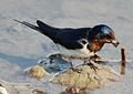
Japanese subspecies of Barn Swallow ( Hirundo rustica gutturalis )


fishes
The Japanese coastal waters are criss-crossed by cold and warm ocean currents, whose lines of contact offer good growth conditions for plankton . The country lies on the edge of the stresses of the continental plates , the shifting of which has created a rugged coastline. This provides a good habitat for a wide variety of fish species (around 1337), and the coast from Sanrikuoki (in Iwate Prefecture ) up to the Kuril Islands is one of the three richest fishing grounds in the world. In the rivers there are also an abundance of fish species, also favored by the rainy climate. A variety of mussels can be found in the brackish water areas of the estuaries . Water pollution and the concreting of river beds are problematic, which has led to the extinction of numerous species. In the seventies there was a strong environmental movement that was able to register its first successes. The diversity of the Japanese fish world can also be experienced as a tourist, because diving is a popular recreational sport in Japan and there are large aquariums in many cities .
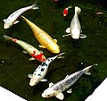
Koi carp

flora
Around 75% of Japan is covered with inaccessible mountain forests, a fact that is often forgotten when reports are made about the concrete seas of modern metropolises. Due to the volcanic origin of the islands, a large number of the native species specialize in these same environments.

Mountain forest


Crops
The most important cultivated plant in Japan is rice imported from Korea , or more precisely Oryza sativa japonica (short grain rice). However, historical poor people's food is millet , since the rice had to be paid as a tax. Various types of beans are also grown, including the adzuki bean , and a range of vegetables, including ginger , radish and spinach . Various citrus fruits such as natsumikan are also indigenous , and a number of fruits and vegetables have also been introduced. The traditional cuisine also includes seaweed (including nori ) and (sea) algae ( wakame ). Traditional Japanese houses are made of crescent fir wood .

Whole grain rice and black brown rice


The ten largest cities
The ten largest cities according to the October 1, 2010 census are:
- Tokyo (8,949,447 inhabitants)
- Yokohama (3,689,603)
- Osaka (2,666,371)
- Nagoya (2,263,907)
- Sapporo (1,914,434)
- Kobe (1,544,873)
- Kyoto (1,474,473)
- Fukuoka (1,463,826)
- Kawasaki (1,425,678)
- Saitama (1,222,910)
See also: Cities in Japan
Infrastructure
Traffic routes
Main article: Traffic in Japan
The well-developed railway lines in Japan have a total length of 23,577 km. This corresponds to position 14 (as of 2004) in the world rankings (for comparison: Germany is in 9th place with 46,142 km). The north-south connection of the Shinkansen is the country's lifeline. The first section from Tōkyō to Osaka was opened for the Olympic Games in 1964 , so that the Japanese can be considered the inventors of the modern high-speed train. Nearly every village and every small island in Japan is connected to the network through small lines operated by the seven successor companies of the privatized state railway JR, through private railways, intercity buses and ferries. In the cities there are excellent local transport connections, subways like in Tokyo , Osaka , Kyoto and many others, trams like in Hiroshima or Matsuyama and of course buses. Unusual solutions can also be found in Japan, such as the Kitakyūshū monorail . Rail and local transport fees vary greatly depending on the region and operating company, but are generally high due to the lack of government subsidies.

Chuo Highway and Mount Fuji

Hydrofoil ferry to Tanegashima


Since the cities are very densely built, the Japanese in the metropolitan areas have to prove that they have a parking space before they can buy a car. A total of around 45 million cars are registered in Japan. In residential areas, the streets are very narrow and have no sidewalks. There are also hardly any trucks in the streets, because only narrow, small trucks can get through the narrow streets to deliver to small shops or the vending machines at every corner . The Japanese toll motorway network covers around 7,000 kilometers, with a further 2,000 being planned. The network is in state hands, but the operating companies were converted into private, publicly owned companies in 2005 and may be sold. There is a speed limit of 100 km / h on the motorways, although many sections are also subject to a speed limit of 80 km / h.
The well-developed road and rail network is all the more astonishing when you consider that many tunnels and bridges are necessary in the mountainous inland and between the islands and that the infrastructure is constantly endangered by earthquakes , typhoons and volcanic eruptions . In Japan, power and telephone lines are always above ground so that they can be repaired quickly in the event of a disaster. One problem, however, is the underground gas pipes; most Japanese cook with natural gas . Fires break out quickly in an earthquake. A dense network of disaster warning systems is therefore part of the Japanese infrastructure .
The largest airports are Tokyo Narita , Tokyo Haneda , Kansai International Airport and Central Japan International Airport, which opened for EXPO Aichi 2005 . Since flat land is always scarce in Japan, the last three of the four were built on artificial islands.
Telephone network
The telephone network is also well developed and almost the entire population has a cell phone . Internet access is available via broadband connections using FTTH .
See also
- List of mountains or elevations in Japan
- List of rivers in Japan
- National parks in Japan
- Three most beautiful landscapes in Japan
- Three famous gardens in Japan
literature
- Alfried Wieczorek, Werner Steinaus, Research Institute for Cultural Goods Nara (Ed.): Time of Dawn. Japan's archeology and history up to the first emperors. Volume 2: Manual. (Publications of the Reiss-Engelhorn-Museums, Volume 11). translated into German by Gabriele Katrop-Fukui u. a. Reiss-Engelhorn-Museen, Mannheim 2004, ISBN 3-927774-18-9 .
Web links
annotation
- ↑ Sometimes the Fossa Magna is mistakenly equated with the ISTL.
Individual evidence
- ↑ a b c 離島 と は (島 の 基礎 知識) (what is a remote island?) ( Japanese , website) Ministry of Land, Infrastructure, Transport and Tourism . August 22, 2015. Archived from the original on July 13, 2007. Retrieved on August 9, 2019: "MILT classification 6,852 Islands (main islands: 5 islands, remote islands: 6,847 islands)"
- ↑ 今後 の 国境 離島 の 保全 、 管理 及 び 振興 の あ り 方 に つ い て 中間 提 言 (案) . (PDF) Kantei , p. 2 , archived from the original on April 2, 2015 ; Retrieved March 7, 2015 (Japanese).
- ^ Embassy of Japan in Germany
- ↑ Nuclear Waste Management Organization of Japan (ed.): Tectonic Setting and Evolution of Japan . S. 35 (English, numo.or.jp [PDF; accessed on October 6, 2013] see Table 6-1: Major events related to formation of the Japanese Islands). Tectonic Setting and Evolution of Japan ( Memento from June 7, 2013 in the Internet Archive )
- ↑ a b c d Hiroshi Machida: The origin of the Japanese chain of islands. In: time of dawn. Handbook, pp. 22-30.
- ↑ Mitsuhiro Oikawa, Masaru Taga, Ichiro Fukuyama, Atsushi Nishishita, Akinori Saito, Shoji Kato, Tatsuhito Koba, Masashiro Iizuka, Yukihiro Komoto: 九州 ・ パ ラ オ 海 嶺 (KPr1 1, KPr1 2, KPr1 3, KPr1 ) 及 び マ リ ア ナ 海 嶺 (IBr1 4) に お け る 精密 地殻 構造 調査 (Cruise report of Multi-Channel and Wide-Angle Seismic surveys on the Kyushu-Palau Ridge (KPr 11, KPr 12, KPr 13, KPr 14, KPr 31, KPr 32 ) and on the Mariana Ridge (IBr 14)) . In: 海洋 情報 部 技 報 . tape 27 , 2009, p. 98–117 (Japanese, mlit.go.jp [PDF; accessed October 6, 2013] with images of the current Palau Kyushu back).
- ↑ Hirotoshi Nishiwaki: Introduction to the Landforms and Geology of Japan. GLGArcs, 2013, archived from the original on April 13, 2014 ; accessed on October 4, 2013 .
- ↑ Kokudo Chiriin : 平 成 26 年 全国 都 道 府 県 市区 町 村 別 面積 調 , p. 100ff .: 島 面積 ( Memento from April 2, 2015 in the Internet Archive )
- ^ The World Factbook . Retrieved February 1, 2014.
- ^ World review of fisheries and aquaculture . Retrieved January 18, 2014.
- ^ Brown, Felicity: Fish capture by country . September 2, 2003. Retrieved January 18, 2014.
- ^ Sea Around Us - Fisheries, Ecosystems and Biodiversity . Retrieved April 1, 2017.
- ↑ What is the Volume of Japan's 200-nm Exclusive Economic Zone? . The Ocean Policy Research Institute. September 20, 2005. Archived from the original on July 29, 2019. Retrieved July 30, 2019.
- ^ Westlake, Adam: "Scientists in Japan discover rare earths in Pacific Ocean east of Tokyo" ( Memento from November 20, 2017 in the Internet Archive ) Japan Daily Press , June 29, 2012.
- ↑ 藤田 和 男 ほ か 監 修 佐 々 木 詔 雄 ほ か 編著 『天然 ガ ス の 本』 日刊 工業 新聞 2008 年 3 月 25 日 初版 1 刷 発 行, ISBN 978-4-526-06024-3 .
- ↑ Statistics on nature reserves in Japan at protectedplanet.net . Retrieved July 26, 2017 (English).
- ↑ Ken Nozawa, Takayoshi Shotake, Shin'ichi Ito, Yoshi Kawamoto: Phylogenetic Relationships among Japanese Native and Alien Horses Estimated by Protein Polymorphisms. In: Journal of Equine Science. Vol. 9 (1998), no. 2, ISSN 1340-3516 , pp. 53-69, doi: 10.1294 / jes.9.53 .
- ^ Country Report (For FAO State of the World's Animal Genetic Resources Process). Editorial Committee Office of the Japanese Country Report, Animal Genetic Resources Laboratory, National Institute of Agrobiological Sciences, Japan. (PDF file; 1.1 MB)
- ↑ a b Ozaki, Kiyoaki, Baba, Takao, Komeda, Shigemoto, Kinjyo, Michio, Toguchi, Yutaka, Harato, Tetsujiro: The declining distribution of the Okinawa rail Gallirallus okinawae. In: Journal of the Yamashina Institute for Ornithology. October 25, 2002; 34 (1), pp. 136-144.
- ↑ 2010 census. ( MS Excel ; 975 kB) Japanese Statistical Office, accessed on March 26, 2011 (Japanese).
- ↑ as of 2004; Source: CIA World Factbook
47 Asian member states of the United Nations :
Afghanistan |
Egypt |
Armenia |
Azerbaijan |
Bahrain |
Bangladesh |
Bhutan |
Brunei |
China |
Georgia |
India |
Indonesia |
Iraq |
Iran |
Israel |
Japan |
Yemen |
Jordan |
Cambodia |
Kazakhstan |
Qatar |
Kyrgyzstan |
Kuwait |
Laos |
Lebanon |
Malaysia |
Maldives |
Mongolia |
Myanmar |
Nepal |
North Korea |
Oman |
East Timor |
Pakistan |
Philippines |
Russia |
Saudi Arabia |
Singapore |
Sri Lanka |
South Korea |
Syria |
Tajikistan |
Thailand |
Turkey |
Turkmenistan |
Uzbekistan |
United Arab Emirates |
Vietnam |
Cyprus
Other areas:
British Indian Ocean Territory |
Hong Kong |
Macau |
Palestine
Disputed States:
Abkhazia |
Nagorno-Karabakh Republic |
South Ossetia |
Turkish Republic of Northern Cyprus
Geography of the States of:
Africa |
Europe |
North America |
Oceania |
South America