Akita (Akita)
| Akita-shi 秋田 市 |
||
|---|---|---|
| Geographical location in Japan | ||
|
|
||
| Region : | Tōhoku | |
| Prefecture : | Akita | |
| Coordinates : | 39 ° 43 ' N , 140 ° 6' E | |
| Basic data | ||
| Surface: | 905.67 km² | |
| Residents : | 306.178 (October 1, 2019) |
|
| Population density : | 338 inhabitants per km² | |
| Community key : | 05201-9 | |
| Symbols | ||
| Flag / coat of arms: | ||
| Tree : | Japanese zelkove | |
| Flower : | Rhododendron indicum | |
| Remembrance Day : | July 12 | |
| town hall | ||
| Address : |
Akita City Hall 1 - 1 - 1 , Sannō Akita -shi Akita 010-8560 |
|
| Website URL: | http://www.city.akita.akita.jp | |
| Location Akitas in Akita Prefecture | ||
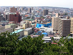
Akita ( Japanese 秋田 市 , - shi , dt. "Autumn field") is a city , seaport and administrative seat of the Akita prefecture of the same name on Honshū , the main island of Japan . The city is located on the Omono River .
history
Akita was an important fortress in the 8th century.
In Iwaki in Yuri County near Akita in what is now the urban area of Yurihonjō at 39 ° 34 ′ 0 ″ N , 140 ° 4 ′ 0 ″ E, numerous research rockets of the Kappa type were launched between 1956 and 1962 . On April 1, 1961, the highest altitude was reached at 350 km.
The incorporated district of Kubota was during the Edo period the capital of the Kubota / Akita fiefdom , which was ruled by the Satake from Kubota Castle in the Edo period .
traffic
Akita Airport is located about 20 kilometers southeast of the city center .
- Train:
- Street:
- Akita Highway
- National road 7
- National road 13
- National road 101,341
- Nihonkai-Tōhoku Highway
economy
The most important oil fields in Japan are located near the city . In addition to an oil refinery , wood and metal processing and the manufacture of silk textiles are important branches of industry.
Town twinning
-
 Lanzhou , China , since 1982
 -
 Passau , since 1984
 -
 Kenai , USA , since 1992
 -
 Vladivostok , Russia , since 1992
 -
 Hitachi-Ōta , Ibaraki
-
 Daigo , Ibaraki
Universities and colleges
sons and daughters of the town
- Masamicz Amano (* 1957), composer
- Itō Einosuke (1903-1959), writer
- Yukio Endō (1937–2009), artistic gymnast
- Takunosuke Funakawa (* 1996), football player
- Yō Gotō (* 1958), composer
- Osamu Kawakami (* ≈1950), musician
- Emiko Okuyama (* 1951), politician
- Ōmi Komaki (1894–1978), writer
- Yūki Sasahara (* 1984), skeleton pilot
- Nozomi Sasaki (* 1988), model, actress and singer
- Jumpei Saitō (* 1992), football player
- Mitsuhisa Taguchi (1955-2019), football goalkeeper
Neighboring cities and communities
Individual evidence
- ↑ Akita in the Encyclopedia Astronautica , accessed on November 20, 2015 (English).
Web links
- Akita City website
- Akita in the Encyclopedia Astronautica (English)


