Wakkanai
| Wakkanai-shi 稚 内 市 |
||
|---|---|---|
| Geographical location in Japan | ||
|
|
||
| Region : | Hokkaidō | |
| Prefecture : | Hokkaidō | |
| Coordinates : | 45 ° 24 ' N , 141 ° 42' E | |
| Basic data | ||
| Surface: | 760.80 km² | |
| Residents : | 33,689 (September 30, 2019) |
|
| Population density : | 44 inhabitants per km² | |
| Community key : | 01214-9 | |
| Symbols | ||
| Flag / coat of arms: | ||
| Tree : | Cherry, Japanese mountain ash | |
| Flower : | Potato rose | |
| town hall | ||
| Address : |
Wakkanai City Hall 3 - 13 - 15 , Chuo Wakkanai -shi Hokkaido 097-8686 |
|
| Website URL: | http://www.city.wakkanai.hokkaido.jp | |
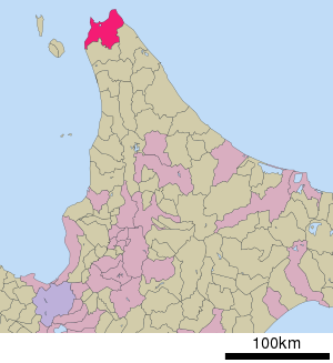
| Location Wakkanais in Hokkaidō Prefecture | ||
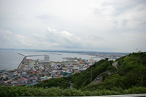
Wakkanai ( Japanese 稚 内 市 , - shi ) is the northernmost city in Japan .
etymology
The name of the city comes from the Ainu language of yam-wakka-nay ( ヤ ㇺ ワ ッ カ ナ イ ) meaning “cold drinking water river”.
geography
Wakkanai is located on the island of Hokkaidō and is the administrative seat of the sub-prefecture of Soya .
climate
The climate of Wakkanai is also one of the coolest in Japan because of its location. In winter it is often frosty and snow falls (January −6 ° C). Only in March do temperatures rise to over 0 ° C. Spring is quite long and it only gets noticeably warmer in June with around 12 ° C. August is the warmest month of the year, with values rising to an average of 20 ° C. In autumn the weather gradually becomes uncomfortable with a lot of rain, but still mild temperatures. Snow falls again at the end of November. 1161 mm of precipitation falls annually, the temperature extremes are between −19.4 ° C and +31.2 ° C.
|
Average monthly temperatures and rainfall for Wakkanai
Source: wetterkontor.de
|
|||||||||||||||||||||||||||||||||||||||||||||||||||||||||||||||||||||||||||||||||||||||||||||||||||||||||||||||||||||||||||||||||||||||
economy
Important industries are fishing , dairy and agriculture .
traffic
Outside the city is Wakkanai Airport . Ferries run from the port to the islands of Rebun and Rishiri and, in the summer months, to Korsakow on the southern tip of Sakhalin . The city can be reached via national roads 40, 232 and 238.
The Wakkanai Station is the northernmost of Japan. It is the terminus of the Sōya main line from JR Hokkaido to Nayoro and Asahikawa . The Tenpoku line, which was closed in 1989, branched off to Otoineppu at Minami-Wakkanai station .
Town twinning
City partnerships exist internally with Ishigaki , the southernmost city in Japan, and internationally with Yuzhno-Sakhalinsk (Sakhalin, Russia) and Anchorage (Alaska).
-
 Korsakov , since 1991
 -
 Yuzhno-Sakhalinsk , since 2001
sons and daughters of the town
- Masa Kamaguchi (* 1966), jazz musician
- Yuuki Ozaki (born 1991), singer
Web links
Individual evidence
- ↑ ア イ ヌ 語 地名 リ ス ト . Hokkaido Prefecture, p. 144 , accessed January 29, 2015 .


