Sunagawa
| Sunagawa-shi 砂 川 市 |
||
|---|---|---|
| Geographical location in Japan | ||
|
|
||
| Region : | Hokkaidō | |
| Prefecture : | Hokkaidō | |
| Coordinates : | 43 ° 12 ' N , 141 ° 47' E | |
| Basic data | ||
| Surface: | 78.69 km² | |
| Residents : | 16,878 (September 30, 2019) |
|
| Population density : | 214 inhabitants per km² | |
| Community key : | 01226-2 | |
| Symbols | ||
| Flag / coat of arms: | ||
| Tree : | Rowanberry | |
| Flower : | lily of the valley | |
| town hall | ||
| Address : |
Sunagawa City Hall 3 - 1 - 1 , Nishi-6-jō-Kita Sunagawa -shi Hokkaidō 073-0195 |
|
| Website URL: | http://www.city.sunagawa.hokkaido.jp/ | |
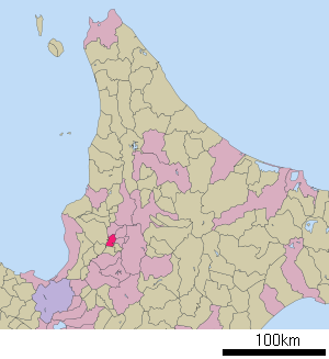
| Location of Sunagawas in Hokkaido Prefecture | ||
Sunagawa ( Japanese 砂 川 市 , - shi ) is a city in the sub-prefecture of Sorachi on the island of Hokkaidō ( Japan ).
geography
Sunagawa is southwest of Asahikawa and northeast of Sapporo .
history
He was appointed Shi on July 1, 1958.
traffic
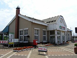
The Sunagawa Station is located on the Hakodate Main Line between Sapporo and Asahikawa , by the railway company JR Hokkaido operates.
Sunagawa is accessible from the Dōō Expressway and National Road 12 .
Neighboring cities and communities
Web links
Commons : Sunagawa - collection of images, videos, and audio files


