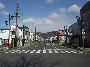
Noboribetsu
| Noboribetsu-shi 登 別 市 |
||
|---|---|---|
| Geographical location in Japan | ||
|
|
||
| Region : | Hokkaidō | |
| Prefecture : | Hokkaidō | |
| Coordinates : | 42 ° 25 ' N , 141 ° 6' E | |
| Basic data | ||
| Surface: | 212.11 km² | |
| Residents : | 47,795 (September 30, 2019) |
|
| Population density : | 225 inhabitants per km² | |
| Community key : | 01230-1 | |
| Symbols | ||
| Flag / coat of arms: | ||
| Tree : | Plane trees | |
| Flower : | Chrysanthemums | |
| town hall | ||
| Address : |
Noboribetsu City Hall 6 - 11 Chuō-chō Noboribetsu -shi Hokkaidō 059-8701 |
|
| Website URL: | http://www.city.noboribetsu.hokkaido.jp/ | |
| Location Noboribetsus in Hokkaido Prefecture | ||
Noboribetsu ( Japanese 登 別 市 , - shi ) is a city in the Iburi sub-prefecture on the island of Hokkaidō ( Japan ).
geography
Noboribetsu is south of Sapporo and east of Muroran on the Pacific Ocean .
Attractions
- Noboribetsu Onsen (Hot Spring)
traffic
Noboribetsu is accessible from the Dōō Expressway and National Road 36. The Noboribetsu Station is located at the Muroran Main Line of JR Hokkaido .
Town twinning
sons and daughters of the town
- Yoshida Brothers , Shamisen musician
- Kazuki Kushibiki (born 1993), football player
- Ikuta Toma , actor, musician
Neighboring cities and communities
Web links
Commons : Noboribetsu - collection of images, videos and audio files


