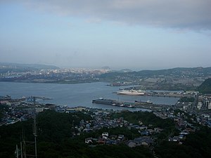
Muroran
| Muroran-shi 室 蘭 市 |
||
|---|---|---|
| Geographical location in Japan | ||
|
|
||
| Region : | Hokkaidō | |
| Prefecture : | Hokkaidō | |
| Coordinates : | 42 ° 19 ' N , 140 ° 58' E | |
| Basic data | ||
| Surface: | 80.65 km² | |
| Residents : | 83,287 (September 30, 2019) |
|
| Population density : | 1033 inhabitants per km² | |
| Community key : | 01205-0 | |
| Symbols | ||
| Flag / coat of arms: | ||
| Tree : | Rowanberry | |
| Flower : | Azaleas | |
| town hall | ||
| Address : |
Muroran City Hall 1 - 2 , Saiwai-chō Muroran -shi Hokkaidō 051-8511 |
|
| Website URL: | www.city.muroran.hokkaido.jp | |
| Location of Muroran's in Hokkaidō Prefecture | ||
Muroran ( Japanese 室 蘭 市 , - shi ) is a city and the seat of the administration of the Iburi sub-prefecture on the island of Hokkaidō , Japan .
geography
Muroran is located south of Sapporo , on the Etomo peninsula on the Uchiura Bay of the Pacific Ocean .
history
The city has existed since August 1, 1922.
traffic
The city's main train station is Higashi-Muroran Station on the Muroran Main Line , which connects Oshamambe with Iwamizawa Station . From this a seven-kilometer branch line branches off to Muroran station , which is located near the port.
Muroran can be reached via the Dōō motorway and national roads 36 and 37.
economy
Town twinning
- Knoxville (United States)
Universities and colleges
sons and daughters of the town
- Asami Abe (* 1985), singer, actress
- Takanohana Kenshi (1950-2005), sumo wrestler
- Manabu Horii (* 1972), speed skater
Neighboring cities and communities
Web links
Commons : Muroran - collection of images, videos and audio files


