Iwamizawa
| Iwamizawa-shi 岩 見 沢 市 |
||
|---|---|---|
| Geographical location in Japan | ||
|
|
||
| Region : | Hokkaidō | |
| Prefecture : | Hokkaidō | |
| Coordinates : | 43 ° 12 ' N , 141 ° 47' E | |
| Basic data | ||
| Surface: | 481.10 km² | |
| Residents : | 80,753 (September 30, 2019) |
|
| Population density : | 168 inhabitants per km² | |
| Community key : | 01210-6 | |
| Symbols | ||
| Flag / coat of arms: | ||
| Tree : | Kobushi magnolia | |
| Flower : | Roses | |
| town hall | ||
| Address : |
Iwamizawa City Hall 1 - 1 - 1 , Hatogaoka Iwamizawa -shi Hokkaidō 068-8686 |
|
| Website URL: | http://www.city.iwamizawa.hokkaido.jp/ | |
| Location of Iwamizawas in Hokkaido Prefecture | ||
Iwamizawa ( Japanese 岩 見 沢 市 , - shi ) is a city and the administrative seat of the sub-prefecture of Sorachi on the Japanese island of Hokkaidō .
geography
Iwamizawa is located southwest of Asahikawa and northeast of Sapporo .
history
The city has existed since April 1, 1943.
traffic
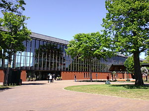
The Iwamizawa station is located on the Hakodate Main Line between Sapporo and Asahikawa , the main railway line on the island. From here the Muroran main line branches off towards Muroran . The station building, a new building from 2007, is considered an architectural masterpiece and has been awarded numerous prizes.
Iwamizawa can be reached via the Dōō Highway , as well as National Road 12 and National Road 234.
Personalities
- Shunta Awaka (* 1995), soccer player
- Saeko Himuro (1957-2008), writer
Town twinning
- Pocatello (United States)
Neighboring cities and communities
Web links
Commons : Iwamizawa - collection of images, videos and audio files


