Hokkaidō Highway
| Hokkaidō Highway in Japan | ||||||||||||||||||||||||||||||||||||||||||||||||||||||||||||||||||||||||||||||||||||||||||||||||||||||||||||||||||||||||||||||||||||||||||||||||||||||||||||||||||||||||||||||||||||||||||||||||||||||||||||||||||||||||||||

|
||||||||||||||||||||||||||||||||||||||||||||||||||||||||||||||||||||||||||||||||||||||||||||||||||||||||||||||||||||||||||||||||||||||||||||||||||||||||||||||||||||||||||||||||||||||||||||||||||||||||||||||||||||||||||||
| map | ||||||||||||||||||||||||||||||||||||||||||||||||||||||||||||||||||||||||||||||||||||||||||||||||||||||||||||||||||||||||||||||||||||||||||||||||||||||||||||||||||||||||||||||||||||||||||||||||||||||||||||||||||||||||||||
| Basic data | ||||||||||||||||||||||||||||||||||||||||||||||||||||||||||||||||||||||||||||||||||||||||||||||||||||||||||||||||||||||||||||||||||||||||||||||||||||||||||||||||||||||||||||||||||||||||||||||||||||||||||||||||||||||||||||
| Operator: | NEXCO Higashi-Nihon | |||||||||||||||||||||||||||||||||||||||||||||||||||||||||||||||||||||||||||||||||||||||||||||||||||||||||||||||||||||||||||||||||||||||||||||||||||||||||||||||||||||||||||||||||||||||||||||||||||||||||||||||||||||||||||
| Start of the street: | Nanae | |||||||||||||||||||||||||||||||||||||||||||||||||||||||||||||||||||||||||||||||||||||||||||||||||||||||||||||||||||||||||||||||||||||||||||||||||||||||||||||||||||||||||||||||||||||||||||||||||||||||||||||||||||||||||||
| End of street: | Nayoro | |||||||||||||||||||||||||||||||||||||||||||||||||||||||||||||||||||||||||||||||||||||||||||||||||||||||||||||||||||||||||||||||||||||||||||||||||||||||||||||||||||||||||||||||||||||||||||||||||||||||||||||||||||||||||||
| Overall length: | 467 km | |||||||||||||||||||||||||||||||||||||||||||||||||||||||||||||||||||||||||||||||||||||||||||||||||||||||||||||||||||||||||||||||||||||||||||||||||||||||||||||||||||||||||||||||||||||||||||||||||||||||||||||||||||||||||||
| of which in operation: | 467 km | |||||||||||||||||||||||||||||||||||||||||||||||||||||||||||||||||||||||||||||||||||||||||||||||||||||||||||||||||||||||||||||||||||||||||||||||||||||||||||||||||||||||||||||||||||||||||||||||||||||||||||||||||||||||||||
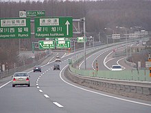
| The motorway near Eniwa. | ||||||||||||||||||||||||||||||||||||||||||||||||||||||||||||||||||||||||||||||||||||||||||||||||||||||||||||||||||||||||||||||||||||||||||||||||||||||||||||||||||||||||||||||||||||||||||||||||||||||||||||||||||||||||||||
|
Course of the road
|
||||||||||||||||||||||||||||||||||||||||||||||||||||||||||||||||||||||||||||||||||||||||||||||||||||||||||||||||||||||||||||||||||||||||||||||||||||||||||||||||||||||||||||||||||||||||||||||||||||||||||||||||||||||||||||
The Hokkaidō-Autobahn or Dōō-Autobahn ( Japanese 央 央 自動 D , Dōō jidōshadō , "Central Hokkaidō-Autobahn", abbreviated 道 央 道 , Dōō Dō , "Central Hokkaidō Street") is a highway in Japan . The highway is the main artery on the island of Hokkaidō and consists of two parts, the southern part from Nanae to Sapporo and the northern part from Sapporo to Nayoro . These two parts each have their own exit numbering. The southern part is approx. 272 kilometers long, the northern part approx. 195 kilometers, so the motorway has a total length of 467 kilometers.
Street description


Nanae-Sapporo
The highway starts at Nanae and runs through mountainous areas along the east coast of Hokkaido and has 2 × 2 lanes there. The first part leads through a rural area with smaller towns. Via Yakumo, the highway follows the coast of Hokkaido. The Hokkaidō Highway also has single-lane sections with 1 × 2 or 2 × 1 lanes. The highway then runs east of Muroran and then turns north past Tomakomai inland and then leads directly to Sapporo. This part of the highway runs through wooded areas and passes several towns south of Sapporo. Then the highway runs through the eastern part of the city of Sapporo and ends at an intersection with the Sasson highway .
Sapporo-Nayoro
The northern part begins at the interchange where the southern part ended. The highway runs east of Sapporo. The motorway here has 2 × 2 lanes and later turns north, through a narrowed valley with several medium-sized towns on the route, and several rivers are crossed. Further to the north the landscape is hilly and some tunnels follow. The highway rises to about 250 meters above sea level. The main city in this area is Asahikawa . The motorway ends shortly afterwards.
history
The motorway has been built since the 1970s. In 1971, the first section between Kitahiroshima and Chitose opened to traffic, which was expanded to four lanes in 1972. In 1978 the part about Tomakomai followed and in 1979 the part between Sapporo and Kitahiroshima. In the 1980s, the highway was expanded both south and north from the Sapporo region. In 1990 the highway reached the city of Asahikawa in the north, and in 1991 it reached the city of Muroran in the south. Between 1992 and 1997 the road was widened westward to Oshamanbe . In 2000 the northern part was expanded to Wassamu and expanded in 2003 with the current end at Shibetsu. Between 2006 and 2009 construction was mainly in the south of Hokkaido, and the highway reached Otoshibe in Yakumo .
Opening dates of the motorway
| from | to | length | date |
|---|---|---|---|
| Kitahiroshima | Chitose | 23 km | December 4th, 1971 |
| Chitose | Tomakomai-higashi | 12 km | October 24, 1978 |
| Sapporo-minami | Kitahiroshima | 5 km | October 29, 1979 |
| Tomakomai-higashi | Tomakomai-nishi | 17 km | October 29, 1980 |
| Sapporo | Iwamizawa | 32 km | 11/09/1983 |
| Tomakomai-nishi | Shiraoi | 15 km | 11/30/1983 |
| Shiraoi | Noboribetsu-higashi | 19 km | October 18, 1985 |
| Sapporo | Sapporo-minami | 8 kilometers | 25.10.1985 |
| Noboribetsu-higashi | Noboribetsu Muroran | 11 km | 10/09/1986 |
| Iwamizawa | Bibai | 22 km | 08/18/1987 |
| Bibai | Takikawa | 27 km | 10/08/1988 |
| Takikawa | Fukugawa | 18 km | 09/12/1989 |
| Fukugawa | Ashikawa Takasu | 27 km | 10/30/1990 |
| Noboribetsu Muroran | Muroran | 10 km | 10/25/1991 |
| Muroran | Date | 13 km | 10/27/1992 |
| Date | Abuta Toyako | 13 km | 03/30/1994 |
| Abuta Toyako | Oshamanbe | 47 km | 10/22/1997 |
| Asahikawa Takasu | Wassamu | 30 km | 04/10/2000 |
| Oshamanbe | Kunnui | 11 km | 11/19/2001 |
| Wassamu | Shibetsu Kenbuchi | 16 km | 04/10/2003 |
| Kunnui | Yakumo | 22 km | 11/18/2006 |
| Yakumo | Otoshibe | 16 km | 10/10/2009 |
| Otoshibe | Mori | 20 km | 11/26/2011 |
| Mori | Kayabe | 10 km | 11/10/2012 |
future
Between Kayabe and Nanae, a piece of the motorway is still missing, but it is served by National Road 5 . This is already partially four lanes and developed with a few crossings, especially when bypassing Nanae.
Traffic volume
In 2003, approximately 9,400 vehicles drove daily on the southern part of the highway, with an increase to approximately 26,000 vehicles in the south of Sapporo. Most vehicles use the highway at Kitahiroshima with 31,000 vehicles per day. The northernmost part near Asahikawa only has 1,600 vehicles per day.
Expansion of the roadways
| from | to | length | Lanes |
|---|---|---|---|
| Onumakoen | Noboribetsu Muroran | 160 km | 1 × 1 |
| Noboribetsu Muroran | Asahikawa Takasu | 235 km | 2 × 2 |
| Asahikawa Takasu | Shibetsu Kenbuchi | 70 km | 1 × 1 |
Web links
- Operating company Higashi-Nihon Kōsokudōro KK (Japanese)
- Hokkaido_Expressway_ (Japan) Wegenwiki (Dutch)
