Tōkyō-Gaikan Highway
| Tōkyō-Gaikan Highway in Japan | |||||||||||||||||||||||||||||||||||||||||||||||||||||||||||||||||||

|
|||||||||||||||||||||||||||||||||||||||||||||||||||||||||||||||||||
| map | |||||||||||||||||||||||||||||||||||||||||||||||||||||||||||||||||||
| Basic data | |||||||||||||||||||||||||||||||||||||||||||||||||||||||||||||||||||
| Operator: | NEXCO Higashi-Nihon | ||||||||||||||||||||||||||||||||||||||||||||||||||||||||||||||||||
| Start of the street: | Setagaya | ||||||||||||||||||||||||||||||||||||||||||||||||||||||||||||||||||
| End of street: | Ichikawa | ||||||||||||||||||||||||||||||||||||||||||||||||||||||||||||||||||
| Overall length: | 34 km | ||||||||||||||||||||||||||||||||||||||||||||||||||||||||||||||||||
| of which in operation: | 37 km | ||||||||||||||||||||||||||||||||||||||||||||||||||||||||||||||||||
|
Course of the road
|
|||||||||||||||||||||||||||||||||||||||||||||||||||||||||||||||||||
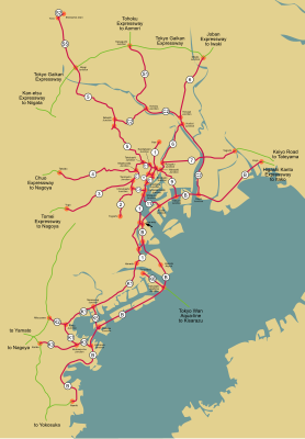
The Tokyo-Gaikan-Autobahn ( Japanese 東京 外環 自動 車道 , Tōkyō Gaikan jidōshadō , dt. "Outer Ring Autobahn Tokyo") is a highway in Japan . The highway is the third ring of the capital Tokyo and is currently only a northern bypass, but is to be used in the future as a three-quarter ring from the Tōmei highway near Setagaya and the Higashi-Kantō highway near Ichikawa. 34 km of the route in northern Tokyo have currently been completed.
Street description
The freeway currently begins at the Oizumi node, where the Kan'etsu freeway begins, which runs to Niigata . The motorway then runs north-east, has 2 × 3 lanes and runs through numerous towns. In the further course the Arakawa River is crossed and there follows a junction with the Tokyo route 5 and route S5. The highway has 2 × 2 lanes and runs through the south of Saitama Prefecture . An important node follows at Kawaguchi, where it crosses the route S1 urban highway and the Tōhoku highway . The road then runs through the suburbs of Tokyo to the Misato intersection, where it intersects the Route 6 urban highway and the Jōban highway . The motorway runs from there to Matsudo, where the motorway ends at National Road 298.
history
The decision was made to build the motorway back in 1966, but it took until 1992 for the first section between the Misato junction and the Wako exit to open. In 1993, the intersection with Route 5 of the city freeway opened. In 1994, the Wako node opened to the Kan'etsu Highway. In 2005 a section opened at Misato.
Opening dates of the motorway
| from | to | length | date |
|---|---|---|---|
| Wako | Misato | 27 km | 11/27/1992 |
| Oizumi | Wako | 3 km | 03/30/1994 |
| Misato | Misato-minami | 4 km | 11/27/2005 |
Traffic volume
The motorway is busy with traffic between 75,000 and 86,000 vehicles per day. The section at Misato is an exception, where there are only 32,000 vehicles per day.
Expansion of the roadways
| from | to | length | Lanes |
|---|---|---|---|
| Oizumi | Wako | 5 km | 2 × 3 |
| Wako | Misato | 29 km | 2 × 2 |
Web links
- Operating company Higashi-Nihon Kōsokudōro KK (Japanese)
- Wegenwiki (Dutch)

