
Sōya main line
| Sōya main line | |||||||||||||||||||||||||||||||||||||||||||||||||||||||||||||||||||||||||||||||||||||||||||||||||||||||||||||||||||||||||||||||||||||||||||||||||||||||||||||||||||||||||||||||||||||||||||||||||||||||||||||||||||||||||||||||||||||||||||||||||||||||||||||||||||||||||||||||||||||||||||||||||||||||||||||||||||||||||||||||||||||||||||||||||||||||||||||||||||||||||||||||||||||||||||||||||||||||||||||||||||||||||||||||||||||||||
|---|---|---|---|---|---|---|---|---|---|---|---|---|---|---|---|---|---|---|---|---|---|---|---|---|---|---|---|---|---|---|---|---|---|---|---|---|---|---|---|---|---|---|---|---|---|---|---|---|---|---|---|---|---|---|---|---|---|---|---|---|---|---|---|---|---|---|---|---|---|---|---|---|---|---|---|---|---|---|---|---|---|---|---|---|---|---|---|---|---|---|---|---|---|---|---|---|---|---|---|---|---|---|---|---|---|---|---|---|---|---|---|---|---|---|---|---|---|---|---|---|---|---|---|---|---|---|---|---|---|---|---|---|---|---|---|---|---|---|---|---|---|---|---|---|---|---|---|---|---|---|---|---|---|---|---|---|---|---|---|---|---|---|---|---|---|---|---|---|---|---|---|---|---|---|---|---|---|---|---|---|---|---|---|---|---|---|---|---|---|---|---|---|---|---|---|---|---|---|---|---|---|---|---|---|---|---|---|---|---|---|---|---|---|---|---|---|---|---|---|---|---|---|---|---|---|---|---|---|---|---|---|---|---|---|---|---|---|---|---|---|---|---|---|---|---|---|---|---|---|---|---|---|---|---|---|---|---|---|---|---|---|---|---|---|---|---|---|---|---|---|---|---|---|---|---|---|---|---|---|---|---|---|---|---|---|---|---|---|---|---|---|---|---|---|---|---|---|---|---|---|---|---|---|---|---|---|---|---|---|---|---|---|---|---|---|---|---|---|---|---|---|---|---|---|---|---|---|---|---|---|---|---|---|---|---|---|---|---|---|---|---|---|---|---|---|---|---|---|---|---|---|---|---|---|---|---|---|---|---|---|---|---|---|---|---|---|---|---|---|---|---|---|---|---|---|---|---|---|---|---|---|---|---|---|---|---|---|---|---|---|---|---|---|---|---|---|---|---|---|---|---|---|---|---|---|---|---|---|---|---|---|---|---|---|---|---|---|---|---|---|---|---|---|---|---|
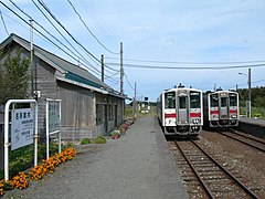
 Diesel multiple unit “Super Sōya” at Onoppunai
| |||||||||||||||||||||||||||||||||||||||||||||||||||||||||||||||||||||||||||||||||||||||||||||||||||||||||||||||||||||||||||||||||||||||||||||||||||||||||||||||||||||||||||||||||||||||||||||||||||||||||||||||||||||||||||||||||||||||||||||||||||||||||||||||||||||||||||||||||||||||||||||||||||||||||||||||||||||||||||||||||||||||||||||||||||||||||||||||||||||||||||||||||||||||||||||||||||||||||||||||||||||||||||||||||||||||||
 | |||||||||||||||||||||||||||||||||||||||||||||||||||||||||||||||||||||||||||||||||||||||||||||||||||||||||||||||||||||||||||||||||||||||||||||||||||||||||||||||||||||||||||||||||||||||||||||||||||||||||||||||||||||||||||||||||||||||||||||||||||||||||||||||||||||||||||||||||||||||||||||||||||||||||||||||||||||||||||||||||||||||||||||||||||||||||||||||||||||||||||||||||||||||||||||||||||||||||||||||||||||||||||||||||||||||||
| Route length: | 259.4 km | ||||||||||||||||||||||||||||||||||||||||||||||||||||||||||||||||||||||||||||||||||||||||||||||||||||||||||||||||||||||||||||||||||||||||||||||||||||||||||||||||||||||||||||||||||||||||||||||||||||||||||||||||||||||||||||||||||||||||||||||||||||||||||||||||||||||||||||||||||||||||||||||||||||||||||||||||||||||||||||||||||||||||||||||||||||||||||||||||||||||||||||||||||||||||||||||||||||||||||||||||||||||||||||||||||||||||
| Gauge : | 1067 mm ( cape track ) | ||||||||||||||||||||||||||||||||||||||||||||||||||||||||||||||||||||||||||||||||||||||||||||||||||||||||||||||||||||||||||||||||||||||||||||||||||||||||||||||||||||||||||||||||||||||||||||||||||||||||||||||||||||||||||||||||||||||||||||||||||||||||||||||||||||||||||||||||||||||||||||||||||||||||||||||||||||||||||||||||||||||||||||||||||||||||||||||||||||||||||||||||||||||||||||||||||||||||||||||||||||||||||||||||||||||||
| Power system : | partly 20 kV 50 Hz ~ | ||||||||||||||||||||||||||||||||||||||||||||||||||||||||||||||||||||||||||||||||||||||||||||||||||||||||||||||||||||||||||||||||||||||||||||||||||||||||||||||||||||||||||||||||||||||||||||||||||||||||||||||||||||||||||||||||||||||||||||||||||||||||||||||||||||||||||||||||||||||||||||||||||||||||||||||||||||||||||||||||||||||||||||||||||||||||||||||||||||||||||||||||||||||||||||||||||||||||||||||||||||||||||||||||||||||||
| Maximum slope : | 20 ‰ | ||||||||||||||||||||||||||||||||||||||||||||||||||||||||||||||||||||||||||||||||||||||||||||||||||||||||||||||||||||||||||||||||||||||||||||||||||||||||||||||||||||||||||||||||||||||||||||||||||||||||||||||||||||||||||||||||||||||||||||||||||||||||||||||||||||||||||||||||||||||||||||||||||||||||||||||||||||||||||||||||||||||||||||||||||||||||||||||||||||||||||||||||||||||||||||||||||||||||||||||||||||||||||||||||||||||||
| Minimum radius : | 200 m | ||||||||||||||||||||||||||||||||||||||||||||||||||||||||||||||||||||||||||||||||||||||||||||||||||||||||||||||||||||||||||||||||||||||||||||||||||||||||||||||||||||||||||||||||||||||||||||||||||||||||||||||||||||||||||||||||||||||||||||||||||||||||||||||||||||||||||||||||||||||||||||||||||||||||||||||||||||||||||||||||||||||||||||||||||||||||||||||||||||||||||||||||||||||||||||||||||||||||||||||||||||||||||||||||||||||||
| Top speed: | 120 km / h | ||||||||||||||||||||||||||||||||||||||||||||||||||||||||||||||||||||||||||||||||||||||||||||||||||||||||||||||||||||||||||||||||||||||||||||||||||||||||||||||||||||||||||||||||||||||||||||||||||||||||||||||||||||||||||||||||||||||||||||||||||||||||||||||||||||||||||||||||||||||||||||||||||||||||||||||||||||||||||||||||||||||||||||||||||||||||||||||||||||||||||||||||||||||||||||||||||||||||||||||||||||||||||||||||||||||||
| Dual track : | Asahikawa - Nagayama | ||||||||||||||||||||||||||||||||||||||||||||||||||||||||||||||||||||||||||||||||||||||||||||||||||||||||||||||||||||||||||||||||||||||||||||||||||||||||||||||||||||||||||||||||||||||||||||||||||||||||||||||||||||||||||||||||||||||||||||||||||||||||||||||||||||||||||||||||||||||||||||||||||||||||||||||||||||||||||||||||||||||||||||||||||||||||||||||||||||||||||||||||||||||||||||||||||||||||||||||||||||||||||||||||||||||||
| Society: | JR Hokkaidō | ||||||||||||||||||||||||||||||||||||||||||||||||||||||||||||||||||||||||||||||||||||||||||||||||||||||||||||||||||||||||||||||||||||||||||||||||||||||||||||||||||||||||||||||||||||||||||||||||||||||||||||||||||||||||||||||||||||||||||||||||||||||||||||||||||||||||||||||||||||||||||||||||||||||||||||||||||||||||||||||||||||||||||||||||||||||||||||||||||||||||||||||||||||||||||||||||||||||||||||||||||||||||||||||||||||||||
|
|||||||||||||||||||||||||||||||||||||||||||||||||||||||||||||||||||||||||||||||||||||||||||||||||||||||||||||||||||||||||||||||||||||||||||||||||||||||||||||||||||||||||||||||||||||||||||||||||||||||||||||||||||||||||||||||||||||||||||||||||||||||||||||||||||||||||||||||||||||||||||||||||||||||||||||||||||||||||||||||||||||||||||||||||||||||||||||||||||||||||||||||||||||||||||||||||||||||||||||||||||||||||||||||||||||||||
The Sōya main line ( Japanese 宗 谷 本 線 , Sōya-honsen ) is a railway line on the Japanese island of Hokkaidō , which is operated by the Hokkaido Railway Company (JR Hokkaido). It runs from Asahikawa via Nayoro to Wakkanai and is the most northerly stretch of the country. The name is derived from the sub-prefecture Sōya . The oldest part of the line opened in 1898 and was completed in 1928.
description
As is usual in Japan, the main Sōya line is laid in Kapspur (1067 mm). In terms of passenger transport, it opens up 53 train stations and stops, plus a freight station operated by JR Freight on the northern outskirts of Asahikawa. The predominantly single-lane route is 259.4 km long and is used by diesel trains. The only exception is the 6.6 km long section between the Asahikawa station and the Kita-Asahikawa freight station in the far south : this section has two lanes and is electrified with 20 kV 50 Hz alternating current so that electric freight trains can also run there.
The maximum speed between Asahikawa and Nayoro is 120 km / h and 95 km / h on the rest of the route. The Sōya Main Line, one of the longest railway lines in Japan, runs largely through mountainous terrain and sparsely populated areas. For this reason, accidents with wildlife are quite common. In addition, the section between Nayoro and Wakkanai is affected by unstable geological conditions and regularly occurring storm damage.
Trains
In long-distance traffic, JR Hokkaido offers three pairs of express trains a day. One of them is the Super Sōya from Sapporo to Wakkanai . The other two are the Sarobetsu trains between Asahikawa and Wakkanai. A connection to and from Sapporo is offered in Asahikawa. The Asahikawa – Wakkanai route takes about 3 hours and 45 minutes by train. All of these trips are carried out with tilting diesel multiple units of the type KiHa261.
The local transport offer depends on the different low population density of the regions passed through. In the section between Asahikawa and Nayoro , passenger trains run approximately every one to two hours. The section between Nayoro and Otoineppu is driven four times a day, the section between Otoineppu and Wakkanai three times a day.
Crossing regional trains in Bakkai
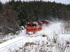
Snow plow diesel locomotive
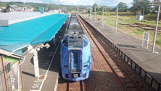
Super soya in horonobe

Kita-Asahikawa freight yard


history
The Japanese Reichstag passed the Hokkaidō Railway Construction Act in 1896, which obliged the state to promote the economic development of the island by building railway lines. For this purpose, the state company Hokkaidō Kansetsu Tetsudō was founded, which among other things had the order to build a line from Asahikawa to the north of the island. On August 12, 1898, it opened the first section of the line between Asahikawa and Nagayama, which was initially called the Teshio Line ( 天 塩 線 , Teshio-sen ). Short extensions followed in stages: on November 25, 1898 to Ranru, on November 15, 1899 to Wassamu, on August 5, 1900 to Shibetsu and on September 3, 1903 to Nayoro .
On April 1, 1905, the Hokkaidō Kansetsu Tetsudō went on in the newly created Railway Office (later the Railway Ministry ). In the same year, after the Russo-Japanese War , Japan was awarded the southern half of Sakhalin Island . Then the decision was made to continue the Teshio Line to the northern tip of Hokkaidō to create a connection to the new Karafuto Prefecture . On November 3, 1911, the Railway Authority opened the Nayoro – Onnenai section and on September 21, 1912, the entire previously constructed line was named Sōya Line ( 宗 谷 線 , Sōya-sen ). A few weeks later, on November 5, 1912, it reached Otoineppu .
It was actually planned to continue building the Sōya line from Otoineppu via Horonobe immediately . However, the Ministry of Railways decided to establish an alternative route along the coast of the Sea of Okhotsk first , even though it was over 20 kilometers longer. The line , later called the Tenpoku Line , was temporarily considered part of the Sōya Line. It was built in six stages and reached the terminus of Wakkanai (today Minami-Wakkanai ) on November 1, 1922.
The section from Otoineppu to Teshio-Nakagawa, which was opened on November 9, 1922, formed the first part of the originally planned route, which was given the provisional designation Teshio-Südlinie ( 天 塩 南 線 , Teshio-nan-sen ). This was extended to Toikambetsu on November 10, 1923. Next came the section from Minami-Wakkanai to Kabutonuma, which went into operation on June 25, 1924 as the Teshio Northern Line ( 天 塩 北 線 , Teshio-hoku-sen ). On July 20, 1925, the southern line reached Horonobe . The gap between Horonobe and Kabutonuma was closed on September 25, 1926, making the northernmost city of Hokkaidōs accessible on two different routes. The new continuous connection was now called the Teshio Line. Another extension was added on December 26, 1928, from Minami-Wakkanai to the new Wakkanai-minato port station (today's Wakkanai station ). The Sōya line between Asahikawa and Otoineppu and the subsequent Teshio line have been referred to as the Sōya main line since April 1, 1930.
As early as May 1, 1923, there was a ferry line operated by the Ministry of Railways between the cities of Wakkanai and Ōdomari (today Korsakow ) on the southern tip of Sakhalin on the La Pérouse road . To improve the transfer relationships, a track was laid on the pier north of the port station and on October 1, 1938, a stop called Wakkanai-sanbashi was established there. When the Red Army occupied the southern half of Sakhalin shortly before the end of the Pacific War and drove out the Japanese living there, this stop lost its function. It was closed on August 25, 1945 and the railway line for passenger traffic was withdrawn to the port station on the same day.
With the cessation of traffic to Sakhalin, the Sōya main line lost its importance. The Japanese State Railways , responsible from 1949, first used diesel multiple units in 1956 . South of Onoppunai, the route led through an area that was very often affected by avalanches and landslides . The 1256 m long Shimodaira tunnel, which went into operation on July 15, 1965, was built there to increase operational safety. The 3.7 km long section between Asahikawa and Shin-Asahikawa was relocated to a viaduct and double-tracked; the work was completed on September 29, 1973. On May 5, 1975, the last train pulled by a steam locomotive ran between Asahikawa and Horonobe , and 13 days later also on the remaining route to Wakkanai.
As a result of the state railroad privatization , the Sōya main line went into the possession of the new company JR Hokkaido on April 1, 1987 , while JR Freight took over the freight traffic. The double lane was extended by another 2.9 km to the Kita-Asahikawa freight yard on November 4, 2002, and the entire double-track section was electrified on May 10, 2003 . In November 2016, JR Hokkaido announced an extensive rationalization program, which affects the Nayoro – Wakkanai section, among other things. The railway company wants to persuade the neighboring communities to bear part of the operating and maintenance costs. Should no agreement be reached by 2019, shutdown would also be conceivable. However, such a measure would run counter to plans to build a Sakhalin-Hokkaidō tunnel .
List of train stations
| Surname | km | Connecting lines | location | place | |
|---|---|---|---|---|---|
| A28 | Asahikawa ( 旭川 ) | 0.0 |
Hakodate main line Furano line |
Coord. | Asahikawa |
| A29 | Asahikawa-Yojō ( 旭川 四条 ) | 1.8 | Coord. | ||
| A30 | Shin-Asahikawa ( 新 旭川 ) | 3.7 | Sekihoku main line | Coord. | |
| W31 | Nagayama ( 永 山 ) | 9.3 | Coord. | ||
| W32 | Kita-Nagayama ( 北 永 山 ) | 11.4 | Coord. | ||
| W33 | Minami-Pippu ( 南比布 ) | 14.7 | Coord. | Pippu | |
| W34 | Pippu ( 比 布 ) | 17.1 | Coord. | ||
| W35 | Kita-Pippu ( 北 比 布 ) | 20.2 | Coord. | ||
| W36 | Ranru ( 蘭 留 ) | 22.8 | Coord. | ||
| W37 | Shiokari ( 塩 狩 ) | 28.4 | Coord. | Wassamu | |
| W38 | Wassamu ( 和 寒 ) | 36.3 | Coord. | ||
| W39 | Higashi Rokusen ( 東 六 線 ) | 41.4 | Coord. | Kembuchi | |
| W40 | Kembuchi ( 剣 淵 ) | 45.2 | Coord. | ||
| W41 | Kita-Kembuchi ( 北 剣 淵 ) | 50.2 | Coord. | ||
| W42 | Shibetsu ( 士 別 ) | 53.9 | Coord. | Shibetsu | |
| W43 | Shimo Shibetsu ( 下士 別 ) | 58.3 | Coord. | ||
| W44 | Tayoro ( 多 寄 ) | 61.7 | Coord. | ||
| W45 | Mizuho ( 瑞 穂 ) | 64.5 | Coord. | ||
| W46 | Fūren ( 風 連 ) | 68.1 | Coord. | Nayoro | |
| W47 | Higashi-Fūren ( 東風 連 ) | 72.6 | Coord. | ||
| W48 | Nayoro ( 名 寄 ) | 76.2 | Coord. | ||
| W49 | Nisshin ( 日 進 ) | 80.2 | Coord. | ||
| W50 | Hokusei ( 北 星 ) | 89.3 | Coord. | ||
| W51 | Chiebun ( 智 恵 文 ) | 91.2 | Coord. | ||
| W52 | Chihoku ( 智 北 ) | 93.3 | Coord. | ||
| W53 | Minami-Bifuka ( 南美 深 ) | 95.6 | Coord. | Bifuka | |
| W54 | Bifuka ( 美 深 ) | 98.3 | Coord. | ||
| W55 | Hatsuno ( 初 野 ) | 101.9 | Coord. | ||
| W56 | Momponai ( 紋 穂 内 ) | 105.0 | Coord. | ||
| W57 | Onnenai ( 恩 根 内 ) | 112.1 | Coord. | ||
| W58 | Toyoshimizu ( 豊 清水 ) | 117.9 | Coord. | ||
| W59 | Teshiogawa Onsen ( 天 塩 川 温泉 ) | 121.5 | Coord. | Otoineppu | |
| W60 | Sakkuru ( 咲 来 ) | 124.7 | Coord. | ||
| W61 | Otoineppu ( 音 威 子 府 ) | 129.3 | Coord. | ||
| W62 | Osashima ( 筬 島 ) | 135.6 | Coord. | ||
| W63 | Saku ( 佐 久 ) | 153.6 | Coord. | Nakagawa | |
| W64 | Teshio-Nakagawa ( 天 塩 中 川 ) | 161.9 | Coord. | ||
| W65 | Utanai ( 歌 内 ) | 170.3 | Coord. | ||
| W66 | Toikambetsu ( 問 寒 別 ) | 175.8 | Coord. | Horonobe | |
| W67 | Nukanan ( 糠 南 ) | 178.0 | Coord. | ||
| W68 | Onoppunai ( 雄 信 内 ) | 183.7 | Coord. | ||
| W69 | Yasuushi ( 安 牛 ) | 189.7 | Coord. | ||
| W70 | Minami horonobe ( 南 幌 延 ) | 191.6 | Coord. | ||
| W71 | Kami horonobe ( 上 幌 延 ) | 194.6 | Coord. | ||
| W72 | Horonobe ( 幌 延 ) | 199.4 | Coord. | ||
| W73 | Shimonuma ( 下 沼 ) | 207.2 | Coord. | ||
| W74 | Toyotomi ( 豊 富 ) | 215.9 | Coord. | Toyotomi | |
| W75 | Tokumitsu ( 徳 満 ) | 220.9 | Coord. | ||
| W76 | Kabutonuma ( 兜 沼 ) | 230.9 | Coord. | ||
| W77 | Yūchi ( 勇 知 ) | 236.7 | Coord. | Wakkanai | |
| W78 | Bakkai ( 抜 海 ) | 245.0 | Coord. | ||
| W79 | Minami-Wakkanai ( 南 稚 内 ) | 256.7 | Coord. | ||
| W80 | Wakkanai ( 稚 内 ) | 259.4 | Coord. | ||
Web links
Individual evidence
- ↑ 平 成 26 年 3 月 ダ イ ヤ 改正 に つ い て . (PDF) JR Hokkaido, December 24, 2013, accessed April 4, 2017 (Japanese).
- ↑ 当 社 単 独 で は 維持 す る こ と が 困難 な 線 区 . (PDF) JR Hokkaido, November 18, 2016, accessed April 4, 2017 (Japanese).
- ↑ Notice to Passengers ... JR Hokkaido, February 27, 2017, accessed on May 29, 2020 .
- ^ Trains bound for Wakkanai. JR Hokkaido, April 3, 2020, accessed May 29, 2020 .
- ↑ a b Kazuo Tanaka: 写真 で 見 る 北海道 の 鉄 道 (Hokkaidō's railroad in photos) . tape 1 . Hokkaidō Shinbunsha, Sapporo 2002, ISBN 978-4-89453-220-5 , pp. 314 .
- ↑ a b c Tanaka: 写真 で 見 る 北海道 の 鉄 道 , pp. 88–89.
- ↑ a b Tanaka: 写真 で 見 る 北海道 の 鉄 道 , pp. 90–91.
- ↑ a b Tanaka: 写真 で 見 る 北海道 の 鉄 道 , pp. 266–267.
- ↑ Satoru Sone: 週刊 歴 史 で め ぐ る 鉄 道 全 路線 国 鉄 ・ JR . tape 20 . Asahi Shimbunsha, Osaka 2009, p. 15 .
- ↑ Sone: 週刊 歴 史 で め ぐ る 鉄 道 全 路線 国 鉄 ・ JR . P. 16.
- ↑ Sone: 週刊 歴 史 で め ぐ る 鉄 道 全 路線 国 鉄 ・ JR . P. 17.
- ↑ JR Hokkaido says it can't maintain half of its railways. The Japan Times , November 19, 2016, accessed April 4, 2017 .
- ↑ Russia dreams of Trans-Siberian Railway link to Hokkaido. Asahi Shimbun , December 12, 2016, accessed April 4, 2017 .
Current lines: Hokkaidō-Shinkansen | Chitose line | Furano line | Hakodate main line | Hidaka main line | Kaikyō Line | Muroran main line | Nemuro main line | Rumoi main line | Sasshō Line | Sekihoku main line | Sekishō Line | Senmō main line | Sōya main line
Released Lines: Chihoku Line | Esashi line
Disused Lines: Horonai Line | Kamisunagawa branch line | Matsumae line | Nayoro main line | Shibetsu line | Shinmei line | Tenpoku Line | Utashinai line