Furusato Ginga Line
| Furusato Ginga Line | |||||||||||||||||||||||||||||||||||||||||||||||||||||||||||||||||||||||||||||||||||||||||||||||||||||||||||||||||||||||||||||||||||||||||||||||||||||||||||||||||||||||||||||||||||||||||||||||||||||||||||||||||||||||||||||||||||||||||||||
|---|---|---|---|---|---|---|---|---|---|---|---|---|---|---|---|---|---|---|---|---|---|---|---|---|---|---|---|---|---|---|---|---|---|---|---|---|---|---|---|---|---|---|---|---|---|---|---|---|---|---|---|---|---|---|---|---|---|---|---|---|---|---|---|---|---|---|---|---|---|---|---|---|---|---|---|---|---|---|---|---|---|---|---|---|---|---|---|---|---|---|---|---|---|---|---|---|---|---|---|---|---|---|---|---|---|---|---|---|---|---|---|---|---|---|---|---|---|---|---|---|---|---|---|---|---|---|---|---|---|---|---|---|---|---|---|---|---|---|---|---|---|---|---|---|---|---|---|---|---|---|---|---|---|---|---|---|---|---|---|---|---|---|---|---|---|---|---|---|---|---|---|---|---|---|---|---|---|---|---|---|---|---|---|---|---|---|---|---|---|---|---|---|---|---|---|---|---|---|---|---|---|---|---|---|---|---|---|---|---|---|---|---|---|---|---|---|---|---|---|---|---|---|---|---|---|---|---|---|---|---|---|---|---|---|---|---|---|
|
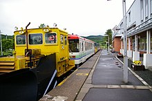
CR70 diesel multiple unit at Nishitomi
| |||||||||||||||||||||||||||||||||||||||||||||||||||||||||||||||||||||||||||||||||||||||||||||||||||||||||||||||||||||||||||||||||||||||||||||||||||||||||||||||||||||||||||||||||||||||||||||||||||||||||||||||||||||||||||||||||||||||||||||
| Route length: | 140.0 km | ||||||||||||||||||||||||||||||||||||||||||||||||||||||||||||||||||||||||||||||||||||||||||||||||||||||||||||||||||||||||||||||||||||||||||||||||||||||||||||||||||||||||||||||||||||||||||||||||||||||||||||||||||||||||||||||||||||||||||||
| Gauge : | 1067 mm ( cape track ) | ||||||||||||||||||||||||||||||||||||||||||||||||||||||||||||||||||||||||||||||||||||||||||||||||||||||||||||||||||||||||||||||||||||||||||||||||||||||||||||||||||||||||||||||||||||||||||||||||||||||||||||||||||||||||||||||||||||||||||||
| Top speed: | 85 km / h | ||||||||||||||||||||||||||||||||||||||||||||||||||||||||||||||||||||||||||||||||||||||||||||||||||||||||||||||||||||||||||||||||||||||||||||||||||||||||||||||||||||||||||||||||||||||||||||||||||||||||||||||||||||||||||||||||||||||||||||
| Dual track : | No | ||||||||||||||||||||||||||||||||||||||||||||||||||||||||||||||||||||||||||||||||||||||||||||||||||||||||||||||||||||||||||||||||||||||||||||||||||||||||||||||||||||||||||||||||||||||||||||||||||||||||||||||||||||||||||||||||||||||||||||
|
|||||||||||||||||||||||||||||||||||||||||||||||||||||||||||||||||||||||||||||||||||||||||||||||||||||||||||||||||||||||||||||||||||||||||||||||||||||||||||||||||||||||||||||||||||||||||||||||||||||||||||||||||||||||||||||||||||||||||||||
The Furusato Ginga Line ( Japanese ふ る さ と 銀河 線 , Furusato-Ginga-sen ) was a railway line in the east of the Japanese island of Hokkaidō . It connected Ikeda with Kitami and was opened in 1910/11. After over seven decades of operation by the state railway, the line became the property of JR Hokkaido in 1987 . It was about to be closed, but was transferred to the local private railway company Hokkaidō Chihoku Kōgen Tetsudō in 1989 . The new company did not succeed in operating the route profitably, which is why it had to be closed for good in 2006.
description
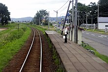
The Furusato Ginga line was Cape -lane, single-track and not electrified. A total of 33 train stations and demand stops were developed . Apart from the terminal stations, the trains could at eight Dodge cross. The maximum permissible speed between Oketo and Kitami was 85 km / h, otherwise 80 km / h. An automatic section block was used for train protection . The greatest distance between two stops was 15.9 km.
At Ikeda station, the Furusato-Ginga line branched off from the Nemuro main line . From there it followed the Toshibetsu-gawa River north. Until shortly before Ashoro it ran exclusively on the right (eastern) side of the valley. Via Rikubetsu she reached the Tokoro-gawa valley at Oketo. She followed this river in an easterly and northeastern direction to the center of Kitami, where she met the main Sekihoku line.
The Rikubetsu station is the location of the Furusato-Ginga-sen Rikubetsu Tetsudō ( ふ る さ と 銀河 線 り く べ つ 鉄 道 ) Railway Museum, which opened in 2008 and where a short section of the route has been preserved. In addition, the station buildings of Ashoro, Honbetsu and Rikubetsu are used as rest stops ( Michi no eki ).
history
The Railway Authority (later the Ministry of Railways ) opened the first section of the route known as the Abashiri Line ( 網 走 線 , Abashiri-sen ) on September 22, 1910 . It was 77.4 km long and led from Ikeda via Ashoro to Rikubetsu . A little over a year later, on September 25, 1911, the 62.6 km long section between Rikubetsu and Nokkeushi ( called Kitami from 1942 ) was opened. In 1912 the line was extended beyond Nokkeushi to Abashiri and renamed the Abashiri Main Line ( 網 走 本 線 , Abashiri-honsen ).
As the only route to the northeast of Hokkaidō at the time, the Abashiri main line was particularly important for forestry , as it enabled extensive forests and their resources to be developed. In addition, it was the only reliable access to this scarcely populated region in winter, because drift ice made shipping on the Sea of Okhotsk impossible. After the completion of the more direct Sekihoku Main Line in 1932, traffic on the Abashiri Main Line decreased significantly.
The Japanese State Railways (JNR), which was responsible from 1949, began using diesel-powered rail buses for passenger transport on August 22, 1955 . On April 1, 1961, it divided the Abashiri main line: While the Kitami – Abashiri section became part of the Sekihoku main line, the Ikeda – Kitami section was given the new name Chihoku Line ( 池 北 線 , Chihoku-sen ). This was made up of the first Kanji characters from Ikeda ( 池田 ) and Kitami ( 北 見 ) in the On reading . On April 25, 1975, the last freight trains pulled by steam locomotives ran.
Based on the law for the restructuring of the state railway finances passed in 1980, the JNR classified the Chihoku line as one of those routes that should be shut down and switched to bus operation due to the particularly low cost recovery rate . Since trouble-free bus operation could not be guaranteed in winter, this measure was initially not implemented after a second assessment in 1984. As part of the privatization of the state railway, the line passed into the possession of JR Hokkaido on April 1, 1987 ; on the same day all freight traffic was stopped.
In order to maintain rail operations on a permanent basis, the affected cities and municipalities decided on November 14, 1988 to found a rail company with local sponsorship. Two months later, the Hokkaidō Prefecture assured its financial participation and on March 9, 1989, the Hokkaidō Chihoku Kōgen Tetsudō was formally founded . This took over the route on June 4, 1989 and renamed it with the timetable change on August 6, 1989 in Furusato-Ginga-Linie . The new name, which can be translated as “hometown galaxy line”, had been chosen in a public competition and was reminiscent of the 1927 novel Ginga Tetsudō no Yoru (“Night on the Galactic Railway”) by Miyazawa Kenji or on the derived anime film Ginga Tetsudō 999 by Gisaburō Sugii from 1985.
The bursting of the bubble economy in 1990 led to a severe crisis in the regional economy in the subsequent “ lost decade ”, which in turn resulted in increased rural exodus . Falling passenger numbers had a detrimental effect on the finances of the new railway company and the Hokkaidō Prefecture, as the main shareholder, was not willing to bear a higher share of the deficit. For these reasons, the company decided to dissolve itself. The Furusato Ginga line was closed on April 21, 2006 and replaced by a bus line from the company Hokkaidō Kitami Bus .
List of train stations
| Surname | km | Connecting lines | location | place |
|---|---|---|---|---|
| Ikeda ( 池田 ) | 0.0 | Nemuro main line | Coord. | Ikeda |
| Samamai ( 様 舞 ) | 5.7 | Coord. | ||
| Takashima ( 高 島 ) | 11.5 | Coord. | ||
| Ōmori ( 大 森 ) | 16.5 | Coord. | ||
| Yūtari ( 勇 足 ) | 20.8 | Coord. | Honbetsu | |
| Minami Honbetsu ( 南 本 別 ) | 23.5 | Coord. | ||
| Okamedō ( 岡 女 堂 ) | 27.3 | Coord. | ||
| Honbetsu ( 本 別 ) | 29.8 | Coord. | ||
| Senbiri ( 仙 美 里 ) | 36.2 | Coord. | ||
| Ashoro ( 足 寄 ) | 44.6 | Coord. | Ashoro | |
| Aikappu ( 愛 冠 ) | 50.7 | Coord. | ||
| Nishi-Issen ( 西 一線 ) | 54.0 | Coord. | ||
| Shiohoro ( 塩 幌 ) | 55.9 | Coord. | ||
| Kamitoshibetsu ( 上 利 別 ) | 58.4 | Coord. | ||
| Sasamori ( 笹 森 ) | 62.2 | Coord. | ||
| Oyochi ( 大 誉 地 ) | 66.5 | Coord. | ||
| Kunbetsu ( 薫 別 ) | 70.7 | Coord. | Rikubetsu | |
| Rikubetsu ( 陸 別 ) | 77.4 | Coord. | ||
| Bunsen ( 分 線 ) | 83.1 | Coord. | ||
| Kawakami ( 川 上 ) | 87.2 | Coord. | ||
| Shōtoshibetsu ( 小 利 別 ) | 93.5 | Coord. | ||
| Oketo ( 置 戸 ) | 109.4 | Coord. | Oketo | |
| Toyozumi ( 豊 住 ) | 113.8 | Coord. | ||
| Sakaino ( 境 野 ) | 116.6 | Coord. | ||
| Nishi-Kunneppu ( 西 訓 子 府 ) | 118.4 | Coord. | Kunneppu | |
| Nishitomi ( 西 富 ) | 121.4 | Coord. | ||
| Kunneppu ( 訓 子 府 ) | 123.5 | Coord. | ||
| Honami ( 穂 波 ) | 125.3 | Coord. | ||
| Hinode ( 日 ノ 出 ) | 127.4 | Coord. | ||
| Hirosato ( 広 郷 ) | 129.4 | Coord. | Kitami | |
| Kami-Tokoro ( 上 常 呂 ) | 132.2 | Coord. | ||
| Hokkōsha ( 北 光 社 ) | 135.5 | Coord. | ||
| Kitami ( 北 見 ) | 140.0 | Sekihoku main line | Coord. |
Web links
- Various articles on the Furusato Ginga line (Japanese)
Individual evidence
- ↑ a b Kazuo Tanaka: 写真 で 見 る 北海道 の 鉄 道 (Hokkaidō's railroad in photos) . tape 1 . Hokkaidō Shinbunsha, Sapporo 2002, ISBN 978-4-89453-220-5 , pp. 236-237 .
- ↑ 消 え た 鉄 路 、 進 む 過 疎 北海道 ・ ふ る さ と 銀河 線 廃 止 か ら 10 年. Yahoo Japan April 21, 2016; archived from the original on April 19, 2016 ; Retrieved July 23, 2017 (Japanese).
- ↑ a b Committee for Contemporary History Kitami (ed.): 北 見 現代史 (Modern History of Kitami) . Kitami 2007, p. 950-954 .
- ↑ Tanaka: 写真 で 見 る 北海道 の 鉄 道. Pp. 314-315.
- ↑ 北 見 現代史. P. 978.
- ↑ 北 見 現代史. P. 981.


