Nyssa Bridge
Coordinates: 43 ° 52 ′ 37 ″ N , 116 ° 59 ′ 2 ″ W.
| Nyssa Bridge | ||
|---|---|---|
| use |
US Highway |
|
| Crossing of | Snake River | |
| place | Nyssa in Oregon | |
| overall length | 200 m | |
| opening | around 1900 | |
| location | ||
|
|
||
Nyssa Bridge is a road bridge over the Snake River .
location
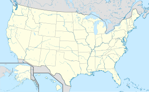
The bridge is located east of the city of Nyssa in Oregon and connects the two US states of Oregon and Idaho , whose border in this section runs through the Snake River. US Highway 26 runs over the bridge .
The closest major road bridges over the Snake River are the Interstate 84 and US Highway 30 bridges about 15 km downstream near Ontario and the state Highway OR 452 bridge about 20 km upstream .
history
A few kilometers south of the current bridge there was initially a ford at the old Fort Boise in the 19th century , and later a ferry connection , with the help of which the settlers who moved west along the Oregon Trail could cross the Snake River. Around 1900 the first bridge as a truss bridge was built on the site of today's bridge . In 1957 it was demolished and replaced by a girder bridge.
In March 2003 the bridge was closed for restoration work for a week. It was then reopened with speed and weight restrictions, and further restoration work followed while traffic was still running.
Web links
- Nyssa Bridge on Bridgehunter.com (with photo of the old bridge)
Individual evidence
- ^ Larry Meyer: Nyssa bridge reopens . In: The Argus Observer . March 20, 2003 ( argusobserver.com [accessed January 4, 2018]).
