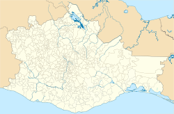
Oaxaca earthquake 2018
| Oaxaca earthquake 2018 | ||
|---|---|---|
|
|
||
| Coordinates | 16 ° 23 '10 " N , 97 ° 58' 44" W | |
| date | February 16, 2018 | |
| Time | 23:39:39 UTC (17:39:39 local time) | |
| intensity | VII on the MM scale | |
| Magnitude | 7.2 M W | |
| depth | 22 km | |
| epicenter | Pinotepa de Don Luis
(4 km S)
|
|
| country | Mexico | |
The 2018 Oaxaca earthquake was a strong earthquake on February 16, 2018 at 5:39 p.m. local time (11:39 p.m. UTC ) in the Sierra Madre del Sur in the state of Oaxaca in southern Mexico . The hypocenter at a depth of 22 km was around 4 km south of Pinotepa de Don Luis .
The quake itself did not claim any fatalities. A helicopter that flew Mexico's Interior Minister Alfonso Navarrete Prida and the state governor to inspect the damage in the region crashed while attempting to land, killing 14 people on the ground. The occupants of the helicopter survive.
Tectonic overview
The earthquake of February 16, 2018 with a magnitude 7.2 occurred as a result of a shallow thrust near the plate boundary between the Coconut Plate and the North American Plate . The event's depth and focal plane resolution are consistent with its occurrence in the subduction zone between these two plates, approximately 90 km northeast of the Central America Trench , where the coconut plate begins its descent into the mantle below Mexico. In the region of this earthquake, the coconut plate moves northeastwards under the North American plate at a speed of about 60 mm per year.
Historically, several significant earthquakes have occurred along Mexico's southern coast. In 1932, an 8.4 magnitude thrust earthquake struck the Jalisco region , a few hundred kilometers northwest of the February 16, 2018 event, and on October 9, 1995, an 8.0 magnitude earthquake struck the Jalisco region , killing 49 people made around 1000 homeless, the region on the border between Colima and Jalisco. The most momentous earthquake in this area occurred on September 19, 1985 in the Michoacán region , about 500 km northwest of the earthquake of February 16, 2018. The effects of that earthquake with a magnitude of 8.0 killed at least 9,500 people and injured 30,000 others as well as 100,000 homeless. In 2003, an earthquake with a magnitude of 7.6 struck Colima; 29 people died, more than 2,000 houses were destroyed and over 10,000 residents were left homeless. In March 2012, the effects of an earthquake in Oaxaca with a magnitude of 7.4 about 60 km northwest of the earthquake on February 16, 2018 killed two people and injured eleven others. The hypocenter of the Chiapas earthquake on September 8, 2017 with a magnitude of 8.2 was 440 km southwest of the coast. The earthquake killed at least 78 people and injured 250 others in Oaxaca, and at least 16 people were killed in Chiapas state. Eleven days later, an earthquake with a magnitude of 7.1 struck the area near Mexico City, about 230 km northeast of the February 16 quake. As a result, over 300 people were killed in and around the capital of Mexico and there was serious property damage.
See also
supporting documents
- ↑ a b c M 7.2 - 3km S of San Pedro Jicayan, Mexico ( English ) In: Earthquake Hazards Program . United States Geological Survey. February 16, 2018. Retrieved February 17, 2020.
- ^ Mexico earthquake: Helicopter crashes in emergency killing 14. In: BBC News . February 17, 2018, accessed August 7, 2018 .
