Oliphant Islands
| Oliphant Islands | ||
|---|---|---|
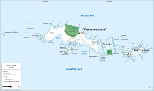
| Map of the South Orkney Islands with the Oliphant Islands off the south coast of Signy Island | ||
| Waters | Weddell Sea | |
| archipelago | South Orkney Islands | |
| Geographical location | 60 ° 44 ′ S , 45 ° 36 ′ W | |
|
|
||
| Residents | uninhabited | |
The Oliphant Islands are a group of small and ice-free islands and cliff rocks in the archipelago of the South Orkney Islands . They lie in front of the Gourlay Peninsula , the southeastern extension of Signy Island , from which they are separated by the Swetlana Passage .
The Norwegian whaling captain Petter Sørlle roughly mapped them during his visit to the South Orkney Islands from 1912 to 1913. Scientists from the British Discovery Investigations re- mapped them in 1933. The Falkland Islands Dependencies Survey (FIDS) carried out surveys in 1947 and named the archipelago. It is named after the Australian physicist and politician Mark Oliphant (1901-2000), who helped the FIDS with the procurement of equipment.
Web links
- Oliphant Islands in the Geographic Names Information System of the United States Geological Survey (English)
- Oliphant Islands on geographic.org (English)

