Ovalau (Fiji)
| Ovalau | ||
|---|---|---|
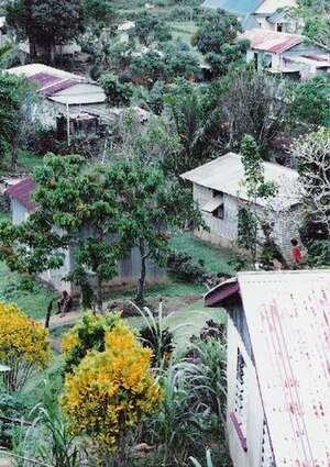
| Village on Ovalau | ||
| Waters | Pacific Ocean | |
| Archipelago | Lomaiviti Islands ( Fiji Islands ) | |
| Geographical location | 17 ° 41 ′ S , 178 ° 47 ′ E | |
|
|
||
| length | 14.9 km | |
| width | 10 km | |
| surface | 102.3 km² | |
| Highest elevation |
Nadelaiovalau 625 m |
|
| Residents | 9000 88 inhabitants / km² |
|
| main place | Levuka | |
| St. John Church, Ovalau | ||
Ovalau (pronounced: oβaˈlau ) is the sixth largest island in Fiji and the administrative seat of the Lomaiviti group of islands.
Until 1882 the city of Levuka was the capital of the British Crown Colony of Fiji (English: Fiji). It is visited by cruise ships from time to time because of its architectural examples.
geography
The land area is 102.3 km², the island has a population of approx. 9000 people who live in 23 villages and the former capital Levuka . Ovalau is of volcanic origin and has a rugged, mountainous topography . In the center of the island, the Caldera , the village Lovoni , the highest peak is the Nadelaiovalau with 625 meters height .
Web links
Commons : Ovalau - collection of images, videos and audio files
Individual evidence
- ↑ UNEP Islands Directory (English)


