Pasul Island
| Pasul Island | ||
|---|---|---|
| Waters | Gambia (river) | |
| Geographical location | 13 ° 40 ′ N , 15 ° 9 ′ W | |
|
|
||
| length | 10.6 km | |
| width | 2.5 km | |
| main place | Kudang Tenda | |
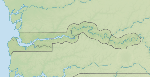
Pasul Island is an inland island in the Gambia River in the West African state of Gambia .
The island is located downstream from Pasari Island , in the south joins the island of Ba Faraba Island . Pasul Island is approximately 10.6 kilometers long and 2.5 kilometers wide. On the north side of the island, the Gambia is around 550 meters wide, on the south side the distance to the south bank is significantly smaller. At the end of the island, in the southwest, the distance widens to a maximum of 50 meters. At Kudang Tenda , in the northeast of the island, the channel is narrowed to around 10 meters. The island is therefore not recognizable as an island on many maps.
Kudang Tenda, is the only populated place on the island. In the south there are extensive mangrove forests, in the north the island is partly used for agriculture, with rice cultivation.
Individual evidence
- ↑ Stephen C. Stringall, Dody Broyles: Gambia. International Travel Maps, Vancouver 2003, ISBN 1-55341-217-6 (map, 96 × 61 cm, 1: 350,000)
- ↑ The North Bank of The Gambia: Places, People and Population ( Memento of the original from January 12, 2011 in the Internet Archive ) Info: The archive link was inserted automatically and has not yet been checked. Please check the original and archive link according to the instructions and then remove this notice. (PDF; 4.8 MB), page 5
