Pendé (river)
|
Pendé Logone Oriental, Logone Ost |
||
|
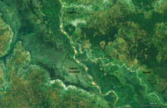
Course of the Pendé in the catchment area of the Schari (center left) |
||
| Data | ||
| location |
|
|
| River system | Shari | |
| Drain over | Logone → Shari → Lake Chad | |
| source | in the Central African Republic | |
| muzzle | Confluence with the Logone Occidental ( Mbéré ) and formation of the Logone Coordinates: 9 ° 5 ′ 20 ″ N , 16 ° 27 ′ 55 ″ E 9 ° 5 ′ 20 ″ N , 16 ° 27 ′ 55 ″ E |
|
| Mouth height |
375 m
|
|
| Catchment area | 15,325 km² | |
| Outflow at the Doba gauge (1537250) A Eo : 14,300 km² Location: 70 km above the mouth |
NNQ (min. Month Ø) MNQ 1947–1975 MQ 1947–1975 Mq 1947–1975 MHQ 1947–1975 HHQ (max. Month Ø) |
0 l / s 4.9 m³ / s 128 m³ / s 9 l / (s km²) 555 m³ / s 928 m³ / s |
|
The confluence of the Pendé (right) and the Logone Occidental (left). |
||
The Pendé (also Logone Oriental or Logone Ost) is a river in Central Africa .
course
It is the right source river of the Logone . The river has its source in the prefecture of Ouham-Pendé in the Central African Republic . The Pendé forms the border between the two states over a length of about 40 km. It joins about 70 km south of Laï with the Logone Occidental ( Mbéré ) to the Logone.
Hydrometry
The flow rate of the river was measured for 28 years (1947-1975) in Doba , about 70 km above the mouth in the Logone.
The mean annual flow rate observed in Doba during this period was 128 m³ / s fed by an area of approximately 14,300 km², a large part of the river's catchment area.


