Pendulum Cove
| Pendulum Cove | ||
|---|---|---|
|
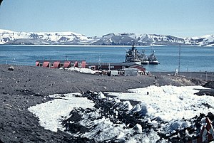
The Argentine station Pedro Aguirre Cerda in Pendulum Cove (1958) |
||
| Waters | Port Foster | |
| Land mass | Deception Island , South Shetland Islands | |
| Geographical location | 62 ° 56 ′ 7 ″ S , 60 ° 35 ′ 59 ″ W | |
|
|
||
|
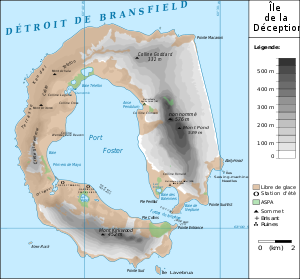
Map of Deception Island with Pendulum Cove (here: Anse Pendulum ) |
||
The Pendulum Cove (English for pendulum Bay ) is a bay of Deception Iceland in the archipelago of the South Shetland Islands . It is located on the northeast side of Port Foster .
Its name is derived from the pendulum measurements that the British navigator Henry Foster had made here as part of the research trip with the HMS Chanticleer (1827–1831).
Web links
- Pendulum Cove in the Geographic Names Information System of the United States Geological Survey (English)
- Pendulum Cove on geographic.org (English)


