Pha Bong
|
ตำบล ผา บ่อง Pha Bong |
||
|---|---|---|
|
|
||
| Coordinates | 19 ° 11 ′ N , 97 ° 59 ′ E | |
| Basic data | ||
| Country | Thailand | |
| Mae Hong Son | ||
| ISO 3166-2 | TH-58 | |
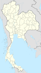
Pha Bong ( Thai : ผา บ่อง ) is the name of a Muban (village - บ้าน ผา บ่อง ) and a tambon (municipality - ตำบล ผา บ่อง ) in the district of Mueang Mae Hong Son in the northern region of Thailand .
The Tambon Pha Bong consists of 4,061 house communities with 9,481 inhabitants (as of 2012).
To the One-Tambon-One-Product-products include hand-woven among others and colored with natural dyes fabrics.
In the community there is the Pha-Bong dam , which dams the Maenam Ramat . About 10 kilometers from the provincial capital Mae Hong Son in the northern part of the municipality there is also a hot spring with a small park and a waterfall of the Huai Mae Samat, a tributary of the Ramat.
Individual evidence
- ↑ Thaitambon.com (in Thai)
- ↑ Department of Provincial Administration : As of 2012 (in Thai)
- ↑ http://www.thaitambon.com/ProvincialStarOTOP/PSO-LP10/MaeHongSongPSO5L.htm (in Thai)
- ↑ http://www.tourdoi.com/north/meahongson/sub1/content_11/index.htm (in Thai)
