Pic N'Ga
| Pic N'Ga | ||
|---|---|---|
|
The Baie de Kuto with the Pic N'Ga in the background on the right |
||
| height | 262 m | |
| location | Kuto , New Caledonia | |
| Coordinates | 22 ° 39 '12 " S , 167 ° 27' 47" E | |
|
|
||
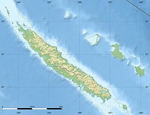
The Pic N'Ga is with a height of 262 m the highest point on the island Île des Pins in the southern province of the New Caledonia archipelago . It is located in the municipality of L'Île-des-Pins near the town of Kuto . It consists of ultramafic rock .
There are conifer populations on the mountain , including the species Podocarpus longifoliolatus , Podocarpus sylvestris and Podocarpus novae-caledoniae .
Web links
- Pic N'Ga - Ile des Pins. In: le guide de Nouvelle-Calédonie. Retrieved May 16, 2017 (French).
Individual evidence
- ^ A b Aljos Farjon, Denis Filer: An Atlas of the World's Conifers. An Analysis of their Distribution, Biogeography, Diversity and Conservation Status . Brill, 2013, ISBN 978-90-04-21181-0 , pp. 414 ( limited preview in Google Book Search [accessed May 16, 2017]).

