Pico Ruivo do Paul
| Pico Ruivo do Paul | ||
|---|---|---|
|
The Pico Ruivo do Paul |
||
| height | 1639 m | |
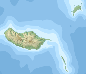
| location | Madeira , Portugal | |
| Coordinates | 32 ° 46 '40 " N , 17 ° 4' 45" W | |
|
|
||
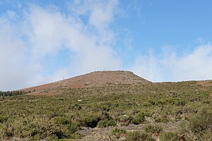
The Pico Ruivo do Paul (Portuguese for Red Moorspitze ) is 1,639 m (1640 m according to other data) the highest point in the Paul da Serra plateau on the Portuguese island of Madeira in the Atlantic Ocean . The mountain, which is not very pronounced in relation to the high plateau, drops away from it with slopes overgrown with bracken and gorse , to the north, however, with a steep edge. From the easily accessible summit, which has a surveying point, there is a rewarding view of the Serra, the Madeiran massif central and the São Vicente valley .
literature
- Rolf Goetz: Madeira: The most beautiful levada and mountain hikes. 60 tours. With GPS tracks . 9th edition, Bergverlag Rother, Munich 2014, pp. 166–167, ISBN 978-3-7633-4274-7 .
Web links
Commons : Pico Ruivo do Paul da Serra - Collection of images, videos and audio files

