Pico do Principe
| Pico do Principe | ||
|---|---|---|
|
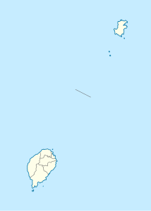
Map of the Gulf of Guinea with Princípe in the chain of islands of the Cameroon Line |
||
| height | 947 m | |
| location | Sao Tome and Principe , Africa | |
| Coordinates | 1 ° 34 '47 " N , 7 ° 22' 56" E | |
|
|
||
| Type | Shield volcano | |
Pico do Príncipe is the highest mountain on Príncipe Island , the smaller of the two inhabited islands of São Tomé and Príncipe .
geography
The Pico do Principe rises to 947 m . Numerous lava flows shape its landscape. They start in a star shape from the region in which the summit is located today, and there are further secondary peaks in the vicinity: Carriote (Pico Carriota, 377 m), Picos de Mencorne (524 m), Morro de Este (562 m), Pico João Dias Pai (436 m). The mountain was created by rising magma, which gave rise to numerous volcanoes along the Cameroon line .
The volcano was active until 15.7 million years ago. Most of the rock is basalt , but later magma flowed in the volcanic vent, which solidified into phonolite . Parts of the rock units have been severely eroded, leaving behind spectacular towers made of durable phonolite that rise almost vertically from the rainforest.
The summit has rarely been climbed. The first expedition took place in 1929. The team set up a base at the summit. In 1956 a second expedition followed, which was supposed to make a botanical inventory. However, it failed due to the weather conditions.
In 1999 a new expedition was started that was able to classify zones: the peaks rise from a plateau to a height of 600 to 700 m and numerous lava flows lead to the summit as mountain ridges. The higher, the more open the canopy becomes in the dense rainforest and the trees have more epiphytes . The summit itself is only a small knoll that drops steeply on three sides.
ecology
The 1999 expedition was carried out by members of the nature conservation organization Ecofac, which has set itself the goal of supporting nature conservation through ecotourism. Little research has been done on the ecology of the area, but some endemic bird and orchid species have been discovered and many more are expected to be undiscovered. The Zona Ecologica (Principe) protection zone has now been established. The mountains Mesa (537 m), Pico Papagaio (680 m) and Pico Mencorne (921 m) are also in the protection zone . 28 bird species have been identified, several of which are endemic and four of which are rare worldwide. In addition, the skink Feylinia polylepis , the blind snake Typhlops elegans and the frog Leptopelis palmatus have been described. A subspecies of the shrew Crocidura poensis is also endemic .
Individual evidence
- ↑ Kevin Burke: Origin of the Cameroon Line of Volcano-Capped Swells. In: The Journal of Geology. 2001, vol. 109: 349-362 (doi = 10.1086 / 319977).
- ^ Kathleen Becker: São Tomé and Príncipe. Bradt Travel Guides 2008: 3rd ISBN 1-84162-216-8
- ^ A b Jonathan Baillie, Gilles Joffroy, Tariq Stevart: Exploration du Pico de Príncipe. ( Memento of the original from September 29, 2011 in the Internet Archive ) Info: The archive link was inserted automatically and has not yet been checked. Please check the original and archive link according to the instructions and then remove this notice. In: Canopée , vol. February 16, 2000 Ecofac.
- ^ Sophie Warne: Gabon, São Tomé and Príncipe. Bradt Travel Guides 2003: 229. ISBN 1-84162-073-4
- ^ Data from BirdLife International: Príncipe forests.

