
Plac Wolności (Opole)

The Plac Wolności (dt. Freedom Square) is a square in the city of Opole in Poland and is located south of Opole Old Town.
location
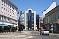
Plac Wolności is the end of several streets. This includes Krakauer Straße (ul. Krakowska) in the south, Wolfgang-Amadeus-Mozart-Straße (ul. Wolfganga Amadeusza Mozarta) in the west and Malapaner Straße (ul. Ozimska) in the east. At the end of Mozartstrasse, which was called Promenadenstrasse until 1945, is the Pfennig Bridge . The square also includes the adjacent park in its name, which extends to the Mühlgraben .
history


In the Middle Ages, the square was outside the city wall. Therefore, the city's protective moat ran in this area. The Opole Duke Nicholas I and his wife had a monastery built for St. Bernard Minorites in 1473 with papal approval on a plot of land at today's location. A church was built in the same year and consecrated to Saint Barbara , the Schrotholzkirche St. Barbara . This was dismantled after the secularization in 1811 and sold to the village community in Kollanowitz , where it still stands today.
After the walls were pulled down and the population of the city increased, today's square was created. One of the first buildings was the old government building , which was built between 1830 and 1833. Hence the first name of the square, the government square. The Upper Silesian government met here until the 1930s, until they moved into the new government building on Pascheke Island in the early 1930s . Then the place was named Annabergplatz . In 1891 a statue of Kaiser Wilhelm I was placed on the square .
During the Second World War , the buildings around the square were almost completely destroyed. The old government building was destroyed to the ground. The Kaiser Wilhelm monument and the “Europa” house on the corner of Malapaner Strasse were also destroyed. In contrast to the old government building, the "Europe" house was rebuilt. The very popular “Europa” restaurant was located here. A park was created on the former site of the government building.
In 1970 the monument to the fighters for Polishism in Opole Silesia was unveiled . It is also known under the name “Opole Nike”. 30 years later, in 2000, the Monument to the Defense of the Opole Voivodeship was erected. The monument consists of a cannon in the shape of the Piast Tower and a base in the shape of the Opole Voivodeship.
In the past few years, Plac Wolności has been completely renovated and rebuilt. Since Krakauer Strasse was converted into a pedestrian zone, there has been a roundabout on it . In the adjacent park there is a fountain designed by Florian Jesionowski , the shape of which is based on the colorful wings of dancing butterflies.
Promenade concerts take place regularly in July and August on the square.
gallery

Monument to the Preservation of the Opole Voivodeship

Opole Nike

House of Europe

Fountain in the park
Building of the PZU

Plane trees on Wolności Square


Web links
literature
- Ryszard Emmerling, Urszula Zajączkowska: Opole travel guide. Schlesischer Verlag ADAN, ISBN 83-915371-6-1 .
Individual evidence
- ↑ Spisla, O. (no year): Opole in the storms of time - Opole w zawierusze czasu. Haus Oberschlesien Foundation (Ratingen-Hösel). ISBN 83-904897-0-8 , pp. 62-63
- ^ Andrzej Hamada: Architecture of Opole in the historical cityscape. Oficyna Piastowska, Opole 2008, ISBN 978-83-89357-45-8 .
- ↑ Anna Będkowska-Karmelita: guide to the Opole region. Alkazar, Opole 2009, ISBN 978-83-925591-3-9 , p. 30.
Coordinates: 50 ° 40 ′ 0.2 ″ N , 17 ° 55 ′ 27.7 ″ E