Pascheke
| Pascheke | ||
|---|---|---|
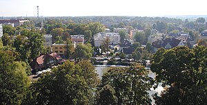
| View from the Piast Tower in south direction over the ice house and the castle pond | ||
| Waters | Or | |
| Geographical location | 50 ° 40 ′ N , 17 ° 55 ′ E | |
|
|
||
The Pascheke ( Polish Wyspa Pasieka , also Insel Wilhelmstal or Schloss-Pascheke ) is an island in the Oder in Opole, Upper Silesia .
Geographical location
The Pascheke is located in downtown Opole. The island is surrounded in the west by the Oder and in the east by its tributary, the Mühlgraben .
In the north the bridges Most Piastowski (German: Piast Bridge ) and the Most Katedralny (German: Cathedral Bridge ) connect the island with the old town of Opole and with the Odervorstadt (Polish: Zaodrze). Further south, the Most Zamkowa (German Castle Bridge) and the Most Groszowy (German Pfennig Bridge) pedestrian bridge connect the island in the east with the old town. The island is also crossed by the railway line of the former Upper Silesian Railway . In the south, the Most na wyspę Bolko , built in 1928, connects the Pascheke Island with the Bolko Island .
history
The island of Pascheke was created in 1600 when the Oder changed its course to the west after a flood and thus separated the Pascheke from the rest of the land mass. Before that, the main river Oder ran east of the island, directly along the old town of Opole.
The name Pascheke comes from the Polish word pasieka (German bee garden). In the past, the island was also called Schloss-Pascheke to distinguish it from the Sczepanowitzer Pascheke corridor to the west .
In 1824 the Wilhelmstal colony and the later Wilhelmsthal district of Opole came into being on the Pascheke . Wilhelmsthal was named after the government building officer Wilhelm Krause. The previously existing community Ostrowek with the Piastenschloss in the north of the island and the Wilhelmstal colony merged in 1829 to form the Wilhelmstal community. This and thus also the island developed into a residential area by the beginning of the 20th century. Since the Piast Castle on Ostrowek was already used as the seat of government, Wilhelmstal was incorporated into Opole in 1891.
In 1928 a pedestrian bridge was built from the Pascheke to the neighboring Bolko Island . In the same year the demolition of the Piast Castle on Ostrowek began, which lasted until 1931. The government building used today by the Opole Voivodeship was built in the same place until 1934 . The New Synagogue , built in 1897, was destroyed in the pogrom night of 1938 .
In the 1960s, the former palace park at the Piast Palace was built on by the amphitheater. The National Festival of Polish Song as well as other concerts and events take place here every year. In July 1997 the island was completely flooded during the flood of the Oder . The water was several meters high in the streets. Today (2015) there are many important administrative and cultural institutions on the island such as the German Consulate, the Government of the Opole Voivodeship , the Radio Opole broadcasting hall , the headquarters of the regional daily newspaper Nowa Trybuna Opolska , the Silesian Institute or the Museum of Polish Song.
Ostrowek
As Ostrowek (Pol. Ostrówek ) refers to the northern tip of the island. The Piast Castle dominated here until it was demolished in the 1920s, the keep of which the Piast Tower has still been preserved. Ships moored here on the Oder until well into the 20th century.
At the northern tip runs ul. Piastowska (until 1945 Hafenstrasse ), which connects the old town of Opole with the Pascheke and the Odervorstadt (Polish: Zaodrze ). The bridge spanning the Mühlgraben is now known as Most Katedralny (German cathedral bridge, Mühlgrabenbrücke until 1945 ). There is a pedestrian bridge next to it. The or spanning bridge on the west side of the island is the Most Piastowski (German Piast Bridge , until 1945 Century Bridge (Polish Most stulecia )). The current shape of the bridge dates from 1959–1963. The old bridge was destroyed in World War II.
Attractions
The island is home to the Piast Tower , the government building of the Opole Voivodeship and the amphitheater, where the National Festival of Polish Song takes place every year. The Pfennig Bridge and the ice house built in 1909 with the castle pond are also worth seeing . This site was completely renovated and modernized in 2012.
The Piast Castle , which was demolished at the end of the 1920s , used to be on the site of the government building . Until 1938, the Opole Synagogue was located in the immediate vicinity of the Eishau .
Web links
Individual evidence
- ^ Paul Steinert: Opole - Upper Silesian government capital . IN: Max Friederichsen (Ed.): Contributions to Silesian regional studies. XXI German Geographers Day 1925. p. 39
- ↑ Bolko Bridge
- ^ Chronicle of the city of Opole
- ^ Paul Steinert: Opole - Upper Silesian government capital . IN: Max Friederichsen (Ed.): Contributions to Silesian regional studies. XXI German Geographers Day 1925. P. 47
- ^ The Opole amphitheater - Fotopolska.eu
- ↑ German Consulate Opole ( Memento of the original from January 11, 2016 in the Internet Archive ) Info: The archive link was inserted automatically and has not yet been checked. Please check the original and archive link according to the instructions and then remove this notice.
- ^ Radio Opole
- ↑ Silesian Institute
- ^ Most Piastowski


