Port San Carlos
| Port San Carlos | ||
|---|---|---|
|
|
||
| Coordinates | 51 ° 30 ′ S , 58 ° 59 ′ W | |
| Basic data | ||
| Country | Falkland Islands | |
| ISO 3166-2 | FK | |
| Residents | 25th | |
|
Port San Carlos
|
||
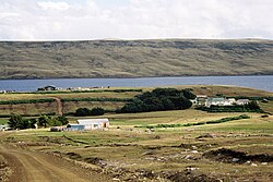
Port San Carlos is located north of San Carlos in the Bay of San Carlos Water in East Falkland .
Code-named Green Beach, the site was part of Operation Sutton during the Falklands War . Port San Carlos is also called "KC" after the previous owner, Keith Cameron.
proof
- ↑ United Kingdom Hydrographic Office (2009). Plans in Falkland Sound [map], 1: 25,000, Admiralty Chart. 2582.
- ^ Falkland Islands Acronyms . Archived from the original on June 19, 2006. Info: The archive link was inserted automatically and has not yet been checked. Please check the original and archive link according to the instructions and then remove this notice. Retrieved August 20, 2010.

