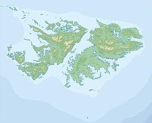
San Carlos Water
| San Carlos Bay | ||
|---|---|---|
|
South end of San Carlos Bay |
||
| Waters | Atlantic | |
| Land mass | Falkland Islands | |
| Geographical location | 51 ° 30 ′ S , 59 ° 5 ′ W | |
|
|
||
| width | 2.5 km | |
| length | 15 km | |
| Tributaries | San Carlos River | |
|
San Carlos |
||
San Carlos Water is a bay in East Falkland , on the Falklandsund . The bay is up to 15 km long and 2.5 km wide. The shore of the bay is on average 20 m above sea level and reaches a maximum height of 220 m. The tidal range here reaches a peak value of at most 1.6 m.
The bay got its name from the Spanish ship San Carlos , which stopped here in 1768. During the Falklands War, the first landing sites for British units were here. The settlements of Ajax Bay , San Carlos , Port San Carlos and Camp Verde were selected as landing sites as part of Operation Sutton . However, after the successful operation and the occupation of the landing points, the Royal Navy suffered heavy losses in the bay during the Battle of San Carlos .
HMS Antelope in the bay on May 23, 1982


