Falklandsund
| Falklandsund | ||
|---|---|---|
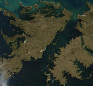
| Satellite image of the Falkland Sound | ||
| Connects waters | South Atlantic | |
| with water | ||
| Separates land mass | East Falkland | |
| of land mass | West Falkland | |
| Data | ||
| Geographical location | 51 ° 40 ′ S , 59 ° 20 ′ W | |
|
|
||
| length | 90 km | |
| Smallest width | 4 km | |
| Coastal towns | Port Howard , Port San Carlos , Fox Bay | |
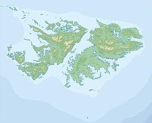
The Falklandsund ( Spanish Estrecho de San Carlos ) is a waterway in the South Atlantic Falkland Islands . It separates the two main islands of the Ostfalkland and Westfalkland archipelago and runs from north-east to south-west. It is approx. 90 km long and at the narrowest point less than 4 km wide. The strait was discovered by John Strong in 1690 . During the Falklands War of 1982, the Sound was a theater of war. On May 21, 1982, British warships, coming from the north, entered the sound and built a beachhead in San Carlos Bay. From this point, they recaptured the East Island from Argentina.
Settlements on Falklandsund are: Port San Carlos and San Carlos on East Falkland and Port Howard and Fox Bay on West Falkland.
Islands in Falklandsund:

