Puerto de A Coruña
| Puerto de A Coruña | |||
|---|---|---|---|
| Data | |||
| UN / LOCODE | ES LCG | ||
| operator | Autoridad Portuaria de A Coruña | ||
| opening | Antiquity | ||
| Port type | Passenger and freight port | ||
| Total area of the port | 1.15 km² | ||
| Passengers | 134407 (2011) | ||
| Goods handled | General cargo, bulk cargo, containers, edible fish | ||
| Throughput | 13 million t | ||
| website | www.puertocoruna.com (English) | ||
| Geographic information | |||
| place | A Coruña | ||
| province | A Coruña Province | ||
| Country | Spain | ||
| Control tower | |||
| Coordinates | 43 ° 21 '52 " N , 8 ° 23' 38" W | ||
|
|||
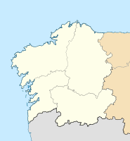
The Puerto de A Coruña is a seaport on the eastern outskirts of A Coruña , Spain. It is located on the Atlantic Ocean in north-western Galicia . The operator and administrator is the public company Autoridad Portuaria de A Coruña .
About two kilometers from the port is the Hercules Tower , a Roman lighthouse from the 2nd century. General and bulk goods as well as containers are handled in the port . It is also a fishing and cruise port. 1,222 ships used the port in 2011.
See also
Web links
Commons : Port of A Coruña - Collection of images, videos and audio files
- Website of the port (Engl.)
Individual evidence
- ↑ a b www.puertocoruna.com ( Memento of the original from March 2, 2014 in the Internet Archive ) Info: The archive link was automatically inserted and not yet checked. Please check the original and archive link according to the instructions and then remove this notice. Traffic> The Port in numbers. Accessed May 10, 2013.

