
Puigmal
| Puigmal | ||
|---|---|---|
 The Puigmal from Fontalba seen from |
||
| height | 2913 msnm | |
| location | Occitania ( France ) / Catalonia ( Spain ) border | |
| Mountains | Pyrenees | |
| Coordinates | 42 ° 23 '0 " N , 2 ° 7' 0" E | |
|
||

The Puigmal or Puigmal d'Er is a mountain in the Eastern Pyrenees , on the border between France and Spain . The Puigmal is not a conspicuous or particularly characteristic mountain and is therefore also contemptuously called coma de vaca ('cow hill'). Nevertheless, the most popular summit tour leads from the Vall de Núria to the Puigmal, the highest mountain there, which offers the hiker a wonderful view.
Routes
On the French and Spanish sides, medium-difficulty hiking and ski tours lead to the summit:
- Sanctuary in Vall de Núria (1,967 m) - Puigmal: 2.5 hours on foot
- Fontalba - Puigmal
- Les Planes - Puigmal
On the French side is the Cerdagne Puigmal 2900 ski area .
literature
- Roger Büdeler: Pyrenees 3 - Spanish Eastern Pyrenees: Val d'Aran to Núria . Bergverlag Rother, Munich 2004, ISBN 3-7633-4309-1 .
- F. Salvador, R. Ma. Asencio: Vall de Núria - Plànol d'excursions . Ferrocarrils de la Generalitat de Catalunya, Ripoll 1991 edition 2001.
- Puigmal, Vall de Núria, Ulldeter - Mapa i guia excursionista i turística; Editorial Alpina, SL: ISBN 84-8090-196-9 ; Societat Gestora d'Informació Territorial, GEOESTEL, SA: ISBN 84-9578-846-2 .
More pictures
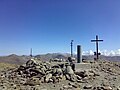
The Puigmal summit

The Puigmal seen from the east

The Puigmal seen from Guils de Cerdaña


Web links
Commons : Puigmal - collection of images, videos and audio files