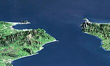
Punta de Tarifa
The Punta de Tarifa (Punta: headland ), also called Punta Marroquí , is considered the southernmost point of mainland Europe . It is located at the southern end of the city of Tarifa in the Andalusian province of Cádiz in southern Spain , in front of the Isla de Las Palomas , which is further south and is connected to the mainland by a dam .
The Punta de Tarifa is located north of the Strait of Gibraltar , about 15 km from Africa . To the west of it lies the Atlantic Ocean , to the east the Mediterranean Sea .
history
In 710 an Arab officer named Tarif ibn Malik - who gave the city of Tarifa its name - landed near Punta de Tarifa in 710 , coming from North Africa with a 500-strong expeditionary army. He then pushed briefly inland and then returned to Africa with rich booty. Encouraged by this success, Tāriq ibn Ziyād , a sub-commander of the caliph in Damascus , launched a campaign to Spain that marked the beginning of Arab rule on the Iberian Peninsula , which was not finally ended until 1492. Coordinates: 36 ° 0 ′ 24 ″ N , 5 ° 36 ′ 29 ″ W.

