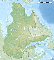
Réserve écologique de Ristigouche
|
Réserve écologique de Ristigouche
|
||
| location | Ristigouche-Partie-Sud-Est , Québec, Canada | |
| surface | 4.73 km² | |
| WDPA ID | 18156 | |
| Geographical location | 48 ° 2 ' N , 66 ° 53' W | |
|
|
||
| Setup date | 1983 | |
| administration | MDDEP | |
The Réserve écologique de Ristigouche is a 473.37 hectare protected area established in 1983 in the south of the Canadian province of Québec .
The area is 5 km southeast of Saint-André-de-Restigouche . The next town is Campbellton , which is already in the south bordering province of New Brunswick . The reserve is part of the Gaspésie – Îles-de-la-Madeleine administrative region on the Gaspésie peninsula .
It represents the typical plant habitats of the Chaleur Bay for the region . This includes above all the yellow birch .
The area is characterized by two plateaus intersected by two valleys. While the two plateaus are around 275 m above sea level, the river valleys of Ruisseau Fraser and Moffet are only around 125 and 80 m high, respectively. The rocky subsoil of the area, which belongs to the northern end of the Appalachian Mountains, is included in the série de Matapédia . It mainly contains slate , quartzite and limestone .
In addition to the yellow birch, the balsam fir and the occidental tree of life characterize the plateau, while alders tend to grow in the valleys . Only one American beech tree lives in the park, which makes it one of the northernmost locations of this species.
The beaver is considered to be sufficiently available that some trees are endangered by their dams.
Web links
- Réserve écologique de Ristigouche , government website
- Satellite image
