Dozois Reservoir
| Dozois Reservoir | |||||||
|---|---|---|---|---|---|---|---|
|
|||||||
|
|
|||||||
| Coordinates | 47 ° 29 '50 " N , 77 ° 5' 48" W | ||||||
| Data on the structure | |||||||
| Construction time: | 1949 | ||||||
| Data on the reservoir | |||||||
| Altitude (at congestion destination ) | 346 m | ||||||
| Water surface | 319 km² | ||||||
| Reservoir length | 61 km | ||||||
| Reservoir width | 34 km | ||||||
| Dozois Reservoir on Route 117 | |||||||
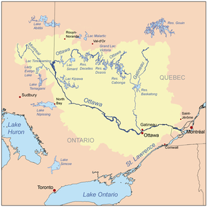
| Location of the reservoir in the catchment area of the Ottawa River | |||||||
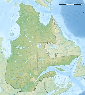
The Réservoir Dozois is a reservoir in the Canadian province of Québec .
It lies entirely in the unorganized territory of the Réservoir-Dozois and the Réserve faunique La Vérendrye . The reservoir is located about 10 km west of the Cabonga Reservoir and about 15 km east of the Grand lac Victoria . Its tributaries include the Ottawa River and the Chochocouane and Capitachouane Rivers. The Route 117 leads directly to the reservoir. The water surface is up to 319 km².
In 1949 the Barrage Bourque dam was built on the Ottawa River . The Dozois Reservoir was created by damming the Ottawa River and flooding various lakes .
Individual evidence
- ↑ Natural Resources Canada - The Atlas of Canada - Lakes ( Memento from January 14, 2013 in the Internet Archive )
- ↑ Hydro-Quebec Dozois Reservoir ( Memento of the original from March 28, 2006 in the Internet Archive ) Info: The archive link was automatically inserted and not yet checked. Please check the original and archive link according to the instructions and then remove this notice.
- ^ Commission de toponymie du Québec - Réservoir Dozois


