Río Pánuco
| Río Pánuco | ||
|
Río Pánuco |
||
| Data | ||
| location | Mexico | |
| River system | Río Pánuco | |
| origin | Confluence of the Moctezuma and Tampaón Rivers 21 ° 58 ′ 5 ″ N , 98 ° 33 ′ 48 ″ W |
|
| muzzle |
Gulf of Mexico Coordinates: 22 ° 16 ′ 0 ″ N , 97 ° 47 ′ 0 ″ W 22 ° 16 ′ 0 ″ N , 97 ° 47 ′ 0 ″ W
|
|
| length | 120 km | |
| Catchment area | 86,500 km² | |
| Drain |
MQ |
1384 m³ / s |
The Río Pánuco is an approx. 120 km long river in the east of Mexico .
course
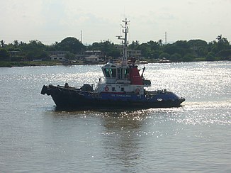
The Río Pánuco is formed by the confluence of the Moctezuma and Tampaón rivers in the state of San Luis Potosí in eastern central Mexico. Hydrologically, it is part of the Tula-Moctezuma-Pánuco system. It flows into the Gulf of Mexico near the cities of Tampico and Ciudad Madero, which are about 25 km northwest of the city of Pánuco . The last 15 km of the river are navigable.
Source rivers
Its longest source river, the Río Moctezuma, rises from numerous smaller source rivers at an altitude of approx. 2800 m in the state of México . Later it is called Río Belice and Río Tula and later still Río Moctezuma.
Another source river, the Río Santamaria, has its source in the Sierra Gorda and is named after its confluence with the Río Gallinas Río Tampaón.
history
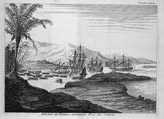
Some of the researchers consider the Río Pánuco as the starting point for the exodus of part of the Toltecs towards the Yucatán peninsula . Juan de Grijalva was the first European to discover the river in 1518.

