Ramelton
| Ramelton Ráth Mealtain Ramelton |
||
|---|---|---|
|
|
||
| Coordinates | 55 ° 2 ′ N , 7 ° 39 ′ W | |
| Basic data | ||
| Country | Ireland | |
| Ulster | ||
| county | Donegal | |
| ISO 3166-2 | IE-DL | |
| Residents | 1212 (2011) | |
| Website | www.ramelton.net (English) | |
|
View of Ramelton
|
||
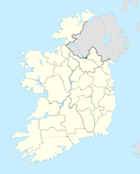
Ramelton ( Irish Ráth Mealtain , "Fortress of Mealtan") is a village with 1,212 inhabitants (2011) in County Donegal in the north of Ireland .
The village is located on the Lennon River, 11 km north of Letterkenny and 4 km west of Milford on the foothills of Lough Swilly , a fjord-like inlet that runs between the Fanad peninsulas in the west and Inishowen in the east.
The historical place ("National Heritage Town") was settled in the 17th century and is built on with numerous Victorian architecture. Archaeological finds point to the Early Stone Age; Settlement remains from the 10th century refer to the Vikings.
The area is home to the Ó Domhnaill ( O'Donnell ) family clan who had ruled what is now County Donegal since the 12th century. In the 15th century, clan chief Calbhach Ó Domhnaill ( Calvagh O'Donnell ) lived in a castle on the island of Rossreagh, which is now the quay of Ramelton, which was destroyed in 1640.
Personalities
- William McAdoo (born October 25, 1853 with Ramelton, † June 7, 1930 in New York City), American politician
- David Gallaher (born October 30, 1873 in Ramelton, † October 4, 1917 at Passchendaele, Belgium), New Zealand rugby union player
- William C. Campbell (born June 28, 1930 in Ramelton), Irish biochemist and parasitologist , winner of the Nobel Prize in Medicine (2015)
Web links
- Official website of Ramelton (English)

