Rathtrevor Beach Provincial Park
|
Rathtrevor Beach Provincial Park
|
||
|
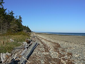
Transition from the beach with driftwood to the forest |
||
| location | British Columbia (Canada) | |
| surface | 3.47 km² | |
| WDPA ID | 65371 | |
| Geographical location | 49 ° 19 ′ N , 124 ° 16 ′ W | |
|
|
||
| Setup date | April 20, 1967 | |
| administration | BC parks | |
The Rathtrevor Beach Provincial Park is a 347 hectare Provincial Park in the Canadian province of British Columbia . It is located about 3 kilometers south of Parksville on the east coast of Vancouver Island and can be reached via Highway 19A . The park is located in the Regional District of Nanaimo .
investment
The park is right on the Strait of Georgia . The area in the north-western part of the park houses the camping area, while the eastern and south-eastern part houses the picnic area on the bank and the group tents. While the camping and tent areas of the park are forested, the central and western parts of the park are dominated by grassland.
The park is a category II protected area ( national park ).
history
The park was established in 1967. The park was named after the former Rath family. William Rath, an Irish-born prospector, settled here in 1886 with his wife and a baby. Then in 1895 they set up a farm.
As with almost all provincial parks in British Columbia, this one too was the hunting and fishing area of various First Nations tribes long before the area was settled by immigrants or it became part of a park .
Flora and fauna
The park is located in the temperate rainforest . British Columbia's ecosystem is divided into different biogeoclimatic zones using the Biogeoclimatic Ecological Classification (BEC) Zoning System . Biogeoclimatic zones are characterized by a fundamentally identical or very similar climate and the same or very similar biological and geological conditions. This results in a very similar population of plants and animals in the respective zones. Within this system, it is assigned to the Dry Maritime Subzone of the Coastal Douglas-fir Zone . After the last forestry use and afforestation, it is now mainly Douglas firs , West American hemlocks and giant trees that grow here . The forest here has an undergrowth of rib ferns , raspberries and buckthorn . In the undergrowth there are also Nuttall's flower dogwood, also known as the Pacific flower dogwood, the heraldic plant of British Columbia.
The tidal range of the Strait of Georgia is also clearly noticeable and visible here, it is usually around 2 to 3 meters. The resulting intertidal zone is rich in marine life. At low tide there is a chance to see mussel beds and other marine life on the beach. The mussels and fish attract not only sea otters and seals , but also ospreys and bald eagles .
The park lets Steller , the national bird of British Columbia (Stellar's Jay Engl.), Observed. Brent geese have also spread out here in the meantime and rest here on their hikes. A wide variety of small mammals and rodents such as raccoons and mink are represented in large numbers .
activities
The tourist attraction of the park is the picnic area with its beach and the intertidal zone. The park is particularly popular with families with children. The park is also criss-crossed by numerous short and easy hiking trails.
The park is that of RLC Enterprize entertaining Nature House , which performs events (the so-called "Interpretive Programs"). This event features lectures and games to bring the audience closer to nature, as well as exhibitions on the natural history of the park. The park has a camping area with sanitary facilities. This offers a total of 199 parking spaces, most of which can be reserved, for campers and tents.
Web links
- Rathtrevor Beach Provincial Park . In: BC Geographical Names (English)
- Rathtrevor Beach Provincial Park . In: English language website of the park at BC Parks
- English-language website of the Nature House
Individual evidence
- ↑ World Database on Protected Areas - Rathtrevor Beach Park (English)
- ↑ Walbran, John T. British Columbia Coast Names, 1592-1906: their origin and history. Ottawa, 1909
- ↑ Biogeoclimatic Zones of British Columbia. British Columbia Ministry of Forests, Lands and Natural Resource Operations , accessed May 19, 2016 .
- ↑ Rathtrevor Beach Provincial Park - Master Plan. (PDF, 1.95 MB) British Columbia Ministry of Environment, Lands and Parks , September 1987, accessed on March 12, 2013 .
- ^ Ecosystems of British Columbia. (PDF, 10.31 MB) British Columbia Ministry of Forests, Lands and Natural Resource Operations, February 1991, accessed on March 12, 2013 .
- ↑ TreeBook. Pacific dogwood. British Columbia Ministry of Forests, Lands and Natural Resource Operations, accessed October 20, 2012 .
- ↑ Northwest Bay (# 7938) Tidal Prediction. Fisheries and Oceans Canada , accessed October 20, 2012 .


