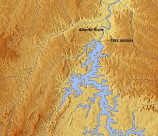
Rio Abaeté
| Rio Abaeté | ||
| Data | ||
| location | Minas Gerais , Brazil | |
| River system | Rio Sao Francisco | |
| Drain over | Rio São Francisco → Atlantic Ocean | |
| source | North of São Gotardo | |
| muzzle |
Rio São Francisco coordinates: 18 ° 2 ′ 15 " S , 45 ° 11 ′ 14" W 18 ° 2 ′ 15 " S , 45 ° 11 ′ 14" W.
|
|
| length | 270 km | |
The Rio Abaeté is an approximately 270 km long river in the Brazilian state of Minas Gerais . It rises in the Serra da Canastra mountain range about 20 kilometers north of São Gotardo . It then heads north through the typical hilly landscape of Minas Gerais. To the north of the Três-Marias reservoir , it finally flows into the Rio São Francisco .
