
Rishiri Rebun Sarobetsu National Park
|
Rishiri Rebun Sarobetsu National Park
|
||
 Rishiri Island |
||
| location | Hokkaidō , Japan | |
| surface | 348.25 km² | |
| WDPA ID | 3099 | |
| Geographical location | 45 ° 12 ' N , 141 ° 15' E | |
|
||
| Setup date | 20th September 1974 | |
| administration | Japanese Ministry of Environment | |

The Rishiri Rebun Sarobetsu National Park ( Japanese 利 尻 礼 文 サ ロ ベ ツ 国立 公園 , Rishiri Rebun Sarobetsu Kokuritsu Kōen ) is a Japanese national park in northwestern Hokkaidō . The park, which opened on September 20, 1974, includes the islands of Rishiri and Rebun , as well as the Sarobetsu plain with an area of 348.25 km². The national park is classified with the IUCN protection category II. The Japanese Ministry of Environment is responsible for the management of the national park.
Flora and fauna
The Rishiri-Rebun-Sarobetsu National Park offers a habitat for a variety of animal and plant species at different altitudes from the coast up to approx. 1100 m. Many migrating bird species such as bean geese are drawn to the national park in spring and autumn. In addition one meets here u. a. also for white- tailed eagles , whistling geese , wagtails , willow bumps and red-crowned cranes .
gallery

Himenuma in the north of Rishiri
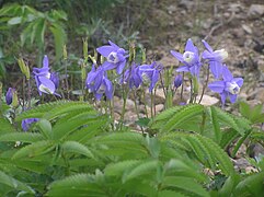
Dwarf Columbine ( Aquilegia flabellata var. Pumila )


.jpg)