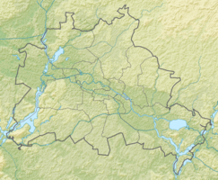
Rohrpfuhl Mahlsdorf
|
Rohrpfuhl Mahlsdorf
|
||
| location | Berlin-Mahlsdorf , Germany | |
| surface | 0.7 ha | |
| Identifier | GLB-09 | |
| Geographical location | 52 ° 31 ' N , 13 ° 37' E | |
|
|
||
| Setup date | 5th September 1994 | |
The Rohrpfuhl Mahlsdorf is a protected part of the landscape and a natural body of water in the Berlin-Mahlsdorf district of the Berlin district of Marzahn-Hellersdorf .
Protected position
The Rohrpfuhl Mahlsdorf was declared a protected part of the landscape according to §§ 18 and 22 of the Berlin Nature Conservation Act of January 30, 1979 (GVBl. P. 183) and last amended by Article V of the law of July 19, 1994 (GVBl. P. 241). The law came into force on September 5, 1994.
description
The Rohrpfuhlgraben used to be a natural drain of the Rohrpfuhl and was connected to the Elsenteich in the south. At present, the water from the Rohrpfuhl is channeled into the rain canal on Hönower Straße . The course of the Rohrpfuhlgraben is no longer recognizable.
Protection purpose
This part of the landscape must be permanently protected, the visual and ecological revitalization of the place and landscape must be preserved. In addition, it must be preserved in its entirety as well as animal and plant species typical for this habitat and for the water surface in detail.
literature
- Roswitha Babig, André Osbahr: Waters in Marzahn-Hellersdorf . 1st edition. District Office Marzahn-Hellersdorf of Berlin, Berlin 2006, p. 22 .
Individual evidence
- ↑ a b Ordinance on the protection of the Rohrpfuhl Mahlsdorf landscape component in the Hellersdorf district of Berlin, Mahlsdorf district , PDF; 310 kB
- ↑ Justification in accordance with Section 3 (2) of the Building Code for the development plan XXIII - 4b in the Marzahn-Hellersdorf district, Mahlsdorf district, PDF; 787 kB

